
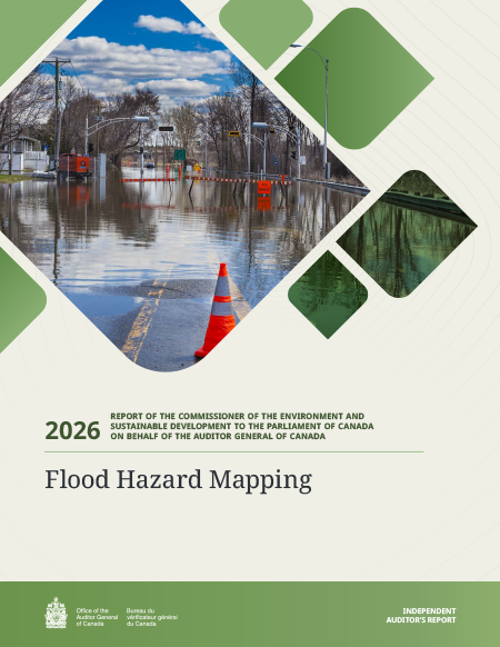
Flood hazard mapping too slow to support climate change adaptation
Flood Hazard Mapping

Report metadata
- Tabling date:
- Audited entities:
- Environment and Climate Change Canada
- Natural Resources Canada
- Public Safety Canada
- Topics:
- Environment
- Safety and Security
- Report type
- Commissioner of the Environment and Sustainable Development reports
At a glance
Overall, Natural Resources Canada, Environment and Climate Change Canada, and Public Safety Canada did not ensure the timely production of effective flood hazard maps—tools necessary for climate change adaptation and for protecting communities. Many maps had not yet been completed, and most of the existing flood hazard information is not practical or actionable for users. Building resilience to flooding depends on having reliable, easy‑to‑use maps. Without them, public safety and infrastructure are at risk.
Public Safety Canada is working to launch a flood risk awareness portal to help people identify flood risks in their areas and take steps to prepare. However, the portal does not consider climate change. In addition, because the system and its data are proprietary to the vendor, the department cannot update or adjust the information to reflect changing conditions.
Natural Resources Canada funds flood map development and tracks which areas are being mapped, but missing performance indicators and unclear definitions make it difficult to account for program results. The department committed to mapping 200 higher‑risk areas by 2028; however, it did not monitor whether the mapping projects covered the priority areas that had been preliminarily identified in a 2022 analysis. As a result, fewer than half of the maps covered the originally identified higher‑risk areas.
To be best prepared for climate change, maps must be reliable and released promptly. Natural Resources Canada was not on track to have all the flood maps in production publicly available by 2028.
Flood hazard maps must integrate climate change projections; otherwise, the data are not accurate enough to guide long‑term decisions, such as where to build homes or develop infrastructure. Without up‑to‑date information readily available to the public, people in Canada face escalating risks to public safety and higher disaster recovery costs.
Key facts and findings
- Canada’s National Risk Profile noted that about 80% of highly populated areas were located, at least partially, in flood hazard zones.
- The federal government spent an average of about $230 million annually from 2016 to 2025 in post flood relief.
- Public Safety Canada missed its deadline to release Canada-wide flood risk ratings through a flood risk awareness portal by the end of 2025.
- As of December 31, 2025, out of 131 mapping projects underway:
- only 64 (49%) included priority areas of higher risk as prioritized in Natural Resources Canada’s 2022 analysis exercise
- only 11 (8%) had been posted on the Canada Flood Map Inventory
Why we did this audit
- Building resilience to future floods requires information that is effective, especially in the context of climate change. Flood hazard maps are meant to support evidence‑based decision making, and therefore to be effective, they should be reliable and actionable.
- Any delays in the publication of reliable and actionable flood hazard maps expose individuals and communities to increasing risks of negative health, financial, and environmental impacts.
- Delays could also put investments in housing, infrastructure, and other physical assets at risk, including the $140 billion planned to be invested by the federal government as detailed in Budget 2025.
Highlights of our recommendations
- To ensure the ongoing reliability of flood hazard maps and federal guidelines to support climate change adaptation, Natural Resources Canada and Environment and Climate Change Canada should regularly review and update their approach to verify that all maps follow appropriate technical requirements, including up‑to‑date scientific information related to climate change impacts.
- To protect individuals most vulnerable to flooding and to help mitigate the increasing cost of flood relief in the context of climate change, Natural Resources Canada should work collaboratively with provinces and territories to update its list of higher‑risk areas and monitor coverage of those areas to inform funding decisions.
Please see the full report to read our complete findings, analysis, recommendations and the audited organizations’ responses.
The federally identified Flood Risk Areas Initiative was identified by Public Safety Canada as a contribution to Goal 11 (Sustainable Cities and Communities) and the corresponding goal of its departmental sustainable development strategy. The Flood Hazard Identification and Mapping Program was identified by Natural Resources Canada a contribution to Goal 13 (Climate Action) and the corresponding goal of its departmental sustainable development strategy.
Visit our Sustainable Development page to learn more about sustainable development and the OAG.
Exhibit Highlights
Exhibit 1—The cost of the federal government’s post flood relief is rising

Text version
Exhibit 1—The cost of the federal government’s post-flood relief is rising
This chart shows the federal government Disaster Financial Assistance Arrangements payments from 1971 to 2025. The payments were adjusted for inflation using 2025 dollars and grouped into 5-year increments.
The Disaster Financial Assistance Arrangements payments were as follows:
•Payments for 1971 to 1975 were $153 million.
•Payments for 1976 to 1980 increased to $202 million.
•Payments for 1981 to 1985 decreased to $44 million.
•Payments for 1986 to 1990 increased to $75 million.
•Payments for 1991 to 1995 decreased to $62 million.
•Payments for 1996 to 2000 increased to $668 million.
•Payments for 2001 to 2005 decreased to $365 million.
•Payments for 2006 to 2010 decreased to $286 million.
•Payments for 2011 to 2015 increased to $1,751 million.
•Payments for 2016 to 2020 decreased to $632 million.
•Payments for 2021 to 2025 increased to $1,731 million.
Note: Adjusted using the Inflation Calculator (Bank of Canada) to November 2025. Data are based on the payment year. Payments may occur many years after flood events.
Source: Based on information from Public Safety Canada
* Adjusted for inflation, 2025 dollars
Note: Adjusted using the Inflation Calculator (Bank of Canada) to November 2025. Data are based on payment year. Payments may occur many years after flood events.
Source: Based on information from Public Safety Canada
Exhibit 3—The mapping projects completed under the previous stage of the Flood Hazard Identification and Mapping Program (2021–2024) were not actionable because of their limited availability

Text version
Exhibit 3—The mapping projects completed under the previous stage of the Flood Hazard Identification and Mapping Program (2021–2024) were not actionable because of their limited availability
This chart shows the number of mapping projects completed under the previous stage of the Flood Hazard Identification and Mapping Program.
In total, 51 mapping projects were completed.
Of these, 35 were publicly available, and 16 were not publicly available.
Of the ones that were publicly available, 29 were listed on the inventory and properly linked, and 6 were not listed on the inventory or improperly linked.
Source: Based on our analysis of information provided by Natural Resources Canada and our review of the publicly available information at the end of the audit period (December 31, 2025)
Source: Based on our analysis of information provided by Natural Resources Canada and our review of the publicly available information at the end of the audit period (December 31, 2025)
Exhibit 4—Flood hazard mapping projects underway had a low overlap with the higher-risk areas identified in the 2022 prioritization exercise

Text version
Exhibit 4—Flood hazard mapping projects underway had a low overlap with the higher-risk areas identified in the 2022 prioritization exercise
This Venn diagram shows the overlap of mapping projects underway and areas identified as higher risk within the larger field of all areas to be mapped.
Of all of the areas to be mapped, 384 areas were identified as higher-risk areas in the 2022 prioritization exercise. There are 131 mapping projects underway. This means that only 49% of mapping projects are aligned with areas identified as higher-risk.
Source: Based on our analysis of Natural Resources Canada’s data at the end of the audit period (December 31, 2025). The overlap was calculated using a buffer zone of 8.3 kilometres.
Source: Based on our analysis of Natural Resources Canada’s data at the end of the audit period (December 31, 2025). The overlap was calculated using a buffer zone of 8.3 kilometres.
Exhibit 5—Natural Resources Canada was not on track to publish all flood mapping projects by March 2028

Text version
Exhibit 5—Natural Resources Canada was not on track to publish all flood mapping projects by March 2028
This chart shows the completion and publication states of flood mapping projects.
As of December 31, 2025, 131 mapping projects were underway.
Of these, 26 were completed.
Of the completed projects, 11 were published, and 15 were not published.
That means that 105 projects need to be completed by March 31, 2028. An unknown number of additional flood mapping projects may be completed.
Source: Based on our analysis of information provided by Natural Resources Canada and our review of the publicly available information at the end of the audit period (December 31, 2025)
Source: Based on our analysis of information provided by Natural Resources Canada and our review of the publicly available information at the end of the audit period (December 31, 2025)