
Infographic: environmental change – snow, ice, and precipitation - monitoring methods
Description: Summary of Environmental change – snow, ice, and precipitation - monitoring methods
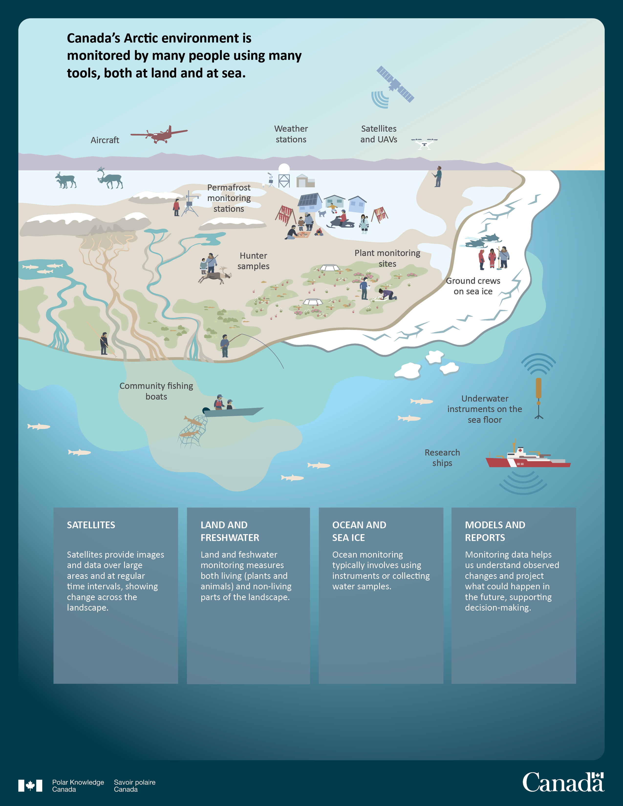
An infographic shows simplified methods of environmental monitoring. In the left upper corner the text reads" Canada's Arctic environment is monitored by many people using many tools, both at land and at sea." Below there is an image of a plane with a capture "aircraft", beside there is a text " weather stations" with an image symbolizing weather station, and an image of a satellite and drone with a capture "satellites and UAVs". Underneath there is an image of the tundra with caribou, flowing rivers and snow-covered eskers.
On the left a human figure beside a drilling equipment symbolizes taking samples of the permafrost. The capture beside reads" permafrost monitoring stations". On the right there is an image of Inuit houses with fish drying racks, dogs, snowmobilers and elders teaching children. The image symbolizes passing of knowledge between generation in a traditional Inuit village. On the right on the icefloe an image of human figures symbolizing researchers and Inuit guide with snowmobiles beside them symbolizes research and ice monitoring. The capture reads "grounds crews on sea ice".
In the center of the tundra Inuit hunter and youth stand together beside the carcass of a caribou. The capture reads "hunter samples". On the right of the hunters there are images of flowers growing on the tundra and human figures symbolizing researchers inspecting the flowers. The capture beside them reads "plant monitoring sites". Underneath, two human figures fish in the river and the ocean using a spear and a fishing rod. An image of a boat on the surface of the ocean is underneath the image of the tundra. The boat pulls a fishing net with fish entangled in the net and other fish swimming beside. A capture beside the boat reads "community fishing boats". On the right there is an image of a sensor on the ocean floor emitting a signal and an image of a Canadian Coast Guard research ship. The text captures below read "underwater instruments on sea floor" and "research ships". Below the images there are four textboxes with text which read:
Satellites: Satellites provide images and data over a large area and at regular intervals, showing change across the landscape.
Land and fresh water: land and freshwater monitoring measures both living (plants and animals) and nonliving parts of the landscape.
Ocean and sea ice: ocean monitoring typically involves using instruments or collecting water samples.
Models and reports: monitoring data helps us understand observed changes and project what could happen in the future supporting decision making.

Citation information
McLennan, D., Brown, K., Scharien, R., Else, B., Wilson, K., Humphreys, E., Marsh, P., Ullulaq, J., Park, B., Cockney-Goose, T., Aipellie, G. and Qillaq, N., 2022, Environmental change in the Kitikmeot Region of western Nunavut and Ulukhaktok region of eastern Northwest Territories. Polar Knowledge: Aqhaliat Report, Volume 4, Polar Knowledge Canada, p. 8–33. DOI: 10.35298/pkc.2021.01.eng
Page details
- Date modified: