Wildlife and landscape science research topics: space for habitat and geographic information system
| Article Title |
|---|
Space for Habitat and GIS |

Earth Observation technologies, which include air photos and satellite images, are able to consistently map large, dynamic landscapes and revisit these locations often to track spatial and temporal changes in wildlife and habitat.
This ability to attain and evaluate information about species and habitat location, abundance and distribution is a major advantage, especially for Canada, the second largest country in the world with large tracts of wilderness that cannot be regularly and completely surveyed by ground.
These technologies are also able to combine several forms of digital data in order to standardize monitoring and examination methods, which are important for consistency when comparing data and findings nationwide.

Wildlife and landscape researchers and the Geoinformatics Laboratory represent Environment Canada on the project’s Technical Working Group, established to provide interdisciplinary guidance on technology, science and policy. A recently developed Data Analysis Plan allows experts to compare the relative value, capabilities and cost-effectiveness of various technologies, and the technological ability to work with existing data and partner mandates.
Space for Habitat will not only provide greater understanding of wildlife habitat quality and availability, but will also improve the ability to enforce wildlife regulations and legislation intended to protect wildlife and habitat.
Habitat monitoring and enforcement
One objective of the Space for Habitat project is to evaluate the potential for Earth Observation technologies to monitor compliance and protection requirements in landscapes where Canadian wildlife laws apply, including Protected Areas such as National Wildlife Areas, Migratory Bird Sanctuaries, and critical habitat designated under the Species at Risk Act.
The project will be able to provide sound scientific advice on the effectiveness of current regulations, guidelines and management activities. As new information arises and is incorporated into decision making, this could improve the efficiency and effectiveness of enforcement and management activities across many jurisdictions.
Habitat monitoring in managed forest landscapes
Space for Habitat is focusing first on developing a new monitoring tool in forest habitat. The forest sector has been selected as a case study to inform the development of regulations under the Migratory Birds Convention Act for the incidental take of migratory birds.
Currently, wildlife and landscape scientists are working to:
- develop an effective means to map and monitor migratory bird habitat and related forest structures
- enhance existing biodiversity monitoring and assessment initiatives, including wildlife populations and their use of habitats
- inform the design and promote compliance for an emerging regulatory system to address the incidental take of migratory birds
- establish partnerships and capacity necessary to ensure effective enforcement of relevant wildlife laws across Canada
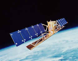
Although currently applied to forestry, Space for Habitat has application to track coastal erosion, classify wetlands, and map vegetation and soil types and conditions for agriculture. Click here to find out more about how RADARSAT observations apply to ecosystem monitoring.
Space for Habitat will improve the reliability and quality of data supporting decision making. This will allow Environment Canada, and project partners to better target resources to high priority areas and species for conservation.
Experts in Space for Habitat and GIS
- Jason Duffe
- Kathryn Lindsay
- Evan Seed
Further reading
- Space for Habitat and project partners
- Geoinformatics Laboratory at the National Wildlife Research Centre
- RADARSAT Constellation, Canadian Space Agency
- Geomatics and Landscape Ecology Research Laboratory, Carleton University