
Nutrient cycling in Cambridge Bay, Nunavut: First assessment of dissolved silicon and its isotopes
Authors
- K.R. Hendry, School of Earth Sciences, University of Bristol, Bristol, United Kingdom, K.Hendry@bristol.ac.uk
- H.C. Ng, School of Earth Sciences, University of Bristol, Bristol, United Kingdom
- M.J. Leng, NERC Isotope Geosciences Facility, British Geological Survey, Keyworth, Nottingham, United Kingdom
- E.M.S. Woodward, Plymouth Marine Laboratory, Prospect Place, The Hoe, Plymouth, United Kingdom
Citation information
Hendry, K.R., Ng, H.C., Leng, M.J. and Woodward, E.M.S. 2020. Nutrient cycling in Cambridge Bay, Nunavut: First assessment of dissolved silicon and its isotopes. Polar Knowledge: Aqhaliat Report, volume 3, Polar Knowledge Canada, p. 62–64. DOI: 10.35298/pkc.2020.15.eng
Introduction
High-latitude coastal regions act as conduits for the transport of important nutrients to the sea and are key regions for the marine biological production that supports important fisheries. Physical, chemical, and biological processes interact to influence this supply of nutrients, not only to algae growing near-shore, but also the flow of these nutrients to the open ocean. These high-latitude regions are undergoing rapid changes driven by climate warming. Understanding these coastal processes is essential for understanding future impacts on marine ecosystems and important resources, including fisheries and wildfowl.
Dissolved Silicon (DSi) is one such nutrient that is essential for certain groups of algae, such as diatoms. Different forms of silicon, like its stable isotopes, can provide insight into the key processes involved in its uptake and release. This report presents the initial findings of a pilot study of DSi in Cambridge Bay, Nunavut.
Methods
Water samples were collected from Cambridge Bay (Figure 1) in the spring melt-season of 2019. A small boat was used to take transects from the river to the sea-ice edge, with assistance from the Canadian High Arctic Research Station (CHARS) field operations staff. The water was tested for salinity (using a hand-held salinometer), filtered, and frozen, if needed for laboratory analysis back in the United Kingdom.
Findings
The freshwater mass balance in Cambridge Bay was calculated, assuming that the water is a mixture of three sources: ocean, sea ice melt, and river discharge. The proportion of freshwater from the river decreased away from the mouth but dominated the surface waters. It was still significant (i.e., about 20%) at a water depth of 20 metres (m), further out into Cambridge Bay.
There is significant input of DSi from the river into Cambridge Bay, originating from within the permafrost environment. The concentrations of DSi showed a significant positive relationship with river input. Other nutrients, such as phosphate, showed a significant negative relationship (i.e., they were higher in seawater). Nitrate concentrations were very low everywhere in the bay and showed no clear trend with no obvious marine or river inputs. Nitrate is likely to be the nutrient limiting algal growth, which supports the marine food chain, meaning that algal production is not likely to be stimulated by enhanced river inputs into the future.
The DSi was very isotopically heavy in the river water, indicating it is released from permafrost. Further chemical weathering linked to permafrost thawing, including formation of isotopically light minerals and biogenic components, could result in a heavier isotopic signature for this region. This heavy isotopic signature was found even in samples dominated by marine inputs at a 20 m depth in Cambridge Bay. The relationship between DSi isotopes and concentrations was opposite to that expected from diatom growth, which is consistent with limiting nitrate concentrations and low productivity. This means that the seawater DSi isotopes largely recorded the mixing between river and marine waters. As a result, tracing silicon isotopes in sediments may be useful to tracking river inputs from land back through time.
We are interested in using our pilot study to co-design a larger-scale research project in collaboration with CHARS, Canadian researchers, and the Cambridge Bay community, to investigate the cycling of nutrients and pollutants in coastal waters and sediments.
Acknowledgements
Many thanks to Angulalik Pedersen, Ann Balasubramaniam, and all the staff and researchers at CHARS and Polar Knowledge Canada.
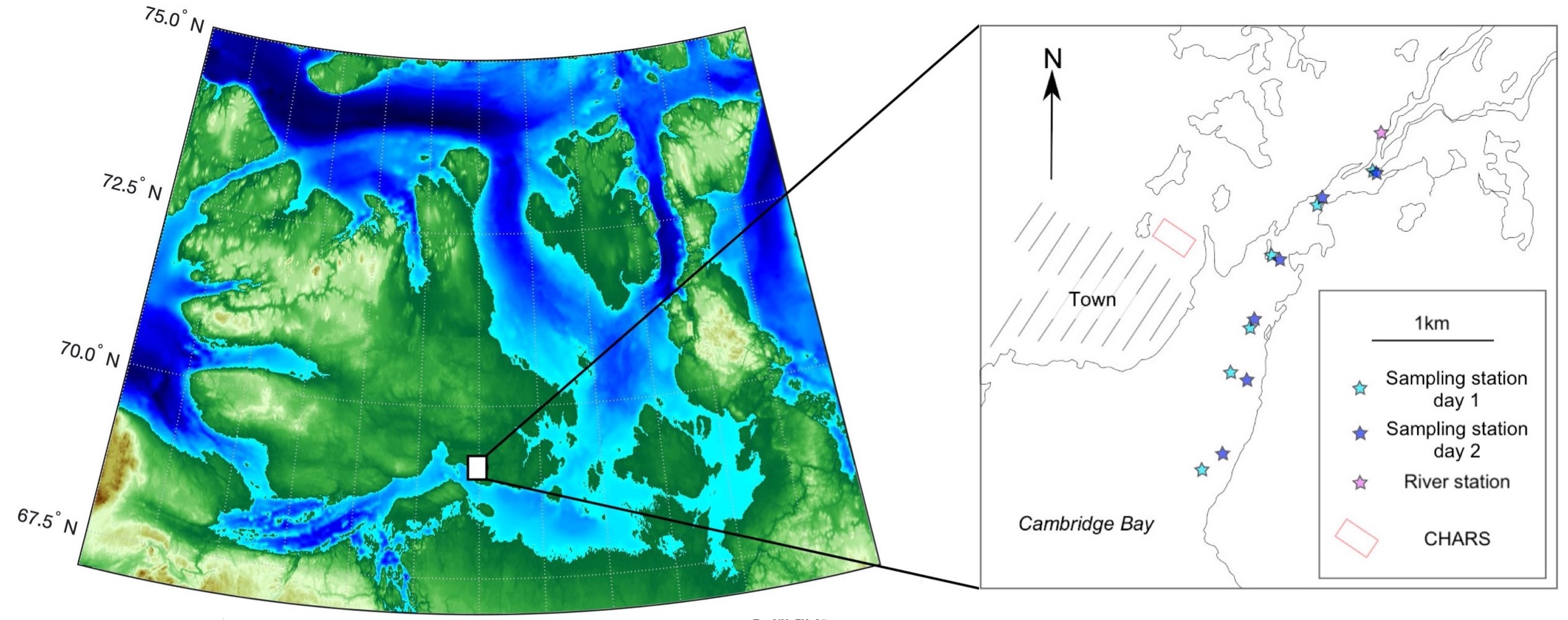
Figure 1: Map of sampling locations (shown by stars) within Cambridge Bay. The water depth (bathymetry) data are from an online database (etopo1).
Polar Knowledge Canada
For media inquiries, contact:
communications@polar-polaire.gc.ca