
Arctic Monitoring Buoys Provide Data for Improved Sea Ice Models
Author: Hilary Dugan – Postdoctoral Fellow, University of Wisconsin-Madison
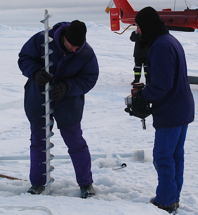
Ice buoy deployment off the CCGS Amundsen. Photo: Bruno Tremblay, McGill University
The International Arctic Buoy Programme maintains a network of drifting sea ice buoys deployed across the Arctic Ocean. Real-time data from the buoys are used for forecasting weather, validating satellite imagery, confirming ice conditions, and improving climate and ice models2.
Highlights
- The Northwest Passage in the Canadian Arctic may become a more viable shipping route through the Arctic as summer sea ice coverage diminishes. The ability to safely navigate the various legs of the route depends on the effectiveness of sea ice forecasts and models.
- Improved sea ice models require monitoring data from remote areas of the Canadian Arctic. To address this, researchers at McGill University deployed monitoring buoys on sea ice in the Canadian Arctic from 2009-2013 as part of the ongoing International Arctic Buoy Programme.
- The monitoring buoys can monitor ice stress, thickness, temperature, and movement, and send data in real-time to researchers via satellite. Buoy deployments have been focused in the Western Canadian Arctic, a relatively understudied area known for thick sea ice.
Context
Future climate projections suggest that the Northwest Passage, a grouping of sea routes through the Canadian Arctic Islands, may become more navigable in the coming decades1. For Arctic shipping to operate safely and sustainably, vessels will require accurate forecasts of sea ice conditions within the Arctic Archipelago. Currently, ship operators are kept abreast of ice conditions through daily sea ice maps produced from satellite imagery, which provide limited forecasting capacity.
Increased and improved sea ice monitoring data is needed for the Canadian Arctic in order to improve the accuracy of predictive sea ice models. In response, researchers at McGill University are deploying monitoring buoys on sea ice in the most understudied regions of the Canadian Arctic as part of the International Arctic Buoy Programme (IABP). The Meteorological Service of Canada and the Canadian Ice Service of Environment Canada have also participated in the IABP.
In addition to short-term forecasting, understanding the movement, stability, and strength of sea ice is crucial for northern populations, who rely on sea ice to access traditional food; the shipping industry as they try to minimizing costs associated with the use of icebreakers; and forecasting long-term trends in sea ice coverage.
Results and Implications
Sea ice monitoring buoys have been deployed annually from 2009-2013 in the Canadian Arctic by researchers at McGill University as part of the ongoing International Arctic Buoy Programme3,4. Installations were concentrated in the Western Canadian Arctic, including in Byam Channel, M’Clintock Channel, and Melville Sound. These are all areas of the Northwest Passage recognized for heavy sea ice.
The buoys were used to monitor a suite of sea ice parameters. Deployments have included separate buoys to monitor the following parameters:
- Ice mass balance buoys: to record sea ice thickness/temperature (to derive winter ice growth and summer ice melt), and air temperature/pressure;
- Spherical drifters: to record ice position;
- Ice stress buoys: to record internal ice temperature, and within-ice stress to understand how much stress the sea ice can withstand before breaking; and,
- Infrared cameras: to capture hourly imagery of sea ice.
All monitoring buoys record geographic position, and use satellite telemetry to transmit data back to the research institution 3,4.
Policy Linkages
- The declining summer sea ice coverage has led to an increase in both industrial and commercial activity in the Arctic, and a demand for more accurate predictions of sea ice extent, months in advance4. Data from monitoring buoys can improve forecasts of future sea ice conditions within the Arctic Archipelago to support the establishment and maintenance of safe shipping routes and navigation for ship operators.
- Improved sea ice forecasts will be crucial to support increased marine traffic that is expected to result from large-scale oil and gas, mining, and infrastructure projects slated to become operational by 2020 in the Canadian Arctic.6
- An increase in the number of “on the ground” ice measurements and long-term monitoring can improve sea ice models and inform organizations such as the United Nations International Maritime Organization and the Canadian Ice Service to update guidelines for shipping in Arctic ice-covered waters7,8.
References
1 Smith, LC and Stephenson, SR. (2013). New Trans-Arctic shipping routes navigable. PNAS, E1191-E1195.2International Arctic Buoy Programme. (2015). http://iabp.apl.washington.edu/index.html
3Hata, Y, and Tremblay, LB. (In press). Anisotropic Internal Thermal Stress in Landfast Sea Ice from the Canadian Arctic Archipelago. Journal of Geophysical Research.
4Hata, Y, and Tremblay, LB. (Accepted). A 1.5D Anisotropic Sigma-Coordinate Thermal Stress Model of Sea Ice in the Canadian Arctic Archipelago. Journal of Geophysical Research.
5Schroeder, D, Feltham, DL, Flocco, D, and Tsmados, M. (2014). September Arctic sea ice minimum predicted by spring melt pond fraction. Nature Climate Change, 4: 353–357.
6Gavrilchuk, K, and Lesage, V. (2014). Large-scale marine development projects (mineral, oil and gas, infrastructure) proposed for Canada’s North. Canadian Technical Report of Fisheries and Aquatic Sciences. 3069: 84pp.
7Arctic Marine Shipping Assessment 2009 Report. (2009). Arctic Council, 2nd printing, 194pp.
8International Maritime Organization. (2015). Shipping in polar waters. http://www.imo.org/en/mediacentre//HotTopics/polar/Pages/default.aspx