
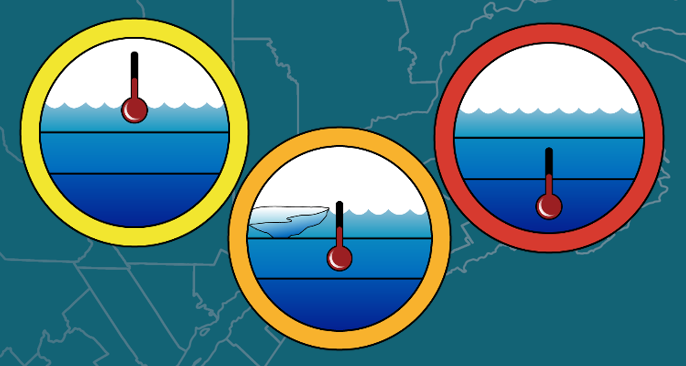
Oceanographic Processes: Temperatures
and Sea Ice
Indicator name: Surface layer temperatures
Status: Moderate in 2018–2024
Trend: Deterioration
Indicator name: Cold intermediate layer temperatures and sea ice
Status: Moderate-Poor in 2018-2024
Trend: Deterioration
Indicator name: Deep water temperatures
Status: Poor in 2018-2024
Trend: Deterioration since 2008-2012


Prepared by: Peter S. Galbraith
Pelagic and Ecosystem Science Direction – Maurice Lamontagne Institute, Fisheries and Oceans Canada
Copyright information
Cat. No.: En78-1/2025E-PDF
ISBN: 978-0-660-78464-9
This publication may be reproduced for personal or internal use without permission, provided the source is fully acknowledged. However, reproduction of this publication in whole or in part for purposes of redistribution requires the prior written permission from the Canada Water Agency by contacting:
Canada Water Agency
510-234 Donald Street
Winnipeg, Manitoba
R3C 1M8
Canada
Email: water-eau@cwa-aec.gc.ca
© His Majesty the King in Right of Canada, as represented by the President of the Canada Water Agency and the Minister of the Environment and Climate Change, 2025
Aussi disponible en français
Highlights
On average, the status of the Surface Layer Temperatures indicator for the Gulf of St. Lawrence was Moderate in the 2018–2024 period. The status of the Cold Intermediate Layer Temperatures and Sea Ice indicator was Moderate–Poor. The status of the Deep Water Temperatures indicator was Poor in each year of the 2018–2024 period, associated with 100-year records for temperatures at 250 m and 300 m that were broken in 2015, 2016 and almost every year thereafter, until 2022.
Problem
The purpose of the Atlantic Zone Monitoring Program (AZMP) is to detect, monitor and understand changes in the productivity and state of the marine environment to help ensure that activities and resources are managed sustainably. Measurements of oceanographic variables are taken during major surveys conducted four times a year.
The summertime water column in the Gulf of St. Lawrence consists of three distinct layers: the surface layer, the cold intermediate layer (CIL) and the deep water layer. Surface temperatures usually peak in early to mid-August. This is followed by gradual cooling, with wind-induced mixing during the fall leading to a progressively deeper and cooler mixed layer that eventually encompasses the CIL. During winter, the surface layer deepens and extends to an average depth of 75 m but may exceed 150 m in some places. During spring, surface warming, sea ice melt waters and continental runoff lead to a lower-salinity and higher-temperature surface layer. Beneath this surface layer, cold waters from the previous winter are partly isolated from the atmosphere and form the summer CIL. This layer persists until the following winter, warming and deepening gradually over the summer, then more rapidly in the fall, as vertical mixing intensifies. Underneath these two layers lies the deep layer, which is unaffected by winter cooling. This layer comes into the Gulf from the ocean at the continental slope. The following describes the temperatures associated with the three layers of the water column throughout the Gulf of St. Lawrence, as well as the state of the maximum seasonal sea ice cover.
Study area
In four annual AZMP surveys that cover the Gulf of St. Lawrence, a probe is lowered through the water column to measure temperature and salinity as a function of depth. In addition, sea surface temperatures and ice cover throughout the Gulf of St. Lawrence are obtained from remote sensing measurements (Figure 1).

Text description of Figure 1
Map of the Gulf of St. Lawrence showing the lines (black lines) covered by the Atlantic Zone Monitoring Program and the positions of the two fixed stations (red dots).
Geographic Context
- The map focuses on the Gulf of St. Lawrence, located in eastern Canada.
- A locator inset map in the top-left corner shows the Gulf’s position in the larger context of Canada and the Atlantic Ocean.
- The inset includes major geographic references such as:
- Hudson Bay
- Quebec and Ontario
- The Atlantic Ocean
- The United States (USA)
Fixed Stations (red circles)
- Two fixed monitoring stations are marked by red circles with bold red labels:
- RIKI: Located near Rimouski, on the southern shore of the lower St. Lawrence estuary.
- VAS: Positioned south of the Magdalen Islands, between the islands and New Brunswick.
Monitoring Lines (black lines)
- Seven black transect lines represent monitored sections within the Gulf:
- TESL: Near RIKI, in the lower estuary.
- TSI: Northwest of Gaspé Peninsula.
- TASO: North of the Gaspé Peninsula.
- TCEN: Central Gulf, southeast of Anticosti Island.
- TBB: West coast of Newfoundland.
- TIDM: Extending southward from the Magdalen Islands toward Nova Scotia.
- TDC: Southeast of the Magdalen Islands, near Newfoundland.
Geographic Labels
- The map includes major provinces, regions, and towns labeled in both French and English, including:
- Québec / Quebec
- Terre-Neuve / Newfoundland
- Nouveau-Brunswick / New Brunswick
- Nouvelle-Écosse / Nova Scotia
- Îles-de-la-Madeleine / Magdalen Islands
- Coastal towns: Rimouski, Gaspé, Sept-Îles, Tadoussac, Mingan
Key measures
Surface layer temperatures
- Surface temperature anomalies in August and mean temperature anomalies from May to November relative to historical values, based on satellite data.
- Seasonal phenological anomalies characterized by the date on which the mean surface temperature across the Gulf of St. Lawrence rises above 12 °C in the spring and drops below 12 °C in the fall, according to satellite data.
Cold intermediate layer temperatures and sea ice
- Maximum seasonal sea ice volume in the Gulf of St. Lawrence, derived from ice charts produced by Environment and Climate Change Canada’s Canadian Ice Service by assigning a thickness value to each stage of ice development.
- Area of the bottom on the Magdalen Shallows occupied by waters colder than 1 °C in September.
- Mean bottom temperature on the Magdalen Shallows in September.
- Average minimum temperature of the cold intermediate layer in the Gulf of St. Lawrence in August (northern Gulf) and September (Magdalen Shallows).
Deep water temperatures
- Mean temperature at depths of 150 m, 200 m, 250 m and 300 m.
To monitor the oceanographic indicators of the St. Lawrence, the key measures above have been compared with the values obtained during the 1981–2010 reference period, and indicators reflecting a deviation from normal conditions have been developed.
First, an annual anomaly value is calculated for each indicator. An anomaly value is the difference between a key measure’s value for the year in question and its mean value over the reference period. This difference is then standardized by dividing it by the standard deviation for the reference period. A negative (or positive) anomaly value means that the key measure’s value for the year in question is less than (or greater than) its mean value for the reference period. For temperature and ice conditions, the direction of a change (positive or negative) cannot be interpreted as good or bad. However, assuming that the aim is to preserve the ecosystem as it existed according to the historical data, any significant change (positive or negative) relative to its historical state may be associated with a status of “Poor” and, conversely, the absence of significant change (within half a standard deviation) may be associated with a status of “Good.” Therefore, the absolute value of the sum of the standardized anomalies of the indicators can be used to describe the status of each characteristic measured.
Status and trends
Surface layer temperatures
On average, the status of the Surface Layer Temperatures indicator was Moderate during the 2018–2024 period (Figure 2). During this period, the status was Poor in 2021 and in 2024. For those two years, none of the key measures reflected a status of “Good.” The May–November mean surface temperature was at a record high in 2024.
This indicator has varied over the years but shows a deteriorating trend in the long term because of global warming.
Cold intermediate layer temperatures and sea ice
On average, the status of the Cold Intermediate Layer Temperatures and Sea Ice indicator was Moderate–Poor during the 2018–2024 period. The status was at its record-setting worst level in 2021.
This indicator has also varied over the years but shows a deteriorating trend in the long term because of global warming.
Deep water temperatures
The deep waters of the Gulf are a mix of warm Gulf Stream water and cold Labrador Current water that comes into the Gulf through the Laurentian Channel at the continental slope, south of the Cabot Strait. A change in the proportions of this mix is the main cause of the observed changes in deep water temperatures. Deep water temperatures increased throughout the Gulf between 2009 and 2022, with inward warm water advection from the Cabot Strait.
The status of the Deep Water Temperatures indicator was Poor in each year of the 2018–2024 period, associated with 100-year records for temperatures at 250 m and 300 m that were broken in 2015, 2016 and almost every year thereafter, until 2022. Mean temperatures at all depths from 150 m to 300 m reached record highs in 2022.

Text description of Figure 2
Indicators for the three key measures: surface layer temperatures, cold intermediate layer temperatures and winter sea ice, and deep water temperatures. Variables in parentheses are inverted so that a positive anomaly corresponds to a warm anomaly (early warming, less sea ice, less area on the bottom of the Magdalen Shallows occupied by cold waters).
Top Panel – Surface Layer Temperatures
- Title: Surface Temperature anomalies
- Y-axis: Sum of anomalies.
- X-axis: Years from 1971 to 2023.
- Stacked bars represent:
- Surface temperature in August.
- Surface temperature, May–November average.
- Sea surface temperature (SST) at the beginning of summer.
- Sea surface temperature (SST) at the end of summer.
- A white line with circular markers overlays the bars, indicating the annual total anomaly sum.
- Background uses a green-to-red gradient scale for visual reference.
Middle Panel – Cold Intermediate Layer (CIL) Temperatures and Sea Ice
- Title: Intermediate depth temperature anomalies and ice
- Y-axis and X-axis: Same as top panel.
- Stacked bars represent:
- Sea ice, maximum volume (inverted).
- Area with surface temperature < 1°C on the Magdalen platform in September (inverted).
- Cold Intermediate Layer (CIF), minimum August temperature.
- Bottom temperature on the Magdalen platform, depth >30 m, in September.
- White line with markers represents the total sum of intermediate anomalies per year.
- Background uses the same green-to-red gradient.
Bottom Panel – Deep Water Temperature
- Title: Deep temperature anomalies
- Y-axis: Higher scale, ranging up to 24.
- X-axis: Years from 1971 to 2023.
- Stacked bars represent:
- Mean temperature at 150 m depth.
- Mean temperature at 200 m depth.
- Mean temperature at 250 m depth.
- Mean temperature at 300 m depth.
- White line with markers indicates the yearly sum of deep temperature anomalies.
- Background uses a consistent green-to-red gradient.
Outlook
Surface layer temperatures are correlated with air temperatures. The mean April–November air temperature over the Gulf of St. Lawrence has increased at an average rate of 1.3 °C every 100 years for the past 150 years. Summertime intermediate layer temperatures and the maximum quantity of winter sea ice are correlated with winter air temperatures, which have increased nearly twice as quickly as the April–November temperature. Although both indicators have varied from year to year, they show a deteriorating trend because of global warming.
The variability in deep water temperatures can be attributed to changes in the proportions of warm Gulf Stream water and cold Labrador Current water coming into the Laurentian Channel at the continental slope. However, the water temperature at 300 m in this area was below normal in 2024, for the first time since 2008. Therefore, this indicator should show some improvement over the next five years.
For more information
GALBRAITH, P.S., CHASSÉ, J., SHAW, J.-L., LEFAIVRE, D. and BOURASSA, M.-N. 2025. Physical Oceanographic Conditions in the Gulf of St. Lawrence during 2024. Can. Tech. Rep. Hydrogr. Ocean Sci. 397: v + 95 p.
State of the St. Lawrence Monitoring Program
Five government partners—Environment and Climate Change Canada; Fisheries and Oceans Canada; Parks Canada; the Ministère de l’Environnement et de la Lutte contre les changements climatiques du Québec; and the Ministère des Forêts, de la Faune et des Parcs du Québec—and Stratégies Saint-Laurent, a non-governmental organization that works actively with riverside communities, are pooling their expertise and efforts to provide Canadians with information on the state of the St. Lawrence and the long-term trends affecting it.
For more information about the State of the St. Lawrence Monitoring Program, please consult our website: https://www.planstlaurent.qc.ca/en/developing-knowledge/state-st-lawrence-monitoring-program.
Acknowledgments
The monitoring data presented in this report is made possible thanks to the dedication of the employees participating in Fisheries and Oceans Canada's Atlantic Zone Monitoring Program.