
Iceberg migration
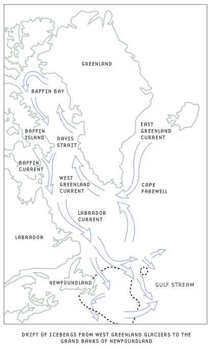
Icebergs travel in the Baffin Island Current and then the Labrador Current south of Hudson Bay. Finally, they reach the Grand Banks of Newfoundland where they drift either eastward north of the Flemish Cap or southward between the Flemish Cap and the Grand Banks which is often referred to as "Iceberg Alley". The southern limit of drift is generally defined by the northern edge of the warm North Atlantic current (Gulf Stream). It is possible for icebergs to be transported across the warm current in cold water eddies, circular currents that flow in the opposite direction of normal flow. The drift of icebergs from their origin on the west coast of Greenland to the coast of Newfoundland is about 1800 nautical miles and takes an average of 2 to 3 years.
Why 90% of Canadian Icebergs Originate in Western Greenland?
East Greenland, Devon, Ellesmere, Bylot, and Baffin Islands all have major glaciers that meet the water. Greenland glacier calving is so prevalent because, physically, Greenland is like a bowl. The island itself is actually below sea level with a huge ice dome sitting on top of it and it is this dome that rises above water. The ice dome is like a scoop of ice cream on a cone dripping into the ocean. The weight of the ice dome, coupled with wave erosion at the water line, erodes crevasses into the ice dome causing calving and fracturing.