
Estuary Islands National Wildlife Area pamphlet

What makes Estuary Islands NWA so special?
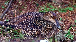
Estuary Islands National Wildlife Area (NWA) was created in 1986 to protect key nesting sites for migratory birds, particularly colonial seabirds such as the Common Eider. The NWA’s 404 hectares comprise a dozen or so islands or parts of islands scattered over some 120 kilometres between Kamouraska and Rimouski (Le Bic) in the St. Lawrence Estuary. These rocky islands are covered with herbaceous vegetation and forests dominated by fir and spruce. The NWA is
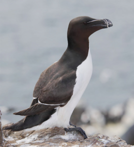
- home to large colonies of seabirds such as the Common Eider, Razorbill and Black-legged Kittiwake;
- colonized by some 10 000 Common Eider pairs-one of the largest colonies of this species in North America;
- frequented by species at risk such as the Peregrine Falcon.
This protected area is subjected to various natural disturbances, including disease outbreaks affecting the Common Eider. The NWA is also exposed to the risk of accidental oil spills in the St. Lawrence. Environment and Climate Change Canada ensures that the species and habitats of this unique and sensitive area are protected.
What are Environment and Climate Change Canada Protected Areas?
Environment and Climate Change Canada establishes marine and terrestrial NWAs for the purposes of conservation, research and interpretation. NWAs are established to protect migratory birds, species at risk, and other wildlife and their habitats. NWAs are established under the authority of the Canada Wildlife Act and are, first and foremost, places for wildlife.
Migratory Bird Sanctuaries (MBSs) are established under the authority of the Migratory Birds Convention Act, 1994, and provide a refuge for migratory birds in marine and terrestrial environments. The current Protected Areas Network consists of 54 NWAs and 92 MBSs comprising more than 12 million hectares across Canada.
What can I do at Estuary Islands NWA?
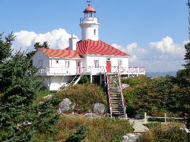
To protect the NWA’s fragile ecosystems, public access is only permitted on part of Pot du Phare Island for outreach purposes. Visitors have access from mid-July to mid-October following the seabird nesting season, provided that visitors use the transportation service offered by Duvetnor, the organization authorized by Environment and Climate Change Canada. Hiking, wildlife observation and photography are authorized at designated locations.
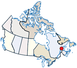
Long description of the map
Location of the NWA on an illustrated map of Canada. The NWA location is indicated by a general annotation in the province of Quebec.
Who can I contact?
Environment and Climate Change Canada - Quebec RegionCanadian Wildlife Service
801-1550 D’Estimauville Avenue
Québec, Quebec G1J 0C3
1-800-668-6767
Email: ec.enviroinfo.ec@canada.ca
Protected Area web site
