
Mississippi Lake National Wildlife Area pamphlet

What makes Mississippi Lake NWA so special?
The 264-ha Mississippi Lake National Wildlife Area (NWA), located on the southwest end of Mississippi Lake in eastern Ontario, comprises McEwen Bay and the surrounding uplands. The marshes in McEwen Bay provide food for thousands of migrating waterfowl each autumn. With its diversity of habitats including wooded swamps, hardwood forests, open fields and marshes, the NWA is also home to a variety of mammals, birds, reptiles, amphibians, fish and invertebrates.
Mississippi Lake NWA is:
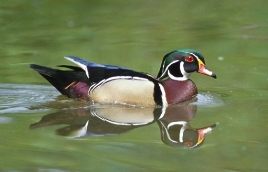
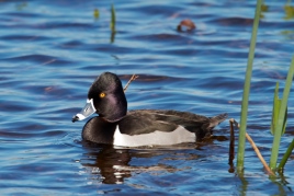
- an important fall staging habitat for tens of thousands of migrating waterfowl; American Black Duck, Ring-necked Duck, Blue-winged Teal, Mallard and Wood Duck are the most common;
- a breeding area for the Common Loon, Marsh Wren and Pied-billed Grebe;
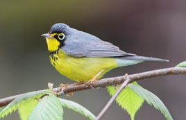
- habitat for several federally listed species at risk, such as the Canada Warbler, Least Bittern, Monarch and Butternut;
- home to 14 species of reptiles and amphibians;
- an important fish nursery;
- within the boundary of the Mississippi Lake Migratory Bird Sanctuary.
What are Environment and Climate Change Canada Protected Areas?
Environment and Climate Change Canada establishes marine and terrestrial NWAs for the purposes of conservation, research and interpretation. NWAs are established to protect migratory birds, species at risk, and other wildlife and their habitats. NWAs are established under the authority of the Canada Wildlife Act and are, first and foremost, places for wildlife.
Migratory Bird Sanctuaries (MBSs) are established under the authority of the Migratory Birds Convention Act, 1994, and provide a refuge for migratory birds in marine and terrestrial environments. The current Protected Areas Network consists of 54 NWAs and 92 MBSs comprising more than 12 million hectares across Canada.
What can I do at Mississippi Lake NWA?
Access is permitted for day use only at the entrance on Drummond Concession 9A. Activities allowed include hiking, skiing, snowshoeing, picnicking and wildlife viewing on the designated trail. Facilities include a public parking lot, hiking trail, public boat launch and washroom. Recreational boating and sport fishing (no lead sinkers) are permitted from December 16 through September 14, subject to federal and provincial regulations. Access to other parts of the NWA is restricted and requires a permit. For more information on access and permitting, please contact the Canadian Wildlife Service Regional office.
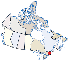
Long description of the map
Location of the NWA on an illustrated map of Canada. The NWA location is indicated by a general annotation in the province of Ontario.
Who can I contact?
Environment and Climate Change Canada - OntarioCanadian Wildlife Service
4905 Dufferin Street
Toronto, Ontario M3H 5T4
1-800-668-6767
Email: ec.enviroinfo.ec@canada.ca
Protected Area web site
