
Portobello Creek National Wildlife Area Management Plan: chapter 1
1 Description of the protected area
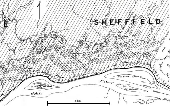
Portobello Creek National Wildlife Area (NWA) (45°47'N 66°33'E) borders the Saint John River, New Brunswick, lying between the villages of Maugerville to the west and Sheffield to the east (Figure 1). The most prominent feature of the NWA is the Portobello Creek, some 12 km in length, which meanders through the lowlands (Whitman 1968). The Portobello Creek flows from west to east and terminates at the junction of Indian and French lakes, a branch of the greater Saint John River watershed (figures 2 and 3). Noonan Stream is the main tributary of the Portobello Creek, joining the creek from the north.
The most significant habitat within the NWA is the expansive floodplain forest that covers 49% of the area. The NWA falls within a warm microclimate that favours hardwood trees such as the Red Oak, Butternut and Silver Maple along the borders of the lower Saint John River. A diversity of wetland habitats is also found, such as shrub swamp, emergent marsh, and open water ponds and creeks.
The Portobello Creek wetlands, together with the adjacent Grand Lake Meadows to the southeast, comprise the largest natural floodplain system remaining in Canada’s Maritime provinces. While development pressures in other locations have resulted in the diking, re-routing, and channelization of floodways and wetlands, the Portobello Creek system remains comparably pristine. Portobello Creek has been described as a “safety valve” for the Lower Saint John River by reducing the volume of water in the river channel (Wright and McIntyre 1970).
In 1974, 4000 ha of this floodplain forest-wetland complex were proposed for acquisition by fee simple purchase. To date, 2084 ha have been designated as an NWA under the Wildlife Area Regulations of the Canada Wildlife Act (Figure 1). Efforts are currently under way to acquire and designate additional lands.
| Categorie | Information |
|---|---|
| Protected area designation | National Wildlife Area |
| Province or territory | New Brunswick |
| Latitude and longitude | 45°55’N 66°21’W |
| Size (ha) | 2084 ha |
| Protected area designation criteria | Historic: Protecting a unique, undeveloped floodplain system with high value to waterfowl and other wetland obligate birds. Current: Meets criteria 1(a), where “the area supports a population of a species or subspecies or group of a species which is concentrated for any portion of the year”. A significant number and diversity of waterfowl use the National Wildlife Area as either breeding or migration habitat. |
| Protected area classification system | Category A - Conservation of species or critical habitat |
| International Union for Conservation of Nature (IUCN) classification | Ib |
| Order in Council number | PC 1995-473 |
| Directory of Federal Real Property (DFRP) number | DFRP number 04103 |
| Gazetted | August 30, 1995 |
| Additional designations | A portion of the National Wildlife Area is listed within the Lower Saint John River Important Bird Area. An area contiguous with the National Wildlife Area is designated as a Protected Natural Area under the provincial Act. |
| Faunistic and floristic importance | Significant floodplain complex |
| Invasive species | Purple Loosestrife (Lythrum salicaria) |
| Species at risk | The NWA supports six species at risk under the federal Species at Risk Act : Butternut (Juglans cinerea), Canada Warbler (Wilsonia canadensis), Chimney Swift (Chaetura pelagicaI), Common Nighthawk (Chordeiles minor), Monarch (Danaus plexippus) and Yellow Rail (Coturnicops noveboracensis) |
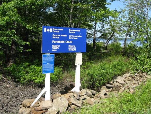
| Management agency | Environment and Climate Change Canada - Canadian Wildlife Service |
| Public access and use | There is limited access over land, with public use of the area primarily through the waterways. |
| Other appropriate information | This area is relatively remote and is frequently accessed by water. In high winds, the more open waterways by French Island can be dangerous for small boats and canoes. |
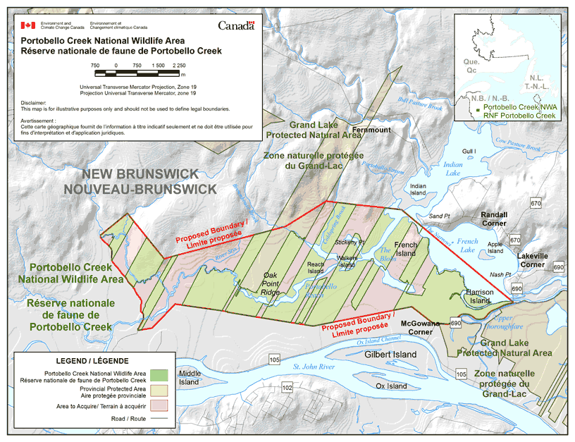
Long description for figure 1
Map showing the boundaries of Portobello Creek NWA, located in New Brunswick. The wildlife area is separated into sections spaced out along Portobello Reach, just north of the St. John River. The map shows the proposed boundary for the NWA, it encompasses the sections of the wildlife area, a section, in the centre, of the Grand Lake Protected Natural Area, and the areas to acquire, creating a continuous wildlife area. The National Wildlife Area extends from French Lake and Indian Lake in the East to the north of Middle Island in the West. In the south-east corner, it shares its boundary with Grand Lake Protected Natural Area. Within Portobello Creek NWA, the map shows a few streams including The Blobs, Portobello Reach and Coldspring Brooks. The map shows several communities such as Randall Corner and Lakeville Corner on the east side, McGowans Corner on the south side, and roads such as the 670, the 690, the 105 and the 102. The inset map shows the location of Portobello Creek NWA in the central southern area of New Brunswick, relative to Newfoundland and Quebec. The scale on the map is in meters and the Universal Transverse Mercator Projection is Zone 19. Disclaimer: This map is for illustrative purposes only and should not be used to define legal boundaries. Portobello Creek NWA, provincial protected areas, areas to acquire and roads are indicated on the map.
1.1 Regional context
Portobello Creek NWA is located in the Atlantic Maritime Ecozone, which includes all of New Brunswick, Prince Edward Island, Nova Scotia and Quebec’s Gaspe Peninsula. Within this ecozone, the NWA is part of the Maritime Lowlands Ecoregion (Figure 4), characterized by mixedwood forests and extensive wetlands. This region is typified by warm summers and mild, snowy winters. Total annual precipitation ranges from 1000-1300 mm. Mean temperatures reach 15.5°C in summer and -5.5°C in winter (Ecological Stratification Working Group 1995).
Portobello Creek NWA falls within the Grand Lake Ecodistrict (Figure 4). The unusually warm climate in this area allows for the presence of trees usually encountered further south, such as Green Ash (Fraxinus pennsylvanica), Butternut (Juglans cinerea) and Silver Maple (Acer saccharinum) (Ecoregions Working Group 1989; Zelazny 2007).
The soils of this area belong to the poorly drained phase of the interval series that is almost exclusively confined to the floodplain region of the Saint John River. These soils are flooded annually by the spring freshet, which deposits thin layers of silt on the surface. The interval soils are very fertile and are of considerable importance to the local economy, particularly for sod production and agriculture. The land immediately adjacent to the Saint John River is somewhat higher and better drained. Inland from the river, the land slopes downhill into poorly drained conditions where water from the spring freshet may remain through much of the growing season (Stobbe 1940).
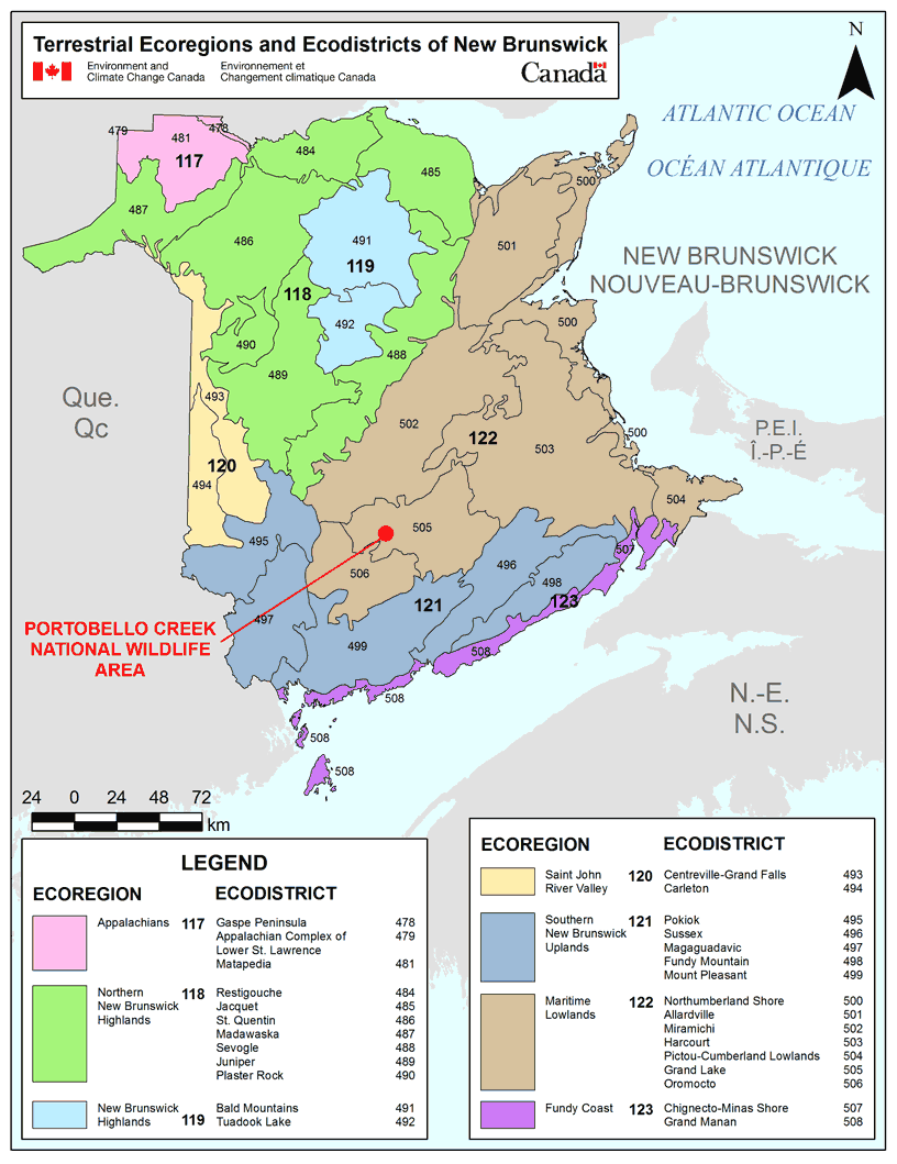
Long description for figure 4
Illustration showing the terrestrial ecoregions and ecodistricts of New Brunswick and the location of Portobello Creek National Wildlife Area. Seven ecoregions are shown, with Portobello Creek NWA being located within Ecoregion No. 122, Maritime Lowlands. 28 ecodistricts are shown, with Portobello Creek NWA being located within Ecodistrict No. 505, Grand Lake, in the central southern area of the province. The scale on the map is in kilometers. The legend shows all terrestrial ecoregions and ecodistricts present in New Brunswick.
1.2 Historical background
The Saint John River has long been home to the Wolastoqiyik (Malecite) First Nation, and the many ancient camp sites along the river attest to this history (Raymond 1950). Lands to the east and south bordered the Mi’kmaq First Nation. Most of the place names in the area have Aboriginal origins. The waters of Portobello Creek eventually empty into the Jemseg River, whose name is derived from “Ajemseg,” a Wolastoqiyik word meaning “gathering place.” There are two registered archaeological sites (Borden designations BIDn-15 and BIDn-16) within Portobello Creek NWA.
The first English trading post on the Saint John River was established at the mouth of the Jemseg River in 1659. This trading post and adjacent land subsequently became the site of Fort Jemseg in 1667. Early French settlers abandoned the area in 1702 when the war between England and France resumed (Raymond 1950). French Acadians returned to Maugerville in 1718 and resettled the area until the expulsion of 1755 (Stobbe 1940; Raymond 1950). In the late 1700s, English settlers from Massachusetts arrived as part of the United Empire Loyalist immigration and took up land along the Saint John River. The configuration of land ownership patterns and parcels today reflects these late 18th-century land grants (Figure 5). Much of the higher and more valuable land adjacent to the river was quickly cleared and settled, while much of the backcountry wetland remained undeveloped.
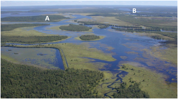
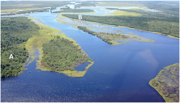
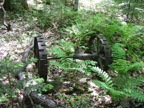
One area of backcountry wetland that was developed was at Stickney Point, west of French Island (Figure 6). This site is now accessible primarily by boat, and although considered remote by today’s standards, the site is central to the waterways that were once the primary means of navigation. The site at Stickney Point may have been the home of the Hon. Charles Burpee (1817-1909), who represented Sunbury in the House of Commons from 1867 to 1887 and was a member of the Senate in 1900.
Long description for figure 5
Late 18th-century historical map showing land grants in Sheffield and Maugerville, New Brunswick. Grants consist of narrow sections of lands from the shore of the John River and spreading in a north-east direction. Names of the land owners circa 1790 are indicated on the map. The scale on the map is in kilometers.
1.3 Land ownership
Portobello Creek NWA is owned by the Government of Canada and is administered by the Canadian Wildlife Service of Environment and Climate Change Canada. “Water lots,” where title may be held of temporarily or permanently flooded land, are common in the Portobello Creek region. Lands adjoining the NWA are owned by the province and private interests.
The configuration of the current protected area is fragmented, thus complicating both the site administration as well as being able to clearly communicate allowable activities to the public. Land assemblage to complete the proposed total acquisition of 4000 ha is ongoing. This is subject to the availability of acquisition funds. Lands are secured, subject to an independent appraisal, from willing vendors at fair market value, determined at highest and best use.
The federal government does not currently hold the subsurface mineral rights for Portobello Creek NWA.
1.4 Facilities and infrastructure
Portobello Creek NWA is remote and contains no roads or trails, making maintenance requirements minimal (Table 2). Annual visits include site inspections, repairs and replacement of regulatory signage (including boundary, public notice and 2’ x 4’ NWA identification signage). Travel within the NWA is primarily by boat. Two small boat landings function as public points of access: the “Twin Bridges” on Route 690, south of Lakeville Corner, and Sandy Point at the eastern end of the NWA (Figure 7). The western boundary of the NWA can be approached from the Church Road off Route 105 at Maugerville.
| Type of Facility or Infrastructure | Approximate Size (m, m2, km, km2 or m lin.) or Number |
Responsibility Holder or Owner |
|---|---|---|
| Property boundary | 34.6 km | Environment and Climate Change Canada - Canadian Wildlife Service (ECCC-CWS) |
| Boundary signs | 700 | ECCC-CWS |
| NWA entry signs | 1 | ECCC-CWS |
| Public notice signs | 20 | ECCC-CWS |
| Research cabin | 1 (4 x 8 m) | ECCC-CWS |
| Boat landings | 2 (Twin Bridges and Sandy Point) | Province - New Brunswick |
1.5 Socio-economic assessment
Although no specific socio-economic studies have been conducted regarding Portobello Creek NWA, more general surveys have highlighted the value that the Canadian public places on habitat set aside for wildlife (Gates 1975; Environment Canada 1991) and the economic significance of nature-related activities (Environment Canada 2000).
Public access to Portobello Creek NWA is permitted, although the area is not promoted as a tourism destination. The area is frequented by recreational bird watchers, canoeists and photographers; hunting, fishing and trapping are allowed, subject to applicable federal and provincial regulations. These outdoor pursuits support the local economy and provide health benefits to visitors, through leisure exercise and enjoyment.
The waters around French Island support an important harvest of Gaspereau (Alosa pseudoharengus) used as bait for the more lucrative American Lobster (Homarus americanus) fishery. The economic value of this product is considerable.
During flooding events, Portobello Creek and the adjacent floodplain allow water to bypass the communities along the main river, protecting a considerable infrastructure from loss. Wright and McIntyre (1970) describe the Portobello Creek as a “safety valve” for the Lower Saint John River.