
Barren-ground Caribou, Dolphin and Union population, management plan proposed 2017
Official title: Management Plan for the Barren-ground Caribou (Rangifer tarandus groenlandicus), Dolphin and Union population, in Canada: Adoption of the Management Plan for the Dolphin and Union Caribou (Rangifer tarandus groenlandicus x pearyi) in the Northwest Territories and Nunavut [Proposed] - 2017
Table of contents
Species at Risk Act
Management Plan Series
Adopted under Section 69 of SARA
Barren-ground Caribou, Dolphin and Union population
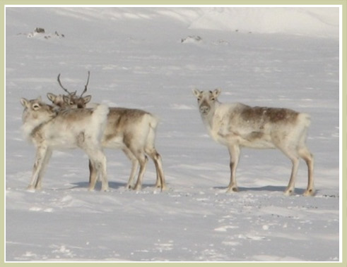
Photo: © Kim Poole
Part 1 - Table of contents
- Part 1 – Federal Addition to the Management Plan for the Dolphin and Union Caribou (Rangifer tarandus groenlandicus x pearyi) in the Northwest Territories and Nunavut, Prepared by Environment and Climate Change Canada.
Part 2 - Table of contents
- Part 2 – Management Plan for the Dolphin and Union Caribou (Rangifer tarandus groenlandicus x pearyi) in the Northwest Territories and Nunavut, prepared by the Government of the Northwest Territories, Department of Environment and Natural Resources; the Government of Nunavut, Department of Environment; and the Government of Canada, Environment and Climate Change Canada.
- Table of contents
- 1 Introduction
- 2 Plan development
- 3 Historical and social perspective
- 4 Species information
- 5 Threats and limiting factors
- 6 Management
- 7 Measuring progress
- 8 Next steps
- 9 References
- Appendix A: IUCN threat classification table and threat calculator results for Dolphin and Union Caribou
- Appendix B: Dolphin and Union Caribou management framework
- Appendix C: Effects on the environment and other species
List of figures
- Figure 1. Management planning process for Dolphin and Union Caribou.
- Figure 2. Caribou range map in Canada, broken down into designatable units (COSEWIC, 2011).
- Figure 3. Dolphin and Union Caribou near High Lake, west of Bathurst Inlet, April 2008. Photo by K. Poole, used with permission.
- Figure 4. Notable place names and the current range of Dolphin and Union Caribou (NWT Environment and Natural Resources, range data developed for Species at Risk program 2016).
- Figure 5. Distribution of calving locations from collared caribou. Data from 1987-89 (green dots; Gunn and Fournier 2000), 1994-97 (orange triangles; Nishi 2000), 1994-97 (red stars; Nishi 2000), 1999-2006 (purple diamonds; Poole et al. 2010) and 2003-06 (yellow squares; Poole et al. 2010). Figure modified from SARC 2013, by B. Fournier, GNWT-ENR 2016.
- Figure 6. Dolphin and Union Caribou fall migration between Victoria Island and the mainland (modified from Poole et al. 2010, by B. Fournier, GNWT-ENR 2016).
- Figure 7. Population Estimates from 1994 to 2015.
- Figure 8. Approximate distribution of wintering Dolphin and Union Caribou during the late 1980s (pink line), and the mid-1990s to mid-2000s (gold line), based on radio-collared caribou. Data from Poole et al. (2010); figure reproduced from the SARC (2013) by B. Fournier, GNWT-ENR 2016.
- Figure 9. Dolphin and Union Caribou cycles: Determining the location of the Dolphin and Union Caribou population within its cycle.
List of tables
- Table 1. Summary of status designations.
- Table 2. Summary of observations on the population and distribution of Dolphin and Union Caribou, from TK, communities, and science up to 1990.
- Table 3. Threat calculator assessment
- Table 4. Management objectives
- Table 5. Approaches to management of the Dolphin and Union Caribou.