
Southern mountain caribou (Rangifer tarandus caribou) protection study 2017: chapter 9
Annex 2. Key maps for high elevation data
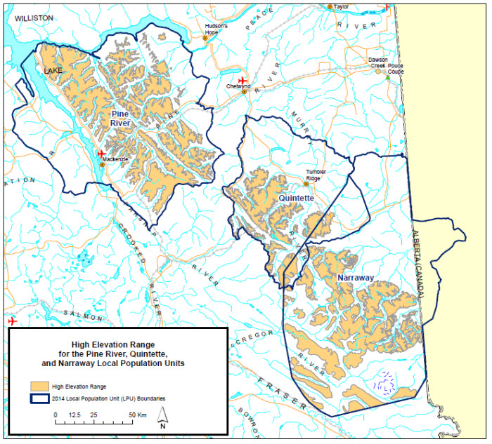
Long description for map A1
This map shows high elevation range as it is mapped by the province of BC, in pale brown. The LPU boundaries are shown in thick dark blue lines.

Long description for map A2
This map shows high elevation range as was used by ECCC to map disturbance in non-high elevation ranges, for the purpose of this study. Different data sources are depicted as follows: wildlife habitat areas (“no harvest”, designated for caribou) are shown in pink outline, ungulate winter ranges (“no harvest”, designated for caribou) are shown in dark blue outline, high elevation summer range mapped by Seip 2015 is shown in orange diagonal lines, high elevation winter range mapped by Seip 2015 is outlined in turquoise, data from Wildlife Infometrics 2008 (equivocal or preferred habitat class) is shown with green fill, and data from the 2005 Hart and Cariboo Mountains dataset is shown in pink fill. The LPU boundaries are shown in thick grey lines.