
Mexican mosquito fern (Azolla mexicana) in British Columbia, proposed recovery strategy 2017
Official title: Recovery Strategy for Mexican Mosquito Fern (Azolla mexicana) in British Columbia - 2017 [Proposed]
Table of contents
Species at Risk Act
Recovery Strategy Series
Adopted under Section 44 of SARA
Mexican Mosquito-fern
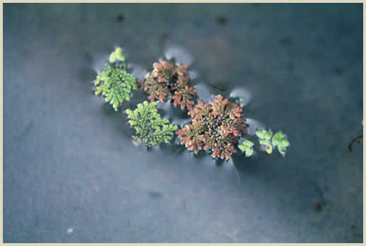
Credit: Paul Redfearn © Ozarks Regional Herbarium
Part 1 - Table of contents
- Part 1 – Federal Addition to the Recovery Plan for the Mexican Mosquito Fern (Azolla mexicana) in British Columbia, prepared by Environment and Climate Change Canada.
List of figures
- Figure 1. Critical habitat for Mexican Mosquito-fern is represented by the shaded yellow polygons where the criteria and methodology set out in Section 1.1 are met. The detailed polygons show the area containing critical habitat at Population #1: Little Fort, north of Mount Loveway (88.3 ha) and Population #3: Mount Loveway, 1.8 km southeast of (3.8 ha). The 1 km x 1 km UTM grid overlay shown on this figure is part of a standardized national grid system that is used to indicate the general geographic area within which critical habitat is found in Canada. Areas outside of the shaded yellow polygons do not contain critical habitat.
- Figure 2. Critical habitat for Mexican Mosquito-fern is represented by the shaded yellow polygons where the criteria and methodology set out in Section 1.1 are met. The detailed polygons show the area containing critical habitat at Population #2: Little Fort, south of (20.1 ha). The 1 km x 1 km UTM grid overlay shown on this figure is part of a standardized national grid system that is used to indicate the general geographic area within which critical habitat is found in Canada. Areas outside of the shaded yellow polygons do not contain critical habitat.
- Figure 3. Critical habitat for Mexican Mosquito-fern is represented by the shaded yellow polygons where the criteria and methodology set out in Section 1.1 are met. The detailed polygon shows the area containing critical habitat at Population #5: Chinook Creek (0.8 ha). The 1 km x 1 km UTM grid overlay shown on this figure is part of a standardized national grid system that is used to indicate the general geographic area within which critical habitat is found in Canada. Areas outside of the shaded yellow polygons do not contain critical habitat.
- Figure 4. Critical habitat for Mexican Mosquito-fern is represented by the shaded yellow polygons where the criteria and methodology set out in Section 1.1 are met. The detailed polygons show the area containing critical habitat at Population #6: Tappen, Shuswap Lake (5.2 ha). The 1 km x 1 km UTM grid overlay shown on this figure is part of a standardized national grid system that is used to indicate the general geographic area within which critical habitat is found in Canada. Areas outside of the shaded yellow polygons do not contain critical habitat.
- Figure 5. Critical habitat for Mexican Mosquito-fern is represented by the shaded yellow polygons where the criteria and methodology set out in Section 1.1 are met. The detailed polygons show the area containing critical habitat at Population #7: Salmon Arm (31.1 ha). The 1 km x 1 km UTM grid overlay shown on this figure is part of a standardized national grid system that is used to indicate the general geographic area within which critical habitat is found in Canada. Areas outside of the shaded yellow polygons do not contain critical habitat.
- Figure 6. Critical habitat for Mexican Mosquito-fern is represented by the shaded yellow polygons where the criteria and methodology set out in Section 1.1 are met. The detailed polygons show the area containing critical habitat at Population #9: Cambie, 2.7 km west of (5.2 ha). The 1 km x 1 km UTM grid overlay shown on this figure is part of a standardized national grid system that is used to indicate the general geographic area within which critical habitat is found in Canada. Areas outside of the shaded yellow polygons do not contain critical habitat.
- Figure 7. Critical habitat for Mexican Mosquito-fern is represented by the shaded yellow polygons where the criteria and methodology set out in Section 1.1 are met. The detailed polygons show the area containing critical habitat at Population #10: Vernon (10.9 ha). The 1 km x 1 km UTM grid overlay shown on this figure is part of a standardized national grid system that is used to indicate the general geographic area within which critical habitat is found in Canada. Areas outside of the shaded yellow polygons do not contain critical habitat.
List of tables
- Tables 1. Summary of essential biophysical features, functions, and attributes of Mexican Mosquito-fern habitat in British Columbia.
- Tables 2. Examples of activities likely to result in the destruction of critical habitat for Mexican Mosquito-fern. Associated threat numbers are in accordance with the IUCN-CMP unified threats classification system (CMP 2010).
Part 2 - Table of contents
- Part 2 – Recovery Plan for Mexican Mosquito Fern (Azolla mexicana) in British Columbia, prepared by the British Columbia Ministry of Environment.
- Table of contents
- 1 COSEWIC species assessment information
- 2 Species status information
- 3 Species information
- 4 Threats
- 5 Recovery goal and objectives
- 6 Approaches to meet recovery objectives
- 7 Species survival and recovery habitat
- 8 Measuring progress
- 9 Effects on other species
- 10 References
List of figures
- Figure 1. Mexican mosquito fern, Little Fort, B.C. (Jamie Fenneman).
- Figure 2. North American distribution of Mexican mosquito fern (COSEWIC 2008).
- Figure 3. Distribution of Mexican mosquito fern in British Columbia. Subpopulations are grouped within the populations for ease of viewing (B.C. Conservation Data Centre 2015).
List of tables
- Table 1. Summary of Mexican mosquito fern populations in British Columbia (B.C. Conservation Data Centre 2015).
- Table 2. Summary of essential features, functionsand attributes of Mexican mosquito fern habitat in British Columbia (compiled by Environment and Climate Change Canada 2015).
- Table 3. Threat classification table for Mexican mosquito fern in British Columbia.
- Table 4. Recovery actions for Mexican mosquito fern.