
Flood forecasting centres across Canada
Alberta Environment's River Forecast Centre
Alberta Environment's River Forecast Centre serves multiple functions such as:
- providing flood warnings for river flood events due to melting snow or heavy rainfall;
- producing monthly water supply forecasts from February to August and providing day-to-day water supply forecasting services during periods of low flow;
- responding to information requests from the public which are on the increase as interest in river-related recreation grows; and
- developing reservoir operation procedures for flood and water supply management.
The River Forecast Centre employs nine full-time staff to supply these services.
Information services
Information for real-time water management has become a focus for much of the Centre's work. River flows and canal diversions are monitored continuously to enable optimum management of often scarce water resources in southern Alberta. Forecasts of flows at the Saskatchewan border are made to ensure that interprovincial apportionment commitments are met.
Several weekly reports of river flow and lake level conditions are distributed to a variety of interested clients by mail and fax.
These reports provide various types of information on historical and present conditions as well as an overall synopsis of flow conditions and a forecast of expected trends. The Centre also maintains a telephone information service using recorded messages regarding flow conditions throughout Alberta, primarily for canoeists.
Data acquisition
The Centre is highly automated, particularly in its ability to collect real-time data. It accesses data from remote river level and weather monitoring stations through satellite and telephone telemetry. The Centre's DACQ Real-time Data Acquisition System processes approximately 20 000 pieces of information each day.
The GOES (Geostationary Operational Environmental Satellite) system is used to obtain data from more than 100 remote sites. The remote data collection platform automatically sends a signal every three hours to the satellite, which relays it to a ground receiving station near Washington, D.C. The River Forecast Centre's DACQ System then accesses the GOES computer by telephone line to download the telemetered information.
Telephone telemetry is used at over 100 stations in Alberta. The DACQ Computer automatically telephones each site, retrieves the data, and stores it. The data are used not only by the River Forecast Centre but by a variety of other water management agencies as well.
As a pilot project, the Centre receives weekly snow cover maps derived from NOAA (U.S. National Oceanic and Atmospheric Administration) satellite imagery. These maps are used to estimate area and water equivalent of snowcover in prairie areas for spring runoff forecasting.
Flood forecasting dissemination
Flood forecasts are produced as the need arises and are sent directly to a variety of government and public news media agencies. Alberta's Public Safety Services Department receives flood warnings from the Centre and uses the information to work with municipalities on flood damage prevention. The Centre also communicates directly with affected municipalities to pass on technical information about the flooding.
Flood information is disseminated in stages. Forecasts based on predicted rainfall are issued to special clients such as Environment Canada to alert them to a potential situation. If heavy rainfall occurs but little or no flooding is expected, a "High Water Advisory" may be issued. If significant flooding is a certainty, then a "Flood Warning" is issued and all concerned parties notified.
During floods, the River Forecast Centre operates around-the-clock if the situation warrants, to provide up-to-date information to the wide variety of agencies involved in flood damage prevention.
British Columbia Flood Forecasting
See the BC Ministry of Sustainable Resource Management's River Forecast Centre Web site
Forecasting Great Lakes Levels
In 1986, when lake levels had reached record highs for the century, Environment Canada established two centres in Ontario to forecast and disseminate information about Great Lakes water levels. One was the Meteorological Service of Canada's Great Lakes Water Level Forecast Centre at the Ontario Weather Centre in Toronto. The other was the Great Lakes Water Level Communications Centre located at the Canada Centre for Inland Waters in Burlington.
The Water Level Forecast Centre notified the Communications Centre of high water level watches and warnings. The Communications Centre, in turn, provided up-to-the-minute information to the public and media.
The Communications Centre was able to maintain a record of the high water events using information obtained from gauges, weather stations, wave rider buoys, Conservation Authorities, police forces, and other first hand observers. The progress of an event's water levels, wave heights and wind directions was plotted.
As lake levels began to decline in 1987, the high water level crisis passed. While both the Communications Centre and the Water Level Forecast Centre retain their capabilities for crisis response, their focus has shifted. The Water Level Information Office currently concentrates on educating the public about the Great Lakes system, the causes of fluctuating water levels and actions people can take to cope with water level changes. It continues to act as a central source of data for flooding and erosion damages, water levels and shore processes in general. The Ontario Weather Centre's responsibility has been assumed by the Regional Centre at Thunder Bay, and it continues to issue high water level watches and warnings when conditions warrant, as was the case during several events in 1997 and 1998.
Manitoba's River Forecast Centre
Streamflow forecasting for the agricultural and urban areas of southern Manitoba is carried out by a River Forecast Centre located in the head office of the Water Resources Branch, Manitoba Department of Natural Resources in Winnipeg. While the River Forecast Centre prepares generalized runoff outlooks for all of Manitoba, river forecasts in the Canadian Shield area of northern Manitoba are prepared by Manitoba Hydro, since streams in this area are highly controlled by the utility for hydroelectric power production.
In southern Manitoba, river forecasting is primarily directed toward floods, since the climate, topography and soils make the area highly susceptible to severe spring floods. During the 1980s, drier weather shifted the emphasis somewhat more toward water supply forecasting for reservoir operations and minimum flow/stage prediction on major rivers.
River forecasting was formally initiated in Manitoba in 1954, following the completion of a major investigation and report subsequent to the disastrous 1950 flood on the Red River. Forecasting procedures remained relatively limited until the 1970s, when the forecasting capability was greatly expanded and improved and the River Forecast Centre, in effect, became established. During the 1980s, a seven-year streamflow simulation study was undertaken in conjunction with the Canada-Manitoba Flood Damage Reduction Agreement on Flood Forecasting. This included testing several models of varying complexity for data requirements, calibration effort required, accuracy and cost effectiveness. Formal reports on the study have been prepared and distributed.
Modelling is just part of the ongoing mandate of the Centre to improve and apply river forecasting methodologies. The applications component involves the preparation of two types of runoff forecasts each spring: preliminary and operational. Preliminaries, or flood outlooks, are prepared well in advance of spring runoff to give an indication of peak flows and water levels to be expected under various probabilities of future weather conditions. Operational forecasts are done once spring runoff has begun and involve prediction of daily as well as peak river levels and dates.
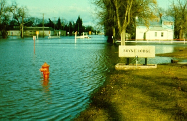
Boyne River (Carman, Manitoba )
Operational forecasting involves the updating of earlier flow and stage predictions based on observed melt conditions, spring precipitation and runoff. This requires daily, synoptic and, at times, hourly data on ambient temperature, dew point temperature, wind, sunshine and precipitation. These data are obtained from the Meteorological Service of Canada (Environment Canada). The Centre has a weather radar hookup with MSC to enable better assessment of the intensity and spatial distribution of rainfall.
Above all, operational forecasting requires real-time data on river levels and flows. Hourly stages are obtained by telephone or computer from a network of satellite data collection platforms (DCPs) and other telemetering devices operated by Environment Canada. Manitoba hires gauge readers to obtain daily water levels at many other locations during spring runoff. Discharge measurements are obtained primarily from Environment Canada, but Manitoba employs up to five additional crews to obtain supplementary measurements during floods.
Operational forecasts for smaller watersheds and tributaries are updated by adjusting predicted runoff volumes based on field observations. Index areas are a useful aid in this process. These are small basins (75 to 200 square kilometres) where snow cover and runoff are intensely monitored. They provide an early indication of the runoff coefficient, which is then used to adjust the predicted runoff in nearby larger tributaries. Unit hydrographs for various rates of melt are used to convert predicted tributary runoff to daily streamflow. Predictions for larger watersheds are made by flood routing of the predicted daily tributary flows. The Muskingum routing method is generally used on the Red River.
Flood forecasts widely distributed
Preliminary forecasts are prepared by the Centre in the third week of February and March. A detailed numerical outlook for the lower decile, median and upper decile weather conditions (that is, dry, average and wet weather) is prepared in late-March. Additional outlooks are prepared in April if runoff is late to start and the flood potential changes significantly. The Centre presents the forecasts to the Flood Forecasting Advisory Committee for approval. Forecasts are provided to the news media through Government Information Services. They are distributed to:
- Manitoba Emergency Measures Organization;
- Emergency Preparedness Canada;
- cities, towns, villages;
- rural municipalities and local government districts;
- Indian bands;
- pertinent federal and provincial government officials; and
- other interested parties.
During a spring flood, status reports and forecasts are issued daily before noon. These reports are submitted to flood fighting organizations and government officials concerned. Major changes and periodic updates are announced through the news releases.
Although these flood forecasting methods continue to serve Manitobans very well, the 1997 flood demonstrated the need for a more dynamic, physically based approach for the Red River. The IJC Red River Task Force on Red River Flooding is currently investigating this requirement.
Flood Forecasting in the North
The development of flood forecasting systems in the North has been restricted by a lack of basic data on floods, and the cost and complexity of forecasting. As well, the limited cost of damages to the few flood-prone communities over the years has been factor.
In the Yukon, Indian and Northern Affairs Canada performs the following forecasting functions:
- developing and issuing daily flood forecasts for Ross River and Mayo during the freshet using a computer based temperature index model;
- developing estimates of breakup timing and associated water levels for the Yukon River at Dawson; and
- issuing monthly estimates of both peak flows and April to September volume runoff during the spring months starting March 1.
Moreover, flood forecasts are developed for all major Yukon drainage basins and other selected key locations.
In the Northwest Territories, Environment Canada field staff have extensively advised and assisted local flood watch committees in Hay River, Fort Simpson, and Aklavik for many years. An initial inter-agency flood forecast system has been developed for Hay River, which uses winter snow accumulation, ice deterioration due to warm weather and solar radiation, observed and forecast flows, and weather forecasts to estimate flood levels. Further cooperative efforts are required by Environment Canada, Indian and Northern Affairs Canada, the Government of the Northwest Territories, and the community of Hay River to complete development of a forecast system for the complex flooding situation at this location.
Ontario's Flood Forecasting and Warning System
Following the devastating impact of Hurricane Hazel in 1954, a flood forecasting and warning system was established in the province. The focus of the system is at the Ministry of Natural Resources (MNR), Aviation, Flood and Fire Management Branch (AFFMB) and the province's Conservation Authorities (CAs).
Since its inception in 1956, forecasting in the province has evolved from slide rules to computers, from volunteer observers phoning in data to direct satellite and telephone links between monitoring sites, and the computer generation of products for interpretation. The system has also evolved from a centralized system into local forecast and warning systems. In 1992, the province's Streamflow Forecast Centre amalgamated with MNR's Aviation and Fire Management Branch to form the Aviation, Flood and Fire Management Branch in order to consolidate MNR's flood, fire and aviation emergency response and associated activities.
Responsibilities for flood forecasting rest with the MNR and the CAs. The Aviation, Flood and Fire Management Branch is responsible for setting provincial flood emergency response policies, maintaining the provincial flood forecasting and warning system, operating the provincial flood and fire centre, and if required, augmenting the provincial response to a flood emergency. The Branch is also responsible for representing Ontario in the Federal-Provincial Agreement for Hydrometric Stations. The Flood Centre is responsible for analyzing, on a daily basis, the province's flood potential. To do this, the Centre maintains a communication and information system - called the Water Resources Information System - to rapidly collect and exchange information with agencies within the system. It also issues an "early alert" of threatening conditions and forecasts runoff and lake storm surge. This information is issued to Conservation Authorities, MNR District offices, emergency response organizations and agencies that operate water control structures.
The Conservation Authorities are responsible for predicting flows and water levels within their watersheds, operating flood control structures, and disseminating flood warnings to local municipalities and agencies. Outside of Conservation Authorities, the Flood Centre works with MNR District offices to predict flows, and the MNR District offices issue the local flood warning messages. The Centre also works with and provides information support to agencies that operate water control structures.
The development of flood forecasting and warning system is coordinated with the assistance of the Provincial Flood Forecasting and Warning Committee. The Committee is chaired by AFFMB and has membership from CAs, MNR Branch and field offices, and Environment Canada. The committee meets at least twice a year and reviews and recommends on items such as standards, models, equipment, information and training requirements.
MNR's Districts and the Conservation Authorities provide consultative services to municipalities for the preparation of flood contingency plans and during the response process. Municipalities, or MNR Districts where no municipalities exist, are responsible for preparing flood contingency plans, and for their implementation. Floodplain residents carry out self-help where possible.
Senior government is responsible for assessing flood situations and declaring provincial flood emergencies where the local capability has been exhausted. Once the declaration is made, the Provincial Flood and Fire Emergency Plan is put into effect. Response to a provincial flood emergency is augmented through AFFMB's Flood and Fire Centre.
Ottawa River Regulation Planning Board
From its source east of the Dozois Reservoir to its confluence with the St. Lawrence River, the Ottawa River travels more than 1130 kilometres. For most of its length, it forms the boundary between the provinces of Ontario and Quebec. Its basin has a total area of 146 300 square kilometres, 65% of which is in Quebec and 35% in Ontario.
Numerous storage dams were constructed in the basin during the period 1900 to 1958, primarily for hydroelectric energy production. In the meantime, several studies have led to reserving some storage for flood protection.
Storage of water in reservoirs operated mainly for the benefit of power generation can reduce flood flows; similarly, release of these waters during drought periods augments flows. The Ottawa River Regulation Planning Board, composed of three members from the federal government and two members each from Ontario and Quebec, ensures management of the principal reservoirs in the basin.
During the period from March to June, the Board and regulating agencies operate three computer-based models to assist in their decision-making. Hydro-Quebec is responsible for RFM, the runoff forecasting model, which supplies expected daily runoff for each specified location. The executive arm of the Board, its Secretariat, is responsible for the following models: SSARR (Streamflow Synthesis and Reservoir Regulation) and MORRO (Model for Ottawa River Regulation and Optimization). The SSARR is a simulation model which takes the known starting condition of the basin and routes the water in the system based on the proposed actions of the regulating agencies and the expected runoff. The MORRO is a multi-objective optimization model; the criteria used by this model are (1) maximization of hydroelectric power generation and (2) minimization of damages caused by flooding. The model reaches a compromise between these two criteria according to their respective monetary values. MORRO and SSARR produce reports of the results for operators and assist them in determining where, when and how much water to release from the reservoirs.
Sensitivity analysis is used on occasion to determine the sensitivity of the system to a variation in natural inflows.
It might be expected that the 30 storage reservoirs -- with more than 14 billion cubic metres capacity -- in the Ottawa River basin would sufficiently contain the floodwaters that occur each year in the Ottawa River system. In many years they do, especially during so-called dry years. Yet sometimes in spring, a heavy snowpack, a late thaw, above-normal rains, or a combination of these events can cause damaging floods. The flood peak from the southern part of the basin is largely unregulated and usually occurs about mid-April. This is followed, about three weeks later, by a second, usually larger peak from the central and northern areas which is partially regulated. The uncontrolled tributary sub-basins can contribute as much as 70% to 80% of the total volume of water passing through the flood risk areas on the Ottawa River.
An important aspect of managing a system such as the Ottawa River basin is to educate and inform the public. A brochure entitled "Managing the Waters of the Ottawa River" has been produced and widely distributed. Residents along the river have access to up-to-date information on flows and levels through a toll-free automated telephone service (numbers are listed below) and at the Ottawa River Regulation Planning Board's Web site.
- English
- Telephone: 819-994-7079
- Toll free: 1-800-778-1246
- French
- Telephone: 819-994-7078
- Toll free:1-800-778-12433
Saint John River Forecast Centre
The Saint John River is 720 kilometres long, draining an area of about 54 000 square kilometres. Approximately 51% of the drainage basin is in New Brunswick, 36% in the state of Maine, and 13% in Quebec. Prior to 1972, flood forecasting was carried out on the Saint John River by the New Brunswick Department of the Environment in cooperation with the New Brunswick Electric Power Commission. In 1973, these two agencies, with assistance from the federal government, combined their efforts to develop a more sophisticated flood forecasting system for the river. In 1977, the Canada-New Brunswick Agreement Respecting Flood Forecasting was signed. The agreement provided federal assistance and established the Saint John River Forecast Centre in the New Brunswick Department of the Environment.
Waterloo Row, Fredericton, New Brunswick (May 1, 1973).

Information on factors affecting flooding such as snow conditions, temperatures, precipitation patterns, water levels and streamflow conditions is routinely monitored by the forecast centre, using a wide variety of telecommunication systems ranging from satellites to the telephone. This information is supplied by several Canadian and U.S.agencies as well as a number of private individuals.
The information is then input to complex computer models along with up-to-date weather forecasts to produce forecasts of water levels along the Saint John River.
Flow forecasts are provided year-round, but special attention is paid to the production of forecasts during the high water period in the spring. Flood forecasts are issued to the public through the media and to several U.S. and Canadian agencies such as the New Brunswick Emergency Measures Organization.
Kennebecasis River flood warning system
A flood warning system has been set up for communities along the Kennebecasis River in the southeastern portion of the Saint John River basin. Since as far back as the mid-1800s, there has been significant flooding along the river. Most of these floods have been caused by heavy rainfall or snowmelt, or both. It may take as little as six hours for flooding to occur following a heavy rainstorm. This is not enough time for the Saint John River Forecast Centre to react and provide warnings to permit emergency action to be taken. Consequently, a self-help program has been established for the area.
Volunteer observers and municipal staff collect data from a network of water level gauging stations, weather observing stations, and snow courses. Their measurements and observations are critical to a successful flood warning program.
The operation is under the direction of a local Coordinator, who is responsible for the collection and analysis of the river and weather data and the issuance of flood warnings to the public through the local media.
Constant contact is maintained with the Saint John River Forecast Centre and the Emergency Measures Organization which organize general releases, as required, through the New Brunswick Information Service and the media at large.
Direct assistance to the program is provided by Environment Canada in addition to that given by the Saint John River Forecast Centre.
Saskatchewan River Forecast Centre
Saskatchewan extends from the plains in the south to the Canadian Shield in the north. The climate varies from semi-arid in the southwest to sub-humid in the central parkland region and northern areas. The southern half of the province, where most of the population lives, experiences mean annual precipitation of 300 to 400 millimetres, of which about 30% falls as snow. In this area, evaporation normally exceeds precipitation; therefore, the effective management of water, especially that which accumulates as snow and is released during spring runoff, is very important. During the spring runoff period, water must be efficiently stored in reservoirs where possible and those communities threatened by floods warned.
The management of the province's water resources is vital both from a water supply and a flood protection perspective. Sound water management can be achieved with proper operational planning of reservoirs and river systems and with an efficient streamflow forecasting service.
Regina, Saskatchewan

The North and South Saskatchewan rivers, with their headwaters in the Rocky Mountains, are the largest rivers in southern Saskatchewan. The rivers support multiple uses such as:
- hydroelectric power generation;
- water for irrigation and stock watering;
- water supply for domestic, municipal and industrial users;
- recreation and wildlife;
- transportation; and
- the commercial fishing industry.
The water use potential of the rivers has been increased significantly by the construction of major dams to create Codette Reservoir, Tobin Lake and Lake Diefenbaker.
The Saskatchewan Water Security Agency has the responsibility for streamflow and water supply forecasting in the province. Where justified by the need for flood warning and water supply management, spring runoff forecasting is carried out for rivers, multipurpose lakes and reservoirs. A runoff outlook, published each February 1, describes the antecedent precipitation conditions prior to freeze-up, winter precipitation to date, and the outlook for runoff in various regions. Detailed forecasts are issued semimonthly from March 1 until runoff commences. This includes peak daily mean flow, runoff volume, and peak water level for 24 stream locations as well as peak lake levels for 17 recreation and multi-purpose lakes and reservoirs.
Water supply and short-term forecasting is carried out in the Saskatchewan, Qu'Appelle and Churchill River basins on an ongoing basis. As well, operational planning for reservoirs and recreation lakes is conducted in this program. Sask Water, in conjunction with Environment Canada, is also responsible for monitoring and managing the flows on international and interprovincial streams to ensure that interjurisdictional commitments are met.
Located in Moose Jaw, the Forecast Centre is the focal point of the forecasting operation. Since 1986 there has been a commitment to automating Centre operations. This has been accomplished by developing a microcomputer-based, integrated database system of data collection, processing, report generation, and forecasting.
Spring runoff forecasts are issued in the form of news releases. A forecast is sent to other provincial departments and agencies, rural and urban municipalities, and the Provincial Emergency Measures Organization.
Water supply forecasts are mailed monthly to concerned agencies and individuals. Prior to major changes in the release from Lake Diefenbaker, the users below Lake Diefenbaker to the junction of the North and South Saskatchewan rivers are notified by telephone. This would give individual landowners who are irrigators time to move portable pump sites to higher ground.
During a flood event, reports are issued daily. Close contact is maintained with both the Alberta River Forecast Centre and the Manitoba River Forecast Centre. Media contacts are also established to help keep the public aware of any potential flooding.
Page details
- Date modified: