Welcome to Nanoose Harbour
About the harbour
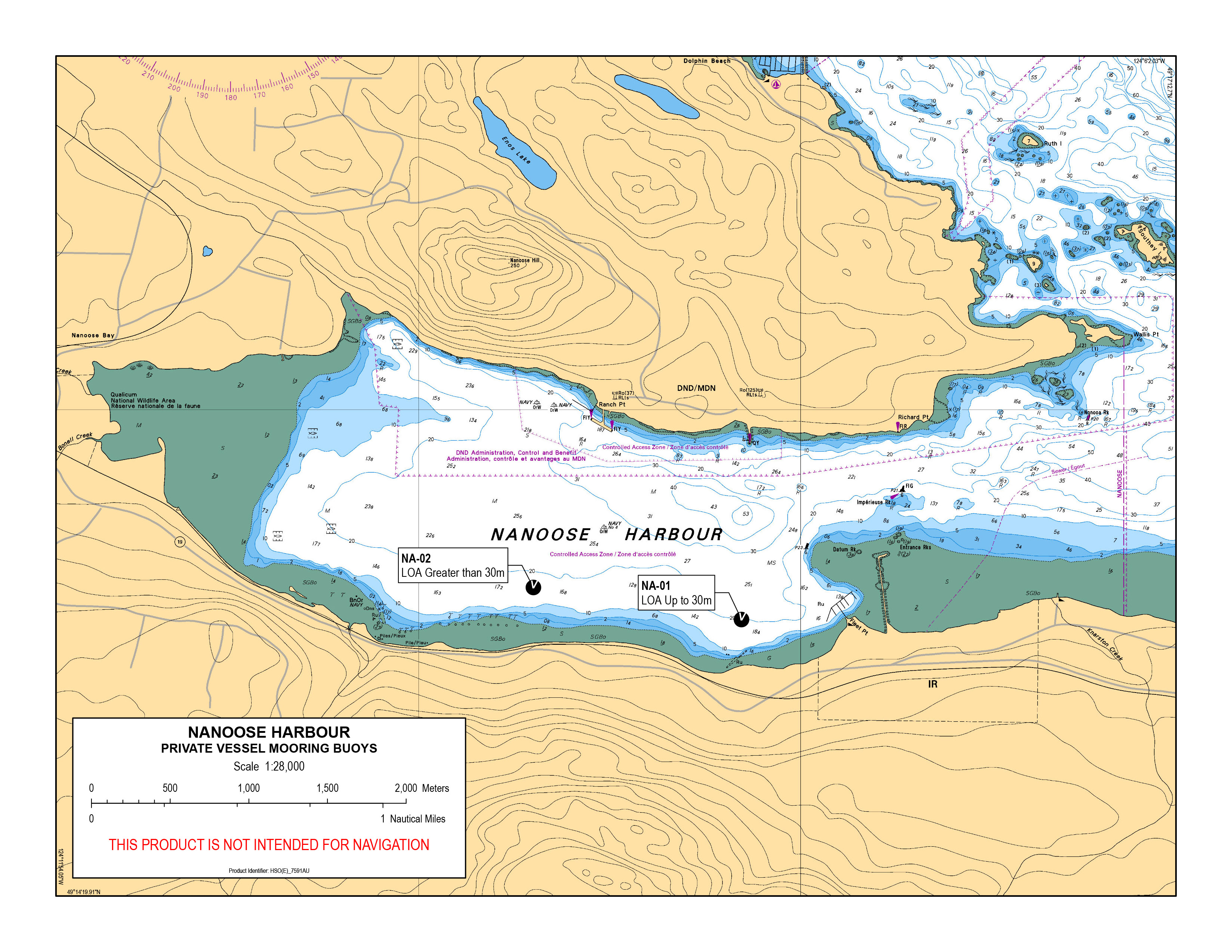
Nanoose Harbour is administered by the Department of National Defence and is governed by the Canada Marine Act and the Natural and Man-made Harbour Navigation and Use Regulations. The harbour is open to the public, within the limitations set out, in an Order in Council, regarding Controlled Access Zones.
For official nautical information on Nanoose Harbour, refer to Chart 3459, and/or PAC 201 Sailing Directions, published by Canadian Hydrographic Services.
The Nanoose Harbour limits are defined as all the navigable waters, including any foreshore, within Nanoose Bay to the west of a line running from the easternmost tip of Wallis Point (Latitude 49°16.250′ N, Longitude 124°06.305′ W) to a point due south on the shore at (Latitude 49°15.295′ N, Longitude 124°06.305′ W).
All pleasure craft are required to register their arrival, intended duration of stay, and departure from the harbour by contacting a harbour official.
Pleasure Craft
Pleasure craft reporting requirements when entering Nanoose Harbour
For pleasure craft requesting to temporarily visit the harbour.
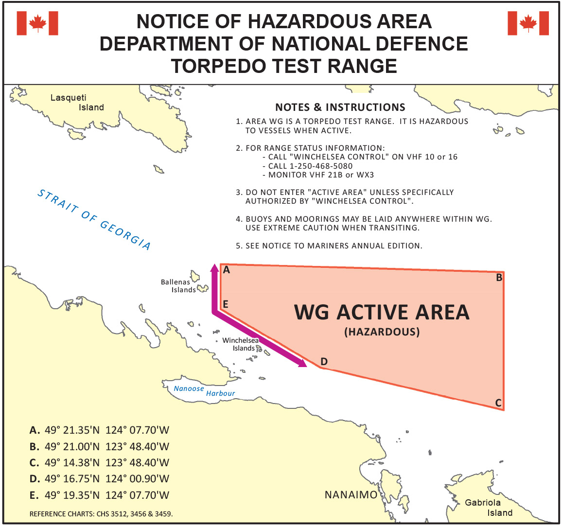
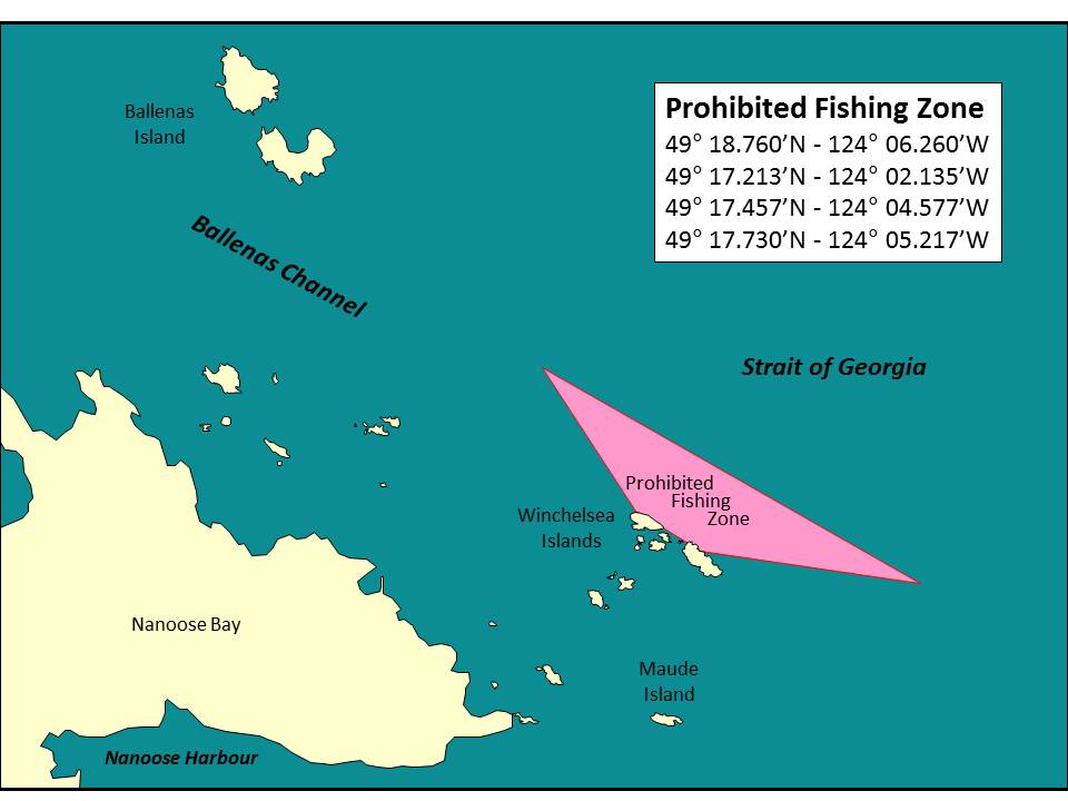
WG Weapons Testing Range
WG search
WG Weapons Range current status
Links
Contact us
| name | number |
|---|---|
| King’s Harbour Master | 250-468-5039 |
| King’s Harbour Master (Nanoose Harbour) | 250-327-4142 |
| Harbour Official / Assistant to King’s Harbour Master | 250-363-7584 |
| Emergency Line 24/7 | 250-363-2160 250-363-5848 |


