Issue 11, Spring 2019
POLAR UPdate, Spring 2019

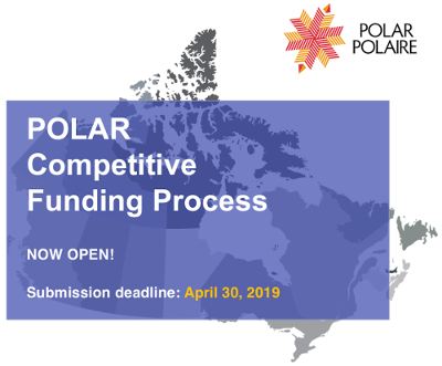
POLAR Competitive Funding Process
In February 2019 Polar Knowledge Canada (POLAR) launched a Call for Funding Applications for its 2020-23 Competitive Funding Process to support its Northern Science and Technology and Polar Knowledge Application programs. The deadline is April 30, 2019 to apply for funding in support of key themes under both programs. Click here for more information or to apply.
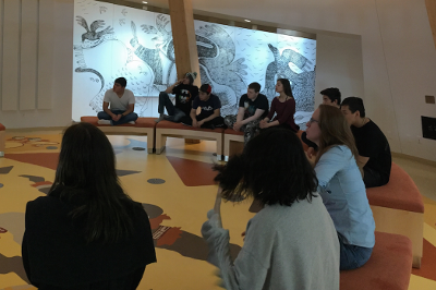
POLAR offers tours of the Canadian High Arctic Research Station campus
In February, POLAR began offering tours of the Canadian High Arctic Research Station (CHARS) campus to introduce visitors to the public areas in the Main Research Building and showcase the beautiful integrated Inuit artwork. Since Feb. 2018 there have been over 75 group and individual tours, with more than 800 people visiting the CHARS campus in this way. If you’re in Cambridge Bay and would like to see the inside of this remarkable facility, the tours take place every Wednesday between 2 and 4 p.m. Drop-ins are welcome at that time, but groups are asked to reserve ahead at tours@polar.gc.ca. If you’re not in Cambridge Bay you can take a virtual tour of the CHARS campus Main Research Building on POLAR’s website here.
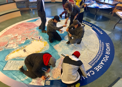
POLAR hosts Women in Northern Science event
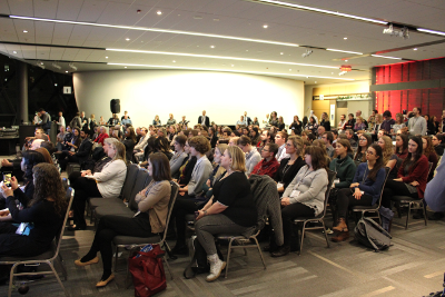
POLAR hosted a panel discussion and networking event celebrating the contributions of women to northern science, at the 2018 ArcticNet Annual Scientific Meeting in Ottawa in December 2018. The event started with an address by the Honourable Carolyn Bennett, Minister of Crown-Indigenous Relations, and moved on to discussions regarding progress in equity and inclusion in northern science, and explored solutions to barriers facing marginalized communities. Panelists included Madeleine Redfern, Mayor of Iqaluit, Dr. Donna Kirkwood, Chief Scientist at Natural Resources Canada, Andrew Dunford, Director of the Climate Change Secretariat at the Department of Environment, Government of Nunavut, and geography professors Dr. Jackie Dawson (University of Ottawa) and Dr. Melissa Lafrenière (Queen’s University).
Pilimmaksaivik Community Outreach Tour
In January POLAR joined other federal government departments, Indigenous organizations and the Government of Nunavut in the Pilimmaksaivik Community Outreach Tour and Travelling Career Fair. Pilimmaksaivik is the federal government’s Centre of Excellence for Inuit Employment in Nunavut. The tour included visits to the eastern Nunavut communities of Qikiqtarjuaq, Clyde River, Pond Inlet, and Arctic Bay to promote employment and education opportunities. POLAR staff spoke with young Inuit and other community members, raising awareness of potential careers and educational opportunities linked to science, technology, engineering, and mathematics. POLAR also promoted its student recruitment and science activities at Pilimmaksaivik’s career fair, held in March in Iqaluit.
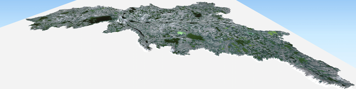
New digital model of arctic topography boosts POLAR’s ecosystem research
A new digital elevation model is helping POLAR researchers understand ecosystems near the Cambridge Bay, Nunavut region. Using data from the Polar Geospatial Center at the University of Minnesota, POLAR staff worked with partners at Environment and Climate Change Canada and the Canadian Space Agency to generate a digital elevation model for the Greiner Lake watershed. The model is based on high-resolution Worldview optical satellite data and, with a vertical accuracy close to 50 cm, is much more accurate than previous models for the watershed. It will help POLAR researchers model and map tundra ecosystems, identify the boundaries of the watershed, and understand how streams and lakes are connected – information that’s essential to understanding how arctic ecosystems function, and predicting how they may change in future. Through its partnerships with the Canadian Space Agency, the National Aeronautics and Space Administration (NASA), the British Antarctic Survey, and US universities, POLAR will be able to add more detail to this model over the coming years.
This will include increasing its elevation accuracy with data from an aerial survey using LIDAR technology, which uses airborne radar to provide very precise elevation measurements.
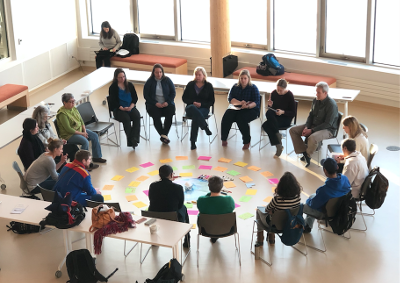
POLAR hosts Arctic Council’s Protection of the Arctic Marine Environment working group workshop at the CHARS campus
In March the Arctic Council working group on the Protection of the Arctic Marine Environment (PAME) held a workshop at the Canadian High Arctic Research Station (CHARS) campus in Cambridge Bay, Nunavut. One of six Arctic Council working groups, PAME provides a forum for collaboration related to the protection and sustainable use of the Arctic marine environment. The workshop at the CHARS campus, chaired by Fisheries and Oceans Canada, brought together Indigenous and community representatives and experts on marine protected areas, to focus on how Indigenous peoples and local communities can participate, as equal contributors, to the process of identifying, planning, and managing Arctic marine protected areas. Discussions emphasized the importance of taking the time to build relationships between researchers, Indigenous organizations and communities.