Ground water at Turkey Lakes watershed
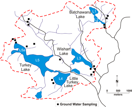
For the study of ground water at the Turkey Lakes Watershed (TLW), 57 test wells representing 69 sampling points were installed in eight sub-basins of the watershed (Figure 1).

Figure 1: Location of ground water sampling stations.
Please roll over with mouse on a desired station to view detail.
These wells (ranging in depth from 0.5 m to 9.7 m) are generally located in the thicker accumulation of till associated with valley floors, but a limited number have been constructed in shallow till.
Ground water in the TLW are well buffered and in general provide a reservoir of alkalinity for surface waters in the basin. the ground water chemistry is dominated by the weathering of carbonates present in the tills. Ground water can follow a variety of pathways through the subsurface. These pathways can have very different flow rates and ground water chemistry. As a result of this the influence of ground water on surface water is highly site specific.