
Overview of the Conservation Implementation Plan for the St. Lawrence Lowlands Priority Place
Alternate format
Document information
Cat. No.: CW66-1585/1-2025E-PDF
ISBN: 978-0-660-75034-7
EC24037
Unless otherwise specified, you may not reproduce materials in this publication, in whole or in part, for the purposes of commercial redistribution without prior written permission from Environment and Climate Change Canada’s copyright administrator. To obtain permission to reproduce Government of Canada materials for commercial purposes, apply for Crown Copyright Clearance by contacting:
Environment and Climate Change Canada
Public Information Centre
Place Vincent Massey building
351 St-Joseph Boulevard
Gatineau, Quebec K1A 0H3
Toll free: 1-800-668-6767
Email: enviroinfo@ec.gc.ca
Front page image copyright: St. Lawrence Lowlands Landscape © Christine Lepage ; Farm and hay bails © Benoît Jobin ; Western Chorus Frog © Raymond Belhumeur ; Blanding’s Turtle © Ryan M. Bolton.
© His Majesty the King in Right of Canada, represented by the Minister of Environment and Climate Change, 2025
Aussi disponible en français
Land acknowledgement
Many of the region’s First Nations attach great cultural and traditional importance to the St. Lawrence Lowlands (SLL). The historical and contemporary presence of the Mohawk, Algonquin, Abenaki, Atikamekw and Wendat nations on this territory is living testimony to this. Through this acknowledgement, it is our intent to show respect for the people who have stewarded these lands and waters since time immemorial and those who continue to care for them. We do this to reaffirm our commitment to learn and work together in the spirit of reconciliation.
Acknowledgements
We would like to thank all partners and collaborators to conservation in the St. Lawrence Lowlands, as well as funders, for their contributions to this initiative. Because of your efforts, a great deal of work has been accomplished, resulting in conservation actions that benefit species at risk and other wildlife, such as migratory birds and species of importance to Indigenous peoples. We would particularly like to thank the partners that were involved in the production of the Atlas of Sites of Conservation Interest in the St. Lawrence Lowlands and in the implementation of related conservation initiatives.
Introduction
Pan-Canadian approach to transforming species at risk conservation in Canada
Canada’s biodiversity is a cornerstone of our way of life. As human impact on the planet grows, more habitat is lost and more species are at risk of extinction. We need to take innovative action to protect and recover the animals, plants, and places we love. The Pan-Canadian Approach to Transforming Species at Risk Conservation in Canada (Pan-Canadian Approach) shifts from single-species approaches to conservation to approaches that focus on multiple species and ecosystems. Focusing our effort in specific locations with high biodiversity and concentrations of species at risk helps conserve habitat that benefits many species at the same time. It also brings together partners with common goals to improve collaboration and promote shared leadership. Through partnership, we are working to achieve sustainable protection and recovery of species at risk.
Important principles guide collaborative work under the Pan-Canadian Approach:
- shared priorities and leadership
- Indigenous engagement
- strengthened evidence-base for decision making
- aligned investments
We identify priorities using defined criteria, followed by:
- cooperative action planning
- investment and implementation of actions
- monitoring and reporting of results
The results and benefits of action under the Pan-Canadian Approach are:
- better conservation outcomes for more species at risk
- improved return on investment
- increased co-benefits for biodiversity and ecosystems
Priority places for species at risk
Under this approach, 12 Priority Places have been selected across Canada. These places have significant biodiversity, high concentrations of species at risk, and opportunities to advance conservation efforts. In each priority place, the federal and provincial or territorial governments are working with Indigenous peoples, organizations and other partners to develop conservation implementation plansFootnote 1.
As a whole, Priority Places have a higher percentage of private land than the rest of Canada and socio-economic activities are present on the landscape. We recognize the importance of stewardship by private landowners to the conservation of species at risk in these places and the need to work more broadly to identify conservation opportunities on those lands; we welcome new opportunities for collaboration with interested parties.
The Priority Places are at different stages of cooperative planning and implementation of conservation actions under the Pan-Canadian Approach. In many of these areas, important conservation work has been ongoing for a long time and in some of these places collaborative approaches and conservation planning were already underway before they were chosen as Priority Places. Other Priority Places are new initiatives and are in earlier stages of engagement and collaborative conservation planning. All of these Priority Places build on existing work by implementing coordinated, multi-partner conservation actions in these places, but there is no one size fits all approach to collaborative planning across these diverse places. To learn more about the Priority Places initiative and the work undertaken by our partners to recover species at risk within these priority places, please visit our interactive website.
Conservation implementation planning in the St. Lawrence Lowlands
Two agreements provided the framework for the development of the implementation strategy for this Priority Place: the St. Lawrence Action Plan (2011 to 2026) and the Canada-Quebec Agreement for the Protection of Species at Risk in Quebec (2012 to 2022). The Atlas of Sites of Conservation Interest in the St. Lawrence LowlandsFootnote 2 was developed mainly under the St. Lawrence Action Plan. The Atlas, as its name implies, identifies sites of conservation interest, building on the method outlined in the Open Standards for the Practice of Conservation. The Atlas is a cornerstone of the implementation approach adopted here and, since 2019, has served as a reference tool for governmental, non-governmental, municipal and academic organizations involved in planning and implementing conservation measures for terrestrial species at risk and natural habitats in the SLL.
The partner engagement framework used in planning and implementing conservation actions in the SLL varies. This framework is geared to partners with existing planning initiatives that target sites of conservation interest (that is those identified in the Atlas) supporting a concentration of terrestrial species at risk. In some cases, stakeholders involved in activities aimed at addressing conservation issues experienced across the SLL are also included.
A more comprehensive document on the strategy prioritized for implementing the Pan-Canadian Approach to Transforming Species at Risk Conservation in Canada in the St. Lawrence Lowlands is available upon request from ECCC (enviroinfo@ec.gc.ca).
St. Lawrence Lowlands Priority Place
Size:
3.15 million hectares
Description:
Corresponds to the natural province of the St. Lawrence Lowlands (BCR 13) to which have been added the Covey Hill (Montérégie) and L'Isle-aux-Grues Archipelago (Chaudière-Appalaches)
Ecosystem composition:
- 40% agricultural lands
- 24% forest
- 10% wetland
- 12% urban
- 11% open water
The St. Lawrence Lowlands Priority Place consists of a landscape of plains stretching over the north and south shores of the St. Lawrence River (Figure 1); it forms a vast and complex geographic feature containing diverse ecological contexts.
The SLL, split by the St. Lawrence River corridor, is of critical importance to migratory birds. It contains 13 migratory bird sanctuaries, four national wildlife areas and 25 important bird areas (IBAs). In addition, 68 priority bird species targeted in the strategy for bird conservation region 13 (BCR-13) occur in this Priority Place.

As of the date of publication of this document, this region had 68 terrestrial species assessed as at risk by COSEWIC (Committee on the Status of Endangered Wildlife in Canada), including 21 birds, 13 plants, 10 reptiles, 10 arthropods, 9 mammals, 4 amphibians and 1 lichen. Among these species, 59 are listed under the Species at Risk Act (SARA) (Figure 2); the SLL Priority Place contains the critical habitat of 17 of these species. Details of these species can be found in Appendix 1.

Long description
Figure 1 shows a map of the St. Lawrence Lowlands Priority Place.

Long description
Figure 2 shows information on the terrestrial species at risk in St. Lawrence Lowlands: a pie chart (left) indicating that there are 59 species listed under SARA and 5 species assessed as at risk by COSEWIC but not listed under SARA, and another pie chart (right) indicating the official status of the species under SARA: 19 endangered species, 19 threatened species, and 21 species of special concern.
Over 89% of the territory of the SLL is privately owned and only a very small portion has a status that allows for the protection of terrestrial species at risk habitat.
Vision statement
The vision statement for species at risk conservation in this Priority Place echoes the broad vision in the Atlas of Sites of Conservation Interest in the St. Lawrence Lowlands:
“The St. Lawrence Lowlands are recognized for their remarkable biodiversity, consisting of functional and representative ecosystems, many of which support viable populations of species at risk. By 2050, habitats necessary for the survival of terrestrial and aquatic fauna and flora (marshes, swamps, peatlands, old fields, forests, perennial crops, etc.) are conserved within an ecological network that is resilient to anticipated changes. The preservation of this natural heritage is possible through the concerted action of different levels of government (federal, provincial and municipal), conservation groups, regional consultation committees, businesses and citizens that manage natural resources in a sustainable manner.”
Conservation targets
The conservation targets represent different components of the territory that, if adequately protected or managed, would make it possible to maintain the overall biodiversity of the St. Lawrence Lowlands. Five ecosystem (coarse filter) conservation targets in the SLL, taken from the Atlas of Sites of Conservation Interest in the St. Lawrence Lowlands, were used as the basis for selecting sites of conservation interest for species at risk and determining conservation actions and strategies (Tables 1 and 2).

Coarse-filter conservation targets retained for implementing conservation actions in the SLL. [Photo credits: Environment and Climate Change Canada - wetlands, forested areas; Rick Harris, CC BY-SA 2.0, via Wikimedia Commons – Open areas - old fields; Benoît Jobin – aquatic environments, open habitats - agricultural grasslands.]
Long description
A series of 5 images representing each of the conservation targets for St. Lawrence Lowlands: Aquatic environments, Old fields, Forested areas, Open habitats - agricultural grasslands, and Wetlands.
Coarse-filter target |
Type of habitat, ecosystem or plant association |
Examples of species at risk associated with the conservation target |
|---|---|---|
Forested Areas |
Terrestrial environment—temperate forests including riparian habitats not consisting of wetlands |
Wood Thrush; Cerulean Warbler; Eastern Wood‑Pewee; Wood Turtle; American Ginseng; Allegheny Mountain Dusky Salamander |
Wetlands |
Marshes, swamps, peatlands, wet meadows, shallow water |
Least Bittern; Yellow Rail; Short-eared Owl; Blanding’s Turtle; Victorin’s Gentian; False Hop Sedge |
Open habitats – old fields |
Early successional herbaceous and shrub habitats |
Western Chorus Frog; Golden‑winged Warbler; Monarch |
Open habitats – agricultural grasslands |
Perennial crops, pastures, natural grasslands |
Bobolink; Eastern Meadowlark; Barn Swallow; Grasshopper Sparrow, Eastern subspecies |
Aquatic environments |
Streams and rivers outside the St. Lawrence River corridor |
Spiny Softshell; Wood Turtle; Northern Map Turtle; Bank Swallow |
Conservation targets |
Goals |
|---|---|
Forested areas |
By 2050, the area of forest cover and the size of forest fragments have not been reduced; the proportion of mature stands has increased; the natural habitat cover in the surrounding landscape is still acceptable; occupation of the territory by the Wood Thrush is improving and the number of viable* occurrences of American Ginseng is maintained. |
Wetlands |
By 2050, the area of wetlands has not been reduced; the natural habitat cover in the surrounding landscape is still good; and the occupation of the territory by species at risk is still stable (Least Bittern, Palm Warbler) or is improving (Four-toed Salamander, Green Dragon). |
Open habitats – old fields |
By 2050, the total (and average) area of early successional habitats (minimum size of 5 ha) has not been reduced, and the natural habitat cover in the surrounding landscape is still very good. |
Open habitats – agricultural grasslands |
By 2050, the total area and relative proportion of perennial crops have increased and the occupation of the territory by the Eastern Meadowlark is improving. |
Aquatic environments |
By 2050, the naturalness of drainage basins has not been reduced, the naturalness of riparian strips is improving and the number of viable occurrences of the Wood Turtle has been maintained. |
* Viable occurrence refers to an occurrence with a quality ranking of A, B, or C or where the number of individuals ≥ the given viability threshold.
Pressures
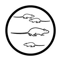
With over half of Quebec’s population living in the SLL, the ecological integrity of the remaining natural habitats is under constant pressure. The threats assessed as high or medium rating overall in the St. Lawrence Lowlands are shown in Tables 3 and 4 below. This assessment is based on three criteria: scope, severity and irreversibility of the damage to the targetFootnote 3. It is important to remember that the assessment is based on threats expected in the future, rather than those experienced in the past. These threats contribute to net losses of habitat for plants and wildlife and a reduction in these habitats’ ecological integrity, which, combined with other factors, largely explains why most species at risk are concentrated in the SLL.
Threats/ pressures |
Icon |
Rating |
|---|---|---|
7.3 Other Ecosystem Modifications |
 |
High |
1.2 Commercial and Industrial Areas |
 |
Medium |
2.3 Livestock Farming and Ranching |
 |
Medium |
4.1 Roads and Railroads |
 |
Medium |
11.4 Changes in Precipitation and Hydrological Regimes |
 |
Medium |
1.1 Housing and Urban Areas |
 |
Medium |
2.1 Annual and Perennial Non-Timber Crops |
 |
Medium |
3.2 Mining and Quarrying |
 |
Medium |
8.1 Invasive Non-native Plants and Animals |
 |
Medium |
11.5 Severe Extreme Weather Events |
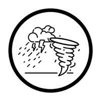 |
Medium |
Conservation target |
Overall threat level |
|---|---|
Forested Areas |
High |
Wetlands |
High |
Open habitats – old fields |
High |
Aquaticenvironments |
High |
Open habitats – agricultural grasslands |
Medium |
Situation analysis
A situation model is required that takes into account the various factors that indirectly contribute to the most significant threats or that, conversely, favourably influence conservation targets. This model will help in determining the key intervention points that will serve as the basis for developing conservation strategies, in order to have the greatest impact and achieve the desired outcomes.
Developing this type of model for the entire SLL may prove extremely difficult, given the diversity of ecological contexts and stakeholders in this vast area, and was not achieved in the SLL Atlas project. However, numerous conservation planning exercises have been carried out in the SLL at different spatial scales. Owing to the experience gained in these projects and the current knowledge of conservation issues, we have been able to identify the main factors contributing to the most significant threats to the habitats of terrestrial species at risk in the SLL (Table 5). These factors (key intervention points) can be adjusted over time to take account of new knowledge and emerging conserving issues.
Threat |
Contributing factor (key intervention point) |
|---|---|
1.1 Housing and Urban Areas |
|
1.2 Commercial and Industrial Areas |
|
2.1 Annual and Perennial Non-Timber Crops |
|
2.3 Livestock Farming and Ranching |
|
3.2 Mining and Quarrying |
|
4.1 Roads and Railroads |
|
7.3 Other Ecosystem Modifications |
|
8.1 Invasive Non-native Plants and Animals |
|
11.4 Changes in Precipitation and Hydrological Regimes |
|
11.5 Severe Extreme Weather Events |
|
Key strategies
The key strategies to be used to address the factors affecting terrestrial species at risk in the SLL vary depending on the geographical context and the stakeholders involved. Since there are significant differences across this vast territory, the adoption of strategies tailored to the priority regions is recommended.
Priority regions
The priority regions were chosen based mainly on:
- the location of species at risk and their habitats (Figure 3)
- the presence of recognized conservation organizations already active in the region; and
- the existence of regional conservation plans setting out conservation strategies for species at risk
These criteria were used to identify four priority regions for the conservation of terrestrial species at risk—the Montreal Metropolitan Community (MMC), Ottawa Valley Natural Area, St. Lawrence Freshwater Estuary Natural Area, and the Centre-du-Québec administrative region (Figure 4).
Each of these regions has a conservation plan that was developed based on the Open Standards for the Practice of Conservation. The conservation targets differ depending on the region but correspond to those in the Atlas. The main threats outlined in the plans are also similar to the 10 threats targeted in the SLL Atlas. Although each plan contains specific key strategies for the region, the resulting implementation of conservation actions at the regional level will have positive impacts on the conservation targets enumerated in the Atlas across the SLL. Table 6 presents a summary of the regional plans, which are presented in more detail in Appendix 2.

Long description
Figure 4 shows a map of the richness of species (occurrence or observation retained) within 1 km x 1 km squares in the St. Lawrence Lowlands.

Long description
Figure 5 shows a map of southern Quebec showing the locations of the 4 regional action plans for St. Lawrence Lowlands Priority Place: Ottawa Valley, Greater Montreal, Centre-du-Quebec, and Fluvial Estuary.
*Appendix 2 provides a detailed description of the different regional plans.
Priority sectors
Along with the priority regions, three sectors of activity were considered:
- logging in private forests
- land-use planning
- agriculture
Since these three sectors pose issues of common concern in the priority regions of the SLL, they can be addressed in an integrated way. The development and implementation of conservation strategies targeting these sectors can therefore benefit the SLL Priority Place as a whole, in combination with the implementation of the regional plans.
Participation of Indigenous communities
Some Indigenous communities are directly involved in, or are contributing to, the planning and/or implementation of regional conservation plans:
- the Wôlinak Environment and Land Office and the Odanak Environment and Land Office are participating in the implementation of the conservation plan for biodiversity hotspots in the Centre-du-Québec region
- under one project, the community of Kebaowek is contributing to some objectives of the Ottawa Valley Natural Area Conservation Plan
- the community of Kahnawà:ke is developing a conservation plan for its territory, which forms an enclave in the MMC, but the actions in the plan could contribute indirectly to the objectives for this priority region
The Indigenous nations present in the SLL (Algonquin, Abenaki, Mohawk, Wendat and Atikamekw) are also carrying out other conservation projects in this Priority Place, mainly under the Aboriginal Fund for Species at Risk and the Indigenous Partnerships Initiative. These actions contribute to the conservation of habitats and species in the SLL and therefore to the Atlas objectives.
The First Nations play a vitally important role in conserving and protecting biodiversity and the land. Greater engagement of First Nations is essential to improve the conservation of species at risk and their habitats. A broader strategy to promote Indigenous engagement, through a partnership with the First Nations of Quebec and Labrador Sustainable Development Institute (FNQLSDI), has been developed under the Indigenous Partnerships Initiative. FNQLSDI worked with the First Nations of Quebec to document their conservation priorities (species and habitats) in order to develop closer collaboration with the Canadian Wildlife Service on species at risk conservation.
Evaluating progress towards outcomes
Each regional plan has its own conservation targets, and these targets should be monitored under their respective plans. Changes in the status of these targets should be reflected in the status of the overall conservation targets in the SLL Atlas, since the regional targets are included in the Atlas targets. Over the longer term, monitoring and analyses at the SLL level will be required to assess the progress achieved by 2050 in attaining the conservation objectives associated with the Atlas.
Appendix 1. Species at risk in the St. Lawrence Lowlands
The species in the list below include all species at risk present in the Priority Place as of the date of publication of this document. The species in the list below include all species at risk found in the priority place. Not all species listed will directly benefit from actions being undertaken through the implementation of strategies in this plan, which is subject to appropriations, priorities, and budgetary constraints of the participating jurisdictions and organizations.
Common name |
Scientific name |
Taxon |
COSEWIC assessment status |
Species at Risk Act status |
Act respecting threatened or vulnerable species status |
|---|---|---|---|---|---|
Green Dragon |
Arisaema dracontium |
Vascular plants |
Special concern |
Not Listed |
Threatened |
Forked Three-awned Grass |
Aristida basiramea |
Vascular plants |
EndangeredFootnote 4 |
Endangered |
Threatened |
White Wood Aster |
Eurybia divaricata |
Vascular plants |
Special concern |
Threatened |
Threatened |
Rusty-patched Bumble Bee |
Bombus affinis |
Arthropods |
Endangered |
Endangered |
Threatened |
American Bumble Bee |
Bombus pensylvanicus |
Arthropods |
Special concern |
Special concern |
|
Yellow-banded Bumble Bee |
Bombus terricola |
Arthropods |
Special concern |
Special concern |
LDTVFootnote 5 |
Grasshopper Sparrow, pratensis subspecies |
Ammodramus savannarum pratensis |
Birds |
Special concern |
Special concern |
Threatened |
Woodland Vole |
Microtus pinetorum |
Mammals |
Special concern |
Special concern |
LDTV |
False Hop Sedge |
Carex lupuliformis |
Vascular plants |
Endangered |
Endangered |
Threatened |
American Water-willow |
Justicia americana |
Vascular plants |
Threatened |
Threatened |
Threatened |
Silver-haired Bat |
Lasionycteris noctivagans |
Mammals |
Endangered |
Not Listed |
LDTV |
Hoary Bat |
Lasiurus cinereus |
Mammals |
Endangered |
Not Listed |
LDTV |
Northern Myotis |
Myotis septentrionalis |
Mammals |
Endangered |
Endangered |
Threatened |
Eastern Red Bat |
Lasiurus borealis |
Mammals |
Endangered |
Not Listed |
Special concern |
Northern Barrens Tiger Beetle |
Cicindela patruela |
Arthropods |
Endangered |
Endangered |
LDTV |
Victorin's Water-hemlock |
Cicuta maculata var. victorinii |
Vascular plants |
Special concern |
Special concern |
Threatened |
Transverse Lady Beetle |
Coccinella transversoguttata |
Arthropods |
Special concern |
Special concern |
|
Nine-spotted Lady Beetle |
Coccinella novemnotata |
Arthropods |
Endangered |
Endangered |
Threatened |
Eastern Ribbonsnake, Great Lakes population |
Thamnophis sauritus |
Reptiles |
Special concern |
Special concern |
LDTV |
Eastern Milksnake |
Lampropeltis triangulum |
Reptiles |
Special concern |
Special concern |
Special concern |
Eastern Whip-poor-will |
Antrostomus vociferus |
Birds |
Special concern |
Threatened |
Special concern |
Common Nighthawk |
Chordeiles minor |
Birds |
Special concern |
Special concern |
LDTV |
Black Ash |
Fraxinus nigra |
Vascular plants |
Threatened |
Not listed |
|
Victorin's Gentian |
Gentianopsis virgata subsp. victorinii |
Vascular plants |
Special concern |
Threatened |
Threatened |
American Ginseng |
Panax quinquefolius |
Vascular plants |
Endangered |
Endangered |
Threatened |
Bobolink |
Dolichonyx oryzivorus |
Birds |
Special concern |
Threatened |
Special concern |
Riverine Clubtail |
Stylurus amnicola |
Arthropods |
Special concern |
Not listed |
|
Skillet Clubtail |
Gomphus ventricosus |
Arthropods |
Special concern |
Endangered |
LDTV |
Wood Thrush |
Hylocichla mustelina |
Birds |
Threatened |
Threatened |
|
Evening Grosbeak |
Coccothraustes vespertinus |
Birds |
Special concern |
Special concern |
|
Short-eared Owl |
Asio flammeus |
Birds |
Threatened |
Special concern |
LDTV |
Bank Swallow |
Riparia riparia |
Birds |
Threatened |
Threatened |
|
Barn Swallow |
Hirundo rustica |
Birds |
Special concern |
Threatened |
|
Flooded Jellyskin |
Leptogium rivulare |
Lichens |
Special concern |
Special concern |
|
Purple Twayblade |
Liparis liliifolia |
Vascular plants |
Threatened |
Threatened |
LDTV |
Eastern Wolf |
Canis lupus lycaon |
Mammals |
Threatened |
Threatened |
|
Chimney Swift |
Chaetura pelagica |
Birds |
Threatened |
Threatened |
Threatened |
Monarch |
Danaus plexippus |
Arthropods |
Endangered |
Endangered |
|
Olive-sided Flycatcher |
Contopus cooperi |
Birds |
Special concern |
Special concern |
Special concern |
Mudpuppy (Great Lakes / St. Lawrence population) |
Necturus maculosus |
Amphibians |
Special concern |
Not Listed |
|
Butternut |
Juglans cinerea L. |
Vascular plants |
Endangered |
Endangered |
Threatened |
Golden-winged Warbler |
Vermivora chrysoptera |
Birds |
Threatened |
Threatened |
Threatened |
Cerulean Warbler |
Septophaga cerulea |
Birds |
Endangered |
Endangered |
Threatened |
Canada Warbler |
Cardellina canadensis |
Birds |
Special concern |
Threatened |
LDTV |
Least Bittern |
Ixobrychus exilis |
Birds |
Special concern |
Threatened |
Special concern |
Little Brown Myotis |
Myotis lucifugus |
Mammals |
Endangered |
Endangered |
Threatened |
Broad Beech Fern |
Phegopteris hexagonoptera |
Vascular plants |
Special concern |
Not listed |
Threatened |
Red-headed Woodpecker |
Melanerpes erythrocephalus |
Birds |
Endangered |
Endangered |
Threatened |
Loggerhead Shrike Eastern subspecies |
Lanius ludovicianus |
Birds |
Endangered |
Endangered |
Threatened |
Eastern Wood-pewee |
Contopus virens |
Birds |
Special concern |
Special concern |
|
Tri-colored Bat |
Perimyotis subflavus |
Mammals |
Endangered |
Endangered |
Threatened |
Gypsy Cuckoo Bumble Bee |
Bombus bohemicus |
Arthropods |
Endangered |
Endangered |
|
Rusty Blackbird |
Euphagus carolinus |
Birds |
Special concern |
Special concern |
LDTV |
Western Chorus Frog, Great Lakes / St. Lawrence - Canadian Shield population |
Pseudacris triseriata |
Amphibians |
Threatened |
Threatened |
Threatened |
Yellow Rail |
Coturnicops noveboracensis |
Birds |
Special concern |
Special concern |
Threatened |
Gray Fox |
Urocyon cinereoargenteus |
Mammals |
Threatened |
Threatened |
|
Spring Salamander, Adirondack / Appalachian population |
Gyrinophilus porphyriticus |
Amphibians |
Threatened |
Threatened |
Special concern |
Allegheny Mountain Dusky Salamander, Appalachian population |
Desmognathus ochrophaeus |
Amphibians |
Endangered |
Endangered |
Threatened |
Eastern Meadowlark |
Sturnella magna |
Birds |
Threatened |
Threatened |
|
Wood Turtle |
Glyptemys insculpta |
Reptiles |
Threatened |
Threatened |
Special concern |
Northern Map Turtle |
Graptemys geographica |
Reptiles |
Special concern |
Special concern |
Special concern |
Spiny Softshell |
Apalone spinifera |
Reptiles |
Endangered |
Endangered |
Threatened |
Blanding's Turtle, Great Lakes / St. Lawrence population |
Emydoidea blandingii |
Reptiles |
Endangered |
Endangered |
Threatened |
Eastern Musk Turtle |
Sternotherus odoratus |
Reptiles |
Special concern |
Special concern |
Threatened |
Eastern Painted Turtle |
Chrysemys picta picta |
Reptiles |
Special concern |
Special concern |
|
Midland Painted Turtle |
Chrysemys picta marginata |
Reptiles |
Special concern |
Special concern |
|
Snapping Turtle |
Chelydra serpentina |
Reptiles |
Special concern |
Special concern |
|
Forked Bluecurls |
Trichostema dichotomum |
Vascular plants |
Threatened |
Not Listed |
LDTV |
Appendix 2. Details of the regional conservation plans
Montreal Metropolitan Community (MMC)
Lead organization
ECCC – Canadian Wildlife Service Québec Region (CWS-QC)
Main planning and implementation partners
Environment and Climate Change Canada (ECCC), MMC, ministère de l'Environnement et de la Lutte contre les changements climatiques de la Faune et des Parcs (MELCCFP), Nature-Action Québec, Éco-Nature, Conseil régional de l’environnement de la Montérégie, Conseil québécois des espèces exotiques envahissantes; Montérégie, Outaouais-Laurentides and Lanaudière regional federations of the UPA; Ministère des Ressources naturelles et des Forêts; Agence forestière de la Montérégie; Agence des forêts privées de Lanaudière; and other local partners and experts.
It should also be noted that the Indigenous territory of Kahnawá:ke forms an enclave within the MMC. Collaboration is underway with the Mohawk community to develop a conservation plan for the natural habitats in its territory based on the Open Standards for the Practice of Conservation. Their actions could contribute indirectly to the objectives for this priority region.
Scope of project
Area within the administrative boundaries of the Montreal Metropolitan Community, which includes 12 regional county municipalities (RCMs), two urban agglomerations and 82 municipalities, with a total population of about 4 million in a territory of over 4,370 km2.

Long description
A map of the Montreal Metropolitan Community showing the boundaries of the 12 MRCs and 82 municipalities that comprise it, and the extent of the territory included in the regional conservation plan.
Land use
The territory consists of urban and agricultural environments, representing 32% and 31% respectively, followed by woodlands (14%), open water areas (11%), old fields (6%) and wetlands (5%). Agricultural environments consist mainly of annual crops (corn, soybeans, grains) (81%), while perennial crops (forage, pasture) cover only 16% of the cultivated land.
Main conservation targets
The critical habitats of eight terrestrial species at risk are found within the MMC: 1) False Hop Sedge (Carex lupuliformis); 2) American Water-willow (Justicia americana); 3) American Ginseng (Panax quinquefolius); 4) Purple Twayblade (Liparis liliifolia); 5) Least Bittern (Ixobrychus exilis); 6) Western Chorus Frog (Pseudacris triseriata) et; 7) Tortue- Spiny Softshell (Apalone spinifera).
Main Threats
Invasive alien species are the main threat to the integrity of the conservation targets, followed by the destruction of natural environments due to urban development, conversion of land to agriculture, and road network development, which increases local mortality and restricts individual movements.
Conservation Strategies
Eight conservation strategies have been formulated:
- land-use planning and municipal bylaws
- protection and conservation of critical habitats
- environmental management and development in agricultural areas
- connectivity between hydric/aquatic and wetland environments
- control of invasive alien species
- management of the water levels of major tributaries
- management, restoration and monitoring of occurrences and critical habitats
- pipeline maintenance plan and emergency plan for accidental spills and pipeline breaks
Note
The action plan and conservation strategies developed to conserve critical habitats for species at risk in the MMC (ECCC 2022) are based on the status report by Jobin et al. (2021) (rapport sur l’état de situation de huit espèces en situation précaire sur le territoire du Grand Montréal)Footnote 6. An English version of this report is available upon request to ECCC (enviroinfo@ec.gc.ca). Although the plan addresses specific targets, the actions identified could benefit other species for which critical habitats have not been identified or that have been designated species at risk in the interim. The action plan has not yet been published but is available upon request from the Canadian Wildlife Service, Quebec Region.
Ottawa Valley Natural Area
Lead organization
Nature Conservancy of Canada (NCC)
Planning and implementation partners
Environment and Climate Change Canada (ECCC), ministère de l'Environnement et de la Lutte contre les changements climatiques de la Faune et des Parcs (MELCCFP), Conseil régional de l'environnement et du développement durable de l'Outaouais [Outaouais regional environment and sustainable development council], Société des établissements de plein air du Québec, National Capital Commission, the Outaouais-Laurentides regional federation of the UPA, Club des ornithologues de l’Outaouais [Outaouais birding club], consultants, experts, and other partners.
Scope of the project
The natural area in question totals 5,704 km2 and includes one of Quebec’s major cities, Gatineau. It mainly lies in the Outaouais administrative region and in the regional county municipalities (RCMs) of Pontiac, Collines-de-l’Outaouais, and Papineau. Land use ranges from urban areas to suburban residential development and includes agricultural land, industrial areas, parks, conservation areas, and recreational and tourism sites. Privately owned land makes up 74.4% of the territory, while provincial and federal lands represent 19.2% and 6.4% respectively.
Land use
Land cover type |
Area (ha) |
Proportion of natural area |
|---|---|---|
Deep water |
53,462 |
9.4% |
Old field / shrubland |
14,285 |
2.5% |
Agricultural |
83,221 |
14.6% |
Human-modified environment |
29,300 |
5.1% |
Woodland |
330,666 |
58.0% |
Wetland |
57,849 |
10.1% |
Bare ground |
1,619 |
0.3% |
Total (ha) |
570,403 |
100.0% |

Long description
A map showing the location of the Ottawa Valley Natural Area, which covers the RCMs of Pontiac, Collines-de-l'Outaouais and Papineau. The map also illustrates the boundaries of the 18 priority sectors, the ecoregion and the integrated water management area by watershed. Woodland, agricultural environment, anthropogenic environment, aquatic environment and wetland areas are also illustrated using different colors.
Conservation targets
Conservation targets are structured around the following seven components: (1) turtles and snakes; (2) limestone ecosystems; (3) field habitats; (4) wetlands; (5) aquatic and riparian habitats; (6) dunes and sand barrens; and (7) forest mosaic.
Main threats
Residential and commercial development, invasive alien species, the management of dams on the Ottawa River and its tributaries, road use and development, and logging are the primary threats. Other threats with a smaller scope such as agricultural activities (practices and intensification) were also identified. The overall threat level in the natural area is considered “High”.
Conservation strategies
This action plan includes a range of conservation strategies, including several that directly affect species at risk:
- protection of lands
- habitat management
- adaptation of agricultural practices
- support for and development of partnerships to, among others, implement the various conservation actions identified in the plan
- knowledge acquisition
- collaboration with NCC in Ontario region
- funding of conservation activities
- conservation planning, and local community engagement
Note
NCC also collaborates with various Indigenous communities (Kitigan Zibi, Kebaowek), to protect and conserve areas in the territory targeted in this plan. The conservation plan for the Ottawa Valley Natural Area and the conservation strategies have not been published. For more information, please contact the NCC (quebec@conservationdelanature.ca).
Freshwater Estuary Natural Area
Lead organization
Nature Conservancy of Canada (NCC)
Planning and implementation partners
Environment and Climate Change Canada (ECCC), ministère de l'Environnement et de la Lutte contre les changements climatiques de la Faune et des Parcs (MELCCFP), Les Deux Rives ZIP Committee / Table de concertation regionale (TCR) de l’estuaire fluvial [fluvial estuary regional round table], Capitale-Nature, Corporation du Bassin de la Jacques-Cartier, Bureau d’écologie appliquée [office of applied ecology], Fondation de la Faune du Québec, ministère de l'Agriculture, des Pêcheries et de l'Alimentation, experts.
Scope of project
The Freshwater Estuary Natural Area covers an area of 5,797 km2 including the intertidal zone and the terrestrial areas on islands and along the river, but excluding the waters of the St. Lawrence River. Spanning both sides of this majestic river, it extends from roughly 20 km east of the outlet of Lake Saint-Pierre to Saint-Jean-Port-Joli and Saint-Joachim. It includes 43 municipalities and six unorganized territories within 12 RCMs. However, this conservation plan does not include the urban agglomerations of Quebec City and Lévis. This natural area is 86% privately owned and has a population of 126,479.
This project aims to obtain the commitment of property owners to implement conservation measures and/or adopt optimal management practices on their properties in order to meet the habitat requirements of species at risk.

Figure 7. St. Lawrence Freshwater Estuary Natural Area
* Some conservation actions have been implemented outside the Freshwater Estuary Natural Area limits.
Long description
A map showing the location of the St. Lawrence Freshwater Estuary Natural Area, which stretches along the St. Lawrence River from Centre-du-Québec to Charlevoix. The map divides the estuary into an eastern sector and a western sector. The map also illustrates the boundaries of the natural area, of the PCAN II priority sectors, and of the ecoregion, and it identifies the administrative regions and RCMs.
Land use
Woodlands are dominant in the natural area, covering 32.5%, followed closely by wetlands and agricultural areas, covering 26% and 25% respectively. The rest of the natural area consists of urban areas (11%), open habitat (old fields/shrubland) (4%), bare ground (1%), and inland aquatic environments (0.5%).
Conservation targets
Conservation targets are articulated around six components: 1) the St. Lawrence River, 2) woodlands, 3) inland wetlands, 4) intertidal wetlands, 5) open habitats, and 6) tributaries, and shallow-water areas.
Main threats
Urban development is the primary threat to the integrity of the conservation targets, followed by invasive alien species, port and bridge infrastructure development, and wastewater discharges. Ten other threats with lesser impacts were also identified. The overall threat level in the natural area is considered “Moderate”.
Conservation strategies
Seven conservation strategies have been formulated:
- legal protection of rare ecosystems and representative communities
- conservation planning in the natural area
- management of problematic species
- stewardship of open habitats
- restoration of shorelines and coastal habitats
- knowledge acquisition to improve protection measures
- community engagement strategy
Note
The action plan and conservation strategies developed to protect the conservation targets identified in the freshwater estuary have not been published. For more information, please contact the Nature Conservancy of Canada (quebec@conservationdelanature.ca).
Centre-du-Québec administrative region
Lead organization
Conseil régional de l’environnement du Centre-du-Québec (CRECQ)
Planning and implementation partners
Environment and Climate Change Canada (ECCC); Université du Québec à Trois-Rivières (UQTR); Habitat; Groupe d’aide pour la recherche et l’aménagement de la faune (GARAF); Société ornithologique du Centre-du-Québec; ministère de l’Agriculture, des Pêcheries et de l’Alimentation du Québec (MAPAQ); Fondation de la faune du Québec; waste management; participating watershed organizations in the Centre-du-Québec region; Ministère de l’Environnement, de la Lutte contre les changements climatiques, de la Faune et des Parcs du Québec (MELCCFP); Odanak Environment and Land Office; Wôlinak Environment and Land Office; Bureau d’écologie appliqué; participating RCMs and municipalities; Nature-Avenir; Hydro-Québec; Agence forestière des bois-francs; Centre-du-Québec regional federation of the UPA; Moulin Michel; World Wildlife Fund, Les Deux Rives ZIP Committee; Réseau de milieux naturels protégés; Fédération des chambres de commerce du Québec; participating landowners.
Scope of project
The project takes place in the Centre-du-Québec administrative region, which is divided into five RCMs: Arthabaska, Bécancour, Drummond, L’Érable and Nicolet-Yamaska. The region has 79 municipalities and two Abenaki Indigenous reserves: Odanak in the Nicolet-Yamaska RCM and Wôlinak in the Bécancour RCM. It covers a total area of 7,262 km2 and has a population of over 251,000, roughly 34.3% of which is rural.
The scope of the project is the conservation of sites of interest in the St. Lawrence Lowlands, focusing on 21 hotspots across the region, 16 of which are in the St. Lawrence Lowlands. These hotspots were chosen by CRECQ based on the results of an analysis of ecosystem mosaics in the Atlas of Sites of Conservation Interest in the St. Lawrence Lowlands, in combination with the presence of one or more species at risk. The 21 hotspots cover an area of approximately 83,000 ha in the Centre-du-Québec region.

Long description
A map of the Centre-du-Québec region showing the 21 core biodiversity hotspots. The map also illustrates the ecological connectivity network, which includes aquatic corridors, terrestrial corridors, RCM boundaries and municipal boundaries, illustrated using different colors.
Land use
Le Centre-du-Québec region is characterized by the prevalence of agricultural and logging activities. The area consists of 46% forests, 12% wetlands, 39% agricultural land, and 10,158 km of watercourses. A total of 93% of the region’s land is located in a green zone, meaning that it is protected for agricultural purposes and only uses related to agriculture are authorized. In addition, 93% of the land is privately owned.
Conservation targets
The conservation targets are the natural areas within each hotspot, including wetland complexes, forest fragments, open habitats, and aquatic ecological units.
Main threats
All the hotspots and different types of natural environments face a range of multiple threats: agriculture (including cranberry cultivation), unsustainable logging practices, invasive alien species, climate change, transportation and service corridors, residential and commercial development (including highly industrialized areas), and pollution from agricultural and forestry effluents and from anthropogenic environments.
| Threats | Information |
|---|---|
Most intense threats to forest fragments |
Unsustainable forestry practices, climate change, urban development, agriculture |
Most intense threats to wetlands |
Agriculture/cranberry cultivation, pollution, invasive alien species, transportation and service corridors |
Most intense threats to open habitats |
Agriculture, transportation and service corridors, commercial and industrial areas |
Source: Blais and Poisson 2021
Conservation strategies
Five conservation strategies were formulated to achieve the action plan objectives:
- organizational governance and accountability
- protection
- sustainable use
- management and restoration
- acquisition of knowledge on species at risk
Note
Each strategy has clear objectives for all the specific and complementary actions to be undertaken, from improving land-use planning by integrating conservation, protection, sustainable use and habitat restoration objectives, to education and outreach. A complete version of the conservation plan is available online in French. For more information, contact the Conseil régional de l’environnement du Centre-du-Québec.