
How is climate change affecting the seashore near Arctic communities?
Climate change is thawing permafrost and bringing bigger storms. What does that mean for coastal communities in Canada's Arctic? POLAR and its partners are studying a Nunavut shoreline to find out.
Over 70 percent of Canada's coastline is in the North. These areas are vulnerable to the effects of climate change, but we know very little about how they are being affected, according to POLAR permafrost scientist Stéphanie Coulombe.
"Permafrost is thawing, sea levels are rising, sea ice is decreasing, and storms are getting stronger and more frequent," explains Coulombe. "These all affect shorelines. Monitoring coastlines and permafrost gives us the data we need to assess how the coasts are going to change, especially around communities. Communities need to know what changes to expect so they can plan how to adapt."
Most shoreline monitoring in Arctic Canada takes place in the Northwest Territories, at Tuktoyaktuk and in the Mackenzie Delta. There is very little data from Nunavut. Coulombe, working with David Didier, of Université du Québec à Rimouski, and Jacob Stolle, of Institut National de la Recherche Scientifique, are helping to fill in this gap. They're collaborating with the hunters and trappers organization (HTO) in Cambridge Bay, Nunavut, to monitor coastal erosion at Augustus Hills. The site, which was selected by the HTO, lies about 20 km west of the community. The project grew out of research that Transport Canada began in 2019.
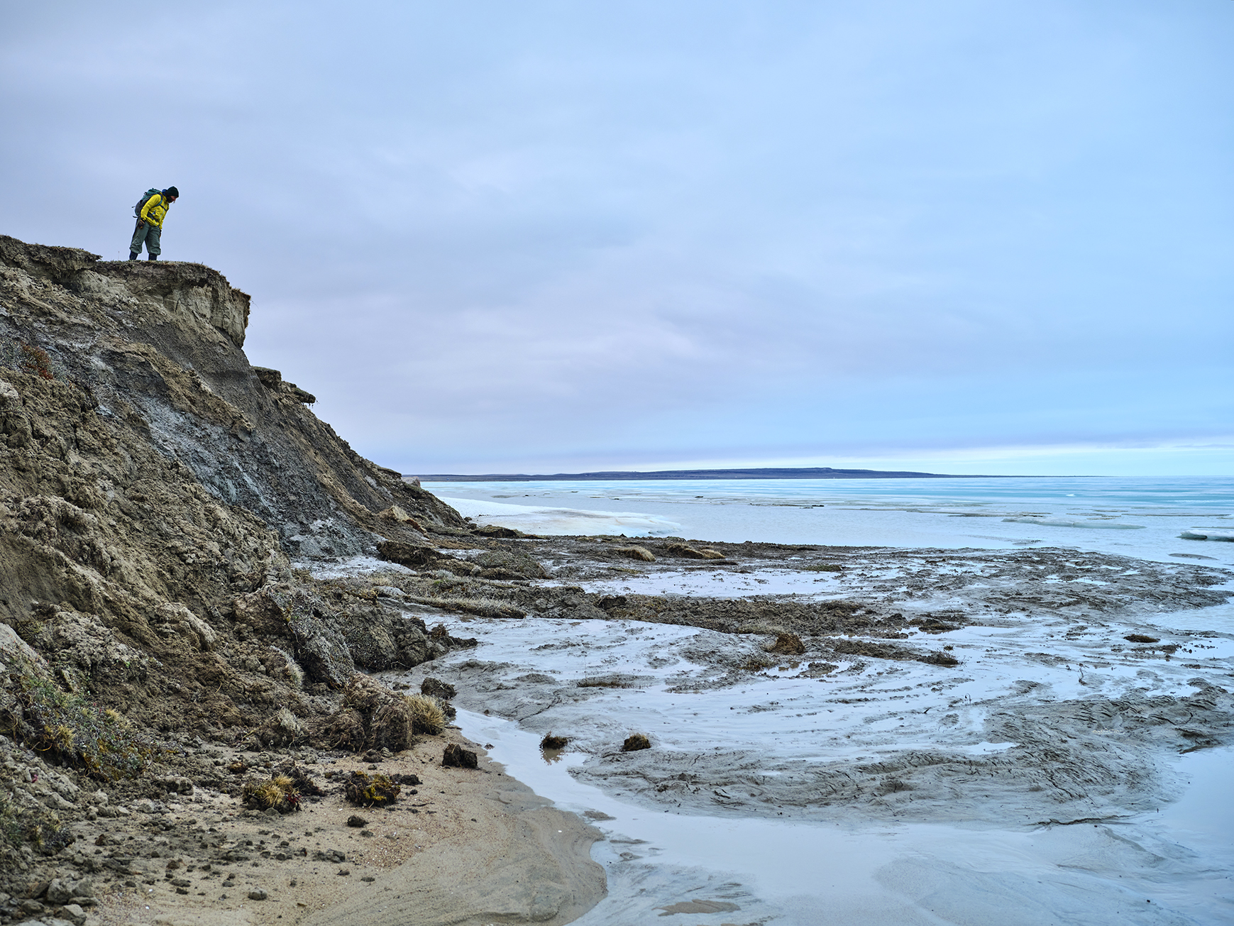
Storms and permafrost thaw are changing the shoreline at Augustus Hills, near Cambridge Bay, Nunavut. Photo: David Didier
In summer of 2022, POLAR research staff and David Didier's research team placed sensors in the water at Augustus Hills to measure water level and surface temperature, and installed a permafrost monitoring station to measure ground temperature at different depths. They also mounted time-lapse and video cameras on a 20-metre tower erected for the purpose, to record changes along the coast. "The time-lapse camera revealed that after only one storm event, the shoreline retreated two metres in some areas," says Coulombe. "We could see that the shoreline was very, very dynamic." The instruments operate from May to November. In 2023 the team will install more, and by the end of that summer will have its first full year of data.
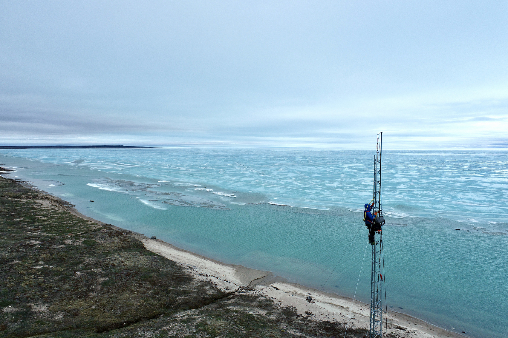
Cameras mounted on a tower record time-lapse photos and videos of shoreline changes. Photo: David Didier
Coulombe recently received air photos taken in the 1950s of the Cambridge Bay area, including the Augustus hills, which will enable her to document changes over the past 70 years. This adds to the growing store of information that will be used to predict how the coastline may change in future, so that the community can plan accordingly.
Like other POLAR research, this project responds to a community priority and works closely with them and other partners. "Collaboration and teamwork are essential to our work," says Coulombe. "We are grateful for all the help and support we have received from the HTO, the graduate students who work with us, and from POLAR's field technicians. The project would not be possible without them!"