Canada's top 10 weather stories for 2014: chapter 2
2. Summer Flooding in the Eastern Prairies
For the past several years, flooding has been the big story across the Prairie provinces. In 2005, torrential rains produced summer flooding. In 2011, it was the combination of snowmelt and ice jamming that created a massive billion-dollar disaster across Saskatchewan and Manitoba. Last year, the coincidence of rapid snowmelt and heavy spring rains in southern Alberta generated the most disruptive, destructive and expensive flood in Canadian history - a $6 billion flood of floods. Unfortunately, anyone looking for a break in 2014 was sorely disappointed. This time water problems prevailed across the eastern Prairies just a week before summer began. Excessive rains on soggy ground − too much rain too fast over too many days - led to huge flooding and another billion-dollar disaster.

On June 15, two major slow-moving weather systems, hours apart and more typical of spring or fall, combined to bring a few soggy days to the eastern Prairies. The prolonged moisture-laden storms moved up from the northern United States and stalled near the Saskatchewan-Manitoba border. Relentless rains turned into biblical-sized deluges over three days. Almost a year’s worth of rain fell in some places. Prior to the soaking, three weeks of wet weather meant that the latest rains had nowhere to go but overland. With soil saturated and ditches filled, the water cascaded into channels that rapidly fed into creeks and rivers.
Excess precipitation in the days and weeks leading up to July 1 included:
- The third wettest spring on record dating back to 1892 for Saskatoon. Total spring (April to June) precipitation was 230 mm or 175 per cent of normal.
- Yorkton had 252 mm of rain in June, which was more than triple the normal accumulation and the wettest ever since 1884 when record-keeping began. Nine days in June had more than 10 mm (normal is 2 days) and spring rainfall totalled 357 mm - another record.
- With observations at Brandon dating back to the 1890s, June 2014 was the wettest month ever with 252 mm - three times June’s normal total and, incredibly, 34 mm higher than the all-time previous wettest month of August 1980. June had four days with rainfall over 25 mm, including 75 mm on June 19, and three days in a row on the final weekend of the month - all on top of it being Brandon’s wettest spring on record.
- One Regina weather site recorded 198 mm of rain in June, which is nearly triple the normal of 70 mm and almost the wettest month on record. Total April-to-June rainfall was 312 mm or 216 per cent of normal, and the second wettest such period with records dating back to 1883.
- To the far west, Lethbridge recorded its wettest June and wettest month ever with 280 mm of rain, which is more rain than the city gets in an average year.

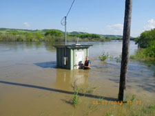
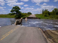
Rains and subsequent flooding at the end of June forced the closure of a hundred highways, including a stretch of the TransCanada east of Regina where dozens of bridges, culverts and utilities were washed away and dozens of basements were filled. Sections of country roads were under water for days on end. The rains also led to record flows on 17 southern Manitoba rivers and streams. Nearly 100 communities, including the cities of Melville and Yorkton in Saskatchewan, declared states of emergency. Citizen volunteers and a thousand military reservists scrambled to fill hundreds of thousands of sandbags to fend off rising floodwaters. Some 1,000 residents, mainly in southwestern Manitoba, were displaced and faced mucky basements and debris-strewn yards on their return home.
Flooded pastures resembled rice paddies and crop fields featured lakes with whitecaps, leaving some of the best farmland in Canada too soggy to farm. Farmers feared losing their growing season altogether. In Manitoba and Saskatchewan, well over one million acres of seeded fields were flooded or drowned and another two million were left unseeded. As much as six million acres of farmland in the west were damaged, drowned or lying on still-frozen ground. Even though some crops recovered from flooding, their high yields suffered. Total costs from flooding exceeded $1 billion as farmers lost crops and communities mopped up. Weeks later, waves of mosquitoes emerged from the sodden ground and standing waters. Hardship was especially prevalent in several First Nations communities where flooding is becoming a ritual that brings both emotional and physical health issues.
The seeds of this summer’s flood started in the fall of 2013, when already saturated soils, combined with high over-winter snowfall covered the eastern Prairies. It was magnified by an exceptionally hard winter with a deep snowpack and a late spring melt that kept soils saturated and potholes filled. Another factor leading to worsening Prairie flooding in recent years that has been brought to light by expert hydrometeorologists is altered drainage patterns on agricultural lands in Saskatchewan and Manitoba and the greater incidence of multi-day rainfalls. Storm rainfalls over larger areas are lasting longer than usual. The network of Prairie potholes and sloughs has already filled to the brim, and now the runoffs are moving overland in a “fill and spill process” that is ripping out roads, inundating homes and overwhelming sewer networks. Ducks Unlimited said that wetland drainage on the Prairies has increased average flows by more than 60 per cent, and a study by the University of Saskatchewan found changes in wetland drainage over 50 years increased recent flood peaks by as much as 32 per cent.