
Air quality monitoring programs
Environment Canada's air quality monitoring networks and data collections are used by scientists and decision-makers to track changes in our air quality. These stations measure pollutants and other chemicals in the atmosphere which may originate in Canada, or from international sources. Information from these networks is used by scientists to track and understand changes in our air quality, determine the effectiveness of air quality regulations, and identify new concerns. Researchers also depend on these measurements to develop and test complex air-quality models, which can be used to produce air-quality forecasts for major Canadian centers, or to understand the potential effects of proposed regulations, new technologies, and other changes in the environment.
These networks, which may be developed in partnership with the provinces and territories, monitor pollutants and other chemicals in the atmosphere from a series of measuring stations.
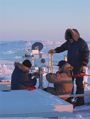
Measuring ozone and UV at a remote monitoring station in Eureka, on Ellesmere Island, Nunavut.
The stations usually contain a collection of sensitive measuring instruments, and may be located in urban or rural areas, or even in extremely remote locations. In many cases, these stations form part of a global network, and help to meet Canada's international commitments to tracking changes in the atmosphere.
Contributing to Policies and International Commitments
A major goal of Environment Canada is to ensure that Canada has the monitoring and data analysis capability to support national and international policies and commitments, and guide future actions on emissions reductions. Examples of how Environment Canada’s air quality monitoring networks and data contribute to these policies and commitments include:
Air quality data obtained from Environment Canada’s monitoring networks are used to determine and predict the health and environmental impacts of air pollution. For example, the Air Quality Health Index and UV Index helps Canadians understand how the air quality around them may impact their health.
Environment Canada’s National Air Pollution Surveillance Network provides air quality data that is used to support the reporting of Canadian Environmental Sustainability Indicators (CESI), which provides Canadians information on key environmental issues. CESI can also help those involved in making or influencing policies or programs to more fully understand and deliver scientifically credible information in a manner that can be readily understood by decision-makers.
Air quality data collected by the monitoring networks is used to assess and manage the potential impacts of certain activities on the environment. Sound scientific assessments help contribute to the development of effective policies and support for air issues and impact analysis. Science assessments have been conducted on priority air issues including transboundary particulate matter smog, and acid deposition.
Canada’s air quality networks are used for the monitoring and surveillance of priority chemicals under the Chemicals Management Plan (CMP), including polybrominated diphenyl ethers (PBDEs) and related brominated contaminants. These networks are also being integrated and expanded to coordinate with multi-media monitoring of CMP priority chemicals such as polyfluorinated alkyls (PFAs).
Data on air pollutants collected by initiatives such as the National Atmospheric Chemistry Database (NAtChem) supports the federal government’s ecoACTION plan by providing information to guide decision-makers in developing policies such as the Regulatory Framework for Air Emissions (Clean Air Regulatory Agenda).
Environment Canada’s networks, data and analyses are used in country-wide assessments and strategies, such as the Canadian Council of the Ministers of Environment (CCME) Canada-Wide Standards for Particulate Matter and Ground-level Ozone (by both the National Air Pollution Surveillance Network and Canadian Air and Precipitation Monitoring Network). The Canadian Air and Precipitation Monitoring Network data and analyses were also used in the CCME Canada-Wide Acid Rain Strategy.
The various networks and data are used for a variety of bi-national initiatives with the United States, including:
- The National Air Pollution Surveillance (NAPS) Network, the Canadian Air and Precipitation Monitoring Network (CAPMoN) and their data are critical components of Canada’s commitments under the Canada-U.S. Agreement on Air Quality and its December 2000 Ozone Annex;
- The Great Lakes Water Quality Agreement, created the Integrated Atmospheric Deposition Network for conducting air and precipitation monitoring in the Great Lakes Basin and for determining atmospheric loadings and trends; and
- The Canada-U.S. Binational Great Lakes Toxics Strategy calls for monitoring of the atmospheric transport and deposition of persistent toxic substances to the Great Lakes basin.
Environment Canada’s Global Atmosphere Passive Sampling (GAPS) Network was crucial for building support for the Stockholm Convention on Persistent Organic Pollutants (POPs) and assessing the effectiveness of control measures for POPs. GAPS was also the only global-scale program for air that reported data to the first Global Monitoring Plan of the Stockholm Convention on POPs.
Our monitoring networks also collect data on the transboundary movement of air pollutants as part of Canada’s commitments to the Convention on Long-range Transboundary Air Pollution, under the United Nations Economic Commission for Europe, and its Task Force on Hemispheric Transport of Air Pollution.