Enhancing emergency preparedness and response

The Oceans Protection Plan—advancing science to support emergency preparedness and response
The Oceans Protection Plan (OPP) is Canada’s plan to protect coasts and waterways for future generations.
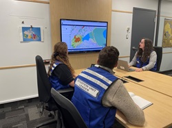
Under the OPP, scientists at Environment and Climate Change Canada (ECCC) gather and study information about wildlife, habitats, and how pollution can impact different environments. This research helps our experts provide up-to-date advice and data in an environmental emergency.
Protecting Canada's Oceans and Shorelines
Our environmental emergency support includes:
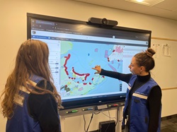
- identifying important environmental resources like wildlife and sensitive ecosystems
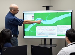
- providing site-specific weather forecasting and trajectory modelling that predicts the direction of spilled products on the water
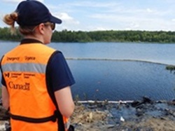
- advising on how to mitigate environmental damage and clean-up hazardous materials
We collaborate with First Nations, Inuit and Métis peoples, as well as other government departments, industry, and coastal communities to enhance this advice.
Stories of how we protect land and water under the Oceans Protection Plan
Learn about the work ECCC scientists and experts do year-round and across the country and how it can help protect lands and waters in an environmental emergency.
Staying prepared! Helping responders stay safe during environmental emergencies

Specialized skills and knowledge are needed to safely respond to environmental emergencies involving hazardous spills.
Learn more
Environment and Climate Change Canada’s Emergencies Science and Technology Section (ESTS) is the department’s centre of expertise for hazardous material spill science.
They support environmental emergency responders 24/7, providing scientific advice, laboratory analysis, and specialized techniques, like site assessment and sampling.
Under the Oceans Protection Plan, ESTS is responsible for advancing science on hazardous and noxious chemicals to improve emergency preparedness and response.
ESTS also develops and offers training to their response partners. The Hazardous Waste Operations and Emergency Response (HAZWOPER) course helps responders stay safe when responding to an environmental emergency that may involve hazardous chemicals.


The HAZWOPER course is one way that ESTS shares knowledge with emergency responders, training them on the proper equipment and methods to use when responding to hazardous spills in the environment.
Responding to a hazardous spill can be risky as there are many unknown factors.
Responders can’t always know what chemicals or hazards they will encounter at a spill.
Substances can affect responders through inhalation, ingestion, or even permeation—when a chemical passes through the skin.
As the level of uncertainty about the chemicals involved increases, so does the level of protection required.


The week-long course blends both theory and practical learning, with classroom time in the mornings and hands-on exercises in the afternoons.
Through table-top and practical exercises, responders are taught how to identify hazards and conduct safety planning. They also practice performing basic tasks like collecting information and taking samples while wearing the additional safety gear.
Trainers show participants how to use protective equipment, ranging from boots and gloves to the specialized totally encapsulated chemical protection suits that can protect against unknown chemicals.
Understanding the various safety equipment options and when to use them gives responders the skills and knowledge they need to protect themselves on the job.


At the conclusion of each exercise, the participants debrief with the instructors to reinforce what they have learned.
The HAZWOPER course is an important part of Environment and Climate Change Canada’s chemical spill response program. It helps ensure that responders are equipped to make efficient and effective decisions to protect themselves as they work to protect the environment during a hazardous spill response.


Learn more about ESTS’s work on hazardous spills through the evolving history of the Arctic Marine Oilspills technical seminar.
Bye-bye buoy! Testing Arctic current models for emergency response

Emergency response begins with preparation as environmental emergencies officers and scientists test models of currents in Frobisher Bay.
Learn more
How do you prepare for an emergency? It’s a question environmental emergency officers with Environment and Climate Change Canada’s (ECCC) National Environmental Emergencies Centre work on every day. During an environmental emergency like an oil spill, these officers provide critical advice to responders about the best ways to clean up spills. They also help predict the possible impacts of a spill on water by projecting where it may go based on models, or simulations, of the water’s flow or currents.
Being able to offer this advice quickly when an emergency happens is the result of ongoing preparation. In the words of Simon Despatie, a Senior Officer with the Preparedness and Response team, “Being prepared is not just saying you’re prepared, it’s getting ready to respond to an emergency.”
Testing the models

It's that attitude that took Simon and Environmental Emergencies Officer Frederic Chantal-Fortin to Iqaluit, Nunavut, in 2022 to gather information on how spill-tracker buoys respond to wind and currents.
Their project centred on launching spill-tracker buoys into Frobisher Bay. Bright orange balls the size of a basketball, the buoys transmit timestamped information about their location and water temperature as they drift with wind and currents. This allowed ECCC scientists in the Emergencies Science and Technology Section, who generate models that anticipate the movement and behaviour of a spill during an emergency, to check the buoy’s actual movement against modelled tracker drifts.

This comparison is important for understanding the precision of the calculated drifts in the model. With work already underway, this exercise fed into ongoing improvements to better model ocean currents in Canadian waters.
Improving preparedness
The team also gained important practical experience from the exercise, from the cold temperatures out on the water to working with Frobisher Bay’s massive tides, which can leave boats sitting on the sea floor at low tide.
“It’s very interesting,” Frederic noted.” It’s another dimension that you have to get your head around to really plan the work.”
Finally, getting to know their counterparts at other organizations in the area was an additional highlight of the trip, which piggybacked onto several other emergency response exercises in the bay.

“Environmental emergencies and spills are stressful events,” Simon explained. “The more we know each other and know what to expect of each other, I think that helps improve the preparedness.”
Return to Triangle Island: B.C.’s unique Tufted puffin paradise

Each year, scientists return to Triangle Island to study Tufted puffins—and how to protect them in an environmental emergency.
Learn more
If you were to stand on Triangle Island on a spring day, you would have no idea you were in the middle of the largest seabird colony in British Columbia. At nighttime, though, the skies surrounding the island are busy highways filled with birds shuttling food from the ocean to their cliffside burrows.
Triangle Island is the outermost of a string of islands off the coast of British Columbia surrounded by the Scott Islands marine National Wildlife Area. It is located in a transition zone where the North Pacific Current splits into the southward-flowing California Current and the northward Alaska Current. It also sits close to the continental shelf break and deeper waters.
“It’s unique,” Mark Hipfner, a research scientist with Environment and Climate Change Canada (ECCC), says. “Because of its location, it is an ideal habitat for a diverse community of seabirds.”
An annual return
The island, with its steep slopes and strong winds, is most easily accessed by helicopter, and only authorized personnel can land there. Under the Oceans Protection Plan (OPP), ECCC scientists have been returning to the island each year for the spring breeding season, when seabirds come to land to nest.
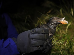
Since seabirds primarily live at sea, breeding season is one of the few opportunities for scientists to study certain species up close: measuring weight and wingspan, taking samples and tagging birds with GPS trackers to follow their movements.

This ongoing research provides responders with information about the areas and species that would need to be protected during an environmental emergency.
Studying puffins

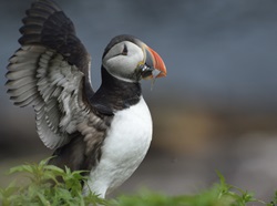
Since the 1970s, ECCC scientists have been studying the island’s Tufted puffins—a large, burrowing seabird with a colourful bill sheath and golden feather tufts that are both lost come winter.
The puffins are declining across their range, but more so in the southern colonies. Triangle Island hosts the largest Tufted Puffin colony south of Alaska, with almost 30,000 breeding pairs. “It sounds like a lot, but in the grand scheme of things, compared to colonies in the eastern Aleutian Islands that support hundreds of thousands of pairs, it’s pretty small,” Mark explains.
Each spring, the puffins return to the island to take advantage of its deep soil and many cliffs, a “great combination” for burrow nesting, according to Mark.
Under the Oceans Protection Plan, scientists are now gathering information on the puffins’ foraging areas and at-sea distribution. This information will help scientists better understand how puffins use their habitat through time. In the event of an environmental emergency, this information will be key to protecting the species—and the unique environment it relies on.
View from the sky: Surveying Arctic coastlines

Thousands of kilometres of footage are helping scientists identify sensitive areas for protection in case of an environmental emergency.
Learn more
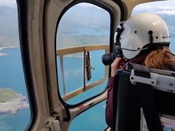
During the summer of 2023, Valerie Wynja and Zhaohua Chen from Environment and Climate Change Canada were in Nunavut, flying in a helicopter just 300 feet in the air, taking photos and video of the stunning coastline.
But Valerie and Zhaohua weren’t there as sightseers. The photos and video footage they collected are being used to classify shorelines in priority areas across the Canadian Arctic—allowing scientists to identify sensitive areas that will need to be protected in the event of an oil spill or other environmental emergency, and providing a trove of open data for all.
Explore Arctic shorelines in the gallery below and learn more about how Valerie and Zhaohua’s work is helping us prepare for, and respond to, environmental emergencies.
Under the Oceans Protection Plan (OPP), we are working to provide responders with the information they need to protect the environment from spills and help its recovery after an emergency.

Valerie and Zhaohua prepare for the day’s flight.

Shoreline type: Pebble cobble beach
Over the course of six days, Valerie and Zhaohua flew 18 hours and documented over 2,300 kilometres of coastline around Lancaster Sound and Parry Channel.
It was their second survey trip of the summer as they worked to gather baseline data on the Arctic as part of the OPP.

Shoreline type: Sand beach

Shoreline type: Glacier ice
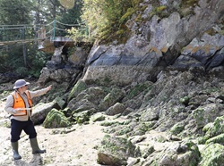
Each type of shoreline is impacted by spills in a different way: oil can harden on rocky shores or sink into the mud in a tidal flat.
Flying at low altitude along the coast, Valerie and Zhaohua captured the different types of shorelines in the area.

Shoreline type: Manmade permeable

Shoreline type: Sand flat
The photos and videos were geotagged—marked with the geographic location—so that analysts could go through the images later and record the shoreline types on a map.
Datasets like these are provided to responders who can use the information to quickly prepare a response and recovery plan as soon as a spill happens.

Shoreline type: Boulder beach with ice wedge polygons

Shoreline type: Bedrock ramp changing to mixed sediment beach
Finalized datasets can also be accessed by anyone through the Open Government Portal.
The information from the surveys can help with local shoreline planning, coastal development, habitat management, or even with studying coastal erosion.

Shoreline type: Mixed sediment flat

Shoreline type: Bedrock cliff with talus slope
Visit the Open Government Portal to see the results from other shoreline surveys and learn more about the different types of shorelines in Canada!
Explore the scope of our activities under the Oceans Protection Plan to support emergency response
Learn through these galleries how the information collected by ECCC scientists and experts helps responders as they prepare for, and respond to, environmental emergencies.
Shoreline surveys
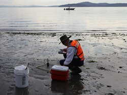
Shoreline surveys gather important information about the coastal environment, including sensitive areas, sediment types, and more. This information helps responders decide the best way to clean up and restore coastal environments after a spill.
Wildlife research
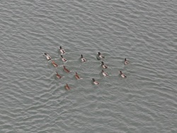
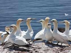
Researchers explore how key marine species, such as the Atlantic puffin, use the environment across their annual cycle. This information helps researchers and responders understand what threats these species might face long term or in an environmental emergency, and how to protect them.
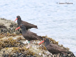
Image 2: To study wildlife, scientists often travel to remote locations at specific times of the year, such as during breeding season, to gather information on changes in population size, diet, and health. 2222
Studying pollution
Scientists study pollution to predict how it could impact the environment during a spill. During an emergency, they use this research to provide scientific advice to environmental emergency responders, helping to determine the recommended environmental protection, clean up and mitigation efforts.
Response activities
The information scientists gather through field and lab research helps responders prepare for an environmental emergency, and shapes what actions they take to protect and restore the environment.
