
Infosheets
Table of contents
- SmartICE community ice monitoring
- Characterizing and monitoring permafrost in Kugluk Territorial Park
- Canadian Ranger Ocean Watch (CROW)
- High Arctic Plants and Methane
- Kitikmeot Sea Science Study (K3S)
- Renewable energy resource assessment
- Nunavut metals management demonstration project
- Waste management technologies
- Wastewater treatment
- Kitikmeot wolverine non-invasive and community-based monitoring
Download the report
Polar Knowledge Canada
For media inquiries, contact:
communications@polar-polaire.gc.ca
SmartICE community ice monitoring
Can technology, combined with Inuit knowledge, help make sea ice travel safer?
Key messages
- SmartICE connects communities across Inuit Nunangat with ice monitoring technology and satellite imagery. The combination of monitoring technology with Inuit sea ice knowledge allows community members to adapt their travel plans for unprecedented and unpredictable ice conditions.
- SmartICE is a social enterprise that delivers ice information services across Inuit Nunangat that prioritizes community collaboration.
- SmartICE works with northern businesses to demonstrate how its ice information services can help reduce harmful effects of climate change on northern business operations.
- Trained operators working for the benefit and safety of their communities continue to operate SmartICE throughout the COVID-19 pandemic.
Project leader
Dr. Trevor Bell, Memorial University of Newfoundland, tbell@mun.ca
More information
Community ice monitoring
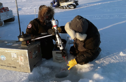
This project combines Inuit knowledge of ice travel safety with new community-operated monitoring technology and satellite imagery. SmartICE makes sea ice travel safer by providing near real-time information on ice conditions. It uses automated sensors (SmartBUOYs), set up anywhere on the ice, and operator-run sensors (SmartQAMUTIKs), towed by a snowmobile along trails, to measure and report ice thickness to communities.
Community members can view the data on SIKU (siku.org), a website by and for Inuit, which provides tools and services for ice safety. From its original northern pilot sites in Nain and Pond Inlet, SmartICE expanded to 24 locations across Inuit Nunangat during the 2020–21 ice season. SmartICE is a work-integrated social enterprise that trains and employs young Inuit as producers, operators, and technicians of its technology.
On-ice training for satellite image interpretation of sea-ice features: SmartICE
Community management
With the support of Polar Knowledge Canada (POLAR), SmartICE has been working in partnership with the SmartICE Community Management Committee in Pond Inlet to understand local ice information needs and create technology and services to respond to those needs. A cross-section of sea ice users, from young hunters to elders, sit on the committee. It is self-titled Sikumiut, meaning "people of the ice."
Sikumiut not only manages local SmartICE operations but also coordinates new sea ice projects for the community. For example, the committee has been documenting Inuit Qaujimajatuqangit (IQ) of safe ice travel to educate youth in the community.
(Left) Pond Inlet Community Operator Andrew Arreak surveys the floe edge in Eclipse Sound with the SmartICE mobile sea ice thickness sensor – the SmartQAMUTIK: SmartICE.
(Right) SIKU screen view of ice thickness data collected by the Smart QAMUTIK off Iqaluit in January 2020: SmartICE
Community ice mapping
SmartICE is co-designing a program to train local operators to make ice travel safety maps for their communities by combining Inuit knowledge and observations with satellite images. This program builds on the legacy of POLAR's support in Pond Inlet and operates in the spirit of self-determination. This is the first project to make sea ice maps in a size and time scale that is specific to on-ice travel for communities.
This project is timely, considering the unprecedented and unpredictable ice conditions caused by changing climate. Operators make these maps locally, combining technology and sea ice knowledge, which Inuit trust. Sea ice knowledge uses all aspects of Inuit culture, including values and language. As a result, elders believe these maps will engage the community effectively.
Northern Product on Centre
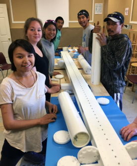
SmartICE trains Inuit to be the producers, operators, and technicians of its technology. In 2019, SmartICE launched its Northern Produc-tion Centre in Nain, Nunatsiavut, where Inuit youth trainees learn how to assemble the SmartBUOY for deployment in communities across Inuit Nunangat. Training considers the whole community, is person-centred, and culturally safe.


Characterizing and monitoring permafrost in Kugluk Territorial Park
How do changing permafrost conditions impact ATV trails?
Key Messages
- Ice wedges are numerous in the Kugluk Territorial Park area and are common sites of permafrost decay along the access road and ATV trail.
- Park managers and community leaders are using information from permafrost research and monitoring to prevent terrain disturbances along the ATV route that improves access to Kugluk Territorial Park for Nunavummiut.
- Knowing how the permafrost conditions in the Arctic are changing will help communities build infrastructure that is functional and sustainable.
Project Leaders*
Leesee Papatsie, Gary Atatahak and Larry Adjun of Nunavut Parks and Special Places, Government of Nunavut.
- * Science partners: Michael Allard and Marc-André Ducharme, Université Laval; Stephanie Coulombe, Polar Knowledge Canada
- Acknowledgements: Community of Kugluktuk; Samuel Bilodeau and Samuel Gagnon, Université Laval; Kugluktuk Joint Planning and Management Committee; Kugluktuk Hunters and Trappers Organization
What we are doing
Researchers, local youth, and other community members are studying permafrost conditions in Kugluk Territorial Park and setting up monitoring sites to record future changes. Their study focuses on the terrain surrounding the access road and ATV trails in the park to understand how changing permafrost conditions affect this important transportation passage for the community of Kugluktuk.
What we have learned
Based on early findings from permafrost coring and ground-penetrating radar, researchers found that the tundra in this area has a high ice content with numerous ice wedges. This makes the terrain sensitive to thawing, erosion, and collapse and has contributed to an increase in both the number and size of ponds in the area. While these processes are occurring naturally due to the climate warming, they are also affected by surface disturbances, such as regular ATV use.
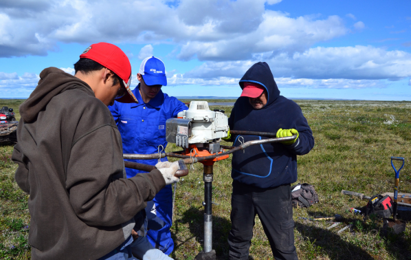
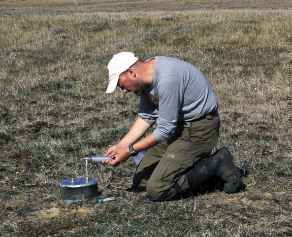
Researchers, including Kugluktuk youth and park staff, operate a portable earth auger to sample permafrost: POLAR
Community outreach and participation
Key steps for the success of this collaborative project include:
Community Input
Researchers work together with the Kugluk Community Joint Planning and Management Committee (CJPMC) to set research goals and moni-tor the project's progress.
Knowledge Transfer
Youth, Indigenous Knowledge holders, and researchers learn from each other by participating in youth camps, Nunavut Parks Days activities, and special events.
Training
Project leads invest time and resources in youth engagement and training opportunities throughout the lifespan of the research project.
Mobilizing results
Researchers make results available to community decision makers through public radio interviews, reporting directly to the CJPMC, and participating in conferences.
Why it matters
The results from this study informed a decision to build a new boardwalk ATV trail in Kugluktuk Territorial Park by identifying areas of ice-rich permafrost and patterns of permafrost degradation. The new ATV route decreases negative impacts on the tundra ecosystem. Ongoing community-led monitoring efforts along the new ATV trail will help ensure it remains safe and operational in the long term.
As the Arctic climate continues to warm, changing permafrost conditions will have major effects on the performance, safety, and reliability of northern transportation routes. This research helps build an understanding of how permafrost is changing in the regions, allowing communities to build infrastructure that meets both the needs of the community and the needs of the changing tundra environment.
Ice wedges
Permafrost can contract and crack in cold winter temperatures. When this happens, water from spring snowmelt fills these cracks and later freezes. The resulting vein of ice that appears in the permafrost is known as an ice wedge, which can grow in height, width, and depth over time as this cycle of melting and freezing repeats.
On the ground, ice wedges appear as raised ridges in the landscape. When viewed from above, ice wedges create a distinct polygon landscape pattern.
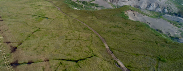
This aerial photo shows the new Kugluk Territorial Park ATV trail under construction in 2019. Ice wedges, a feature of permafrost, are visible.
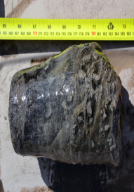
The permafrost soil sample, collected along the ATV trail, has high ice content: POLAR

Canadian Ranger Ocean Watch (CROW)
How can DFO & the Canadian Rangers work together to monitor the southern Northwest Passage?
Key messages
- CROW combines the northern transportation and observation skills of the Canadian Rangers with science from Fisheries and Oceans Canada.
- Canadian Rangers conduct year-round observations of ocean conditions near Kitikmeot communities over a long period of time.
- This project contributes to studies on climate change and marine ecosystems.
- By partnering with the community, this project ensures that local concerns and ocean conditions inform ocean science.
Project leaders*
Bill Williams and Mike Dempsey, DFO Institute of Ocean Sciences bill.williams@dfo-mpo.gc.ca mike.dempsey@dfo-mpo.gc.ca
* Associated Researchers: Institute of Ocean Sciences, DFO, Sidney, BC: Bill Williams, Nadja Steiner, Helen Drost, Kristina Brown; Freshwater Institute DFO, Winnipeg, MB: Darcy McNicholl, Karen Dumnall, Tracey Loewen, Christine Michel; DFO, Inuvik, NT: Jasmine Brewster, Connie Blakeston; Joint Secretariat, Fisheries Joint Management Committee, Inuvik, NT: Kayla Hansen-Craik; Environment Canada, Canadian Ice Service, Ottawa, ON: Stéphanie Tremblay-Therrien.
Who we are
The team includes scientists and technicians from Fisheries and Oceans Canada (DFO) and Rangers from 1 Canadian Ranger Patrol Group (1CRPG). This project is supported by DFO, Polar Knowledge Canada (POLAR), and the Department of National Defence (DND).
What we do
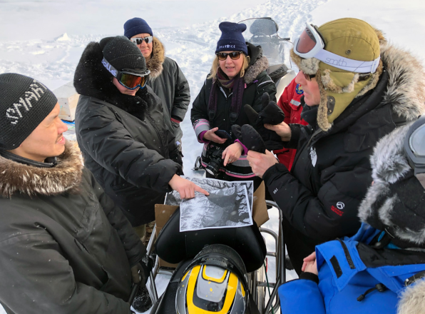
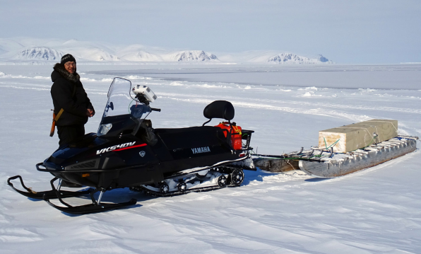
CROW is a DFO collaboration with 1CRPG to gather baseline data in the southern Northwest Passage. 1CRPG uses specialized instruments supplied by DFO to collect samples of sections of the water, from surface to bottom. Rangers measure temperature, depth, and the amount of salt, oxygen, and plant material in the water. Rangers also measure ice and snow thickness. At a small number of stations, Rangers take zooplankton samples, set up ice temperature buoys, and sample water for dissolved carbon dioxide and nutrients.
How do we do it
DFO supplies scientific equipment, training, and study of ocean information. 1CRPG supplies the services of Canadian Rangers to conduct ocean sampling. The Canadian Rangers provide their on-ice excellence and unmatched observational skills for baseline ocean monitoring.
Baseline monitoring
Although rare, continuous year-round observations are needed in the Arctic to detect changes in the ocean environment that may impact fish, wildlife, and the people that depend on them.
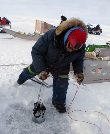
Jimmy Evalik recovers a plankton net through a hole in the ice: Mike Dempsey
Why this matters
It can be difficult and expensive to conduct observations of ocean conditions in the Canadian Arctic. Until recently, all ocean science was done from large ice-breaking ships in the summer from July to October. CROW enables observations and sampling to continue through the ice-covered months with small projects using snowmobiles. It also enables ocean science to use local and Indigenous Knowledge and expertise.
Year-round observations contribute to studies on climate change and marine ecosystems. 1CRPG members offer their own perspectives on baseline conditions and how things may be changing. Ice and snow measurements are useful for monitoring local conditions. They also help researchers improve their understanding of satellite images according to observations on the ground.
Standard measurements of narrow sections across Dease Strait and Dolphin and Union Strait help researchers understand how ocean water circulates in the Kitikmeot region of the Northwest Passage. Water entering Coronation and Queen Maud Gulfs adds nutrients to the region, which is dominated by freshwater input from mainland rivers.

In 2020, measurements in Cambridge Bay and Dease Strait show how water is well mixed in the strait but layered in the bay. In the deep hole (82 m) in Cambridge Bay, oxygen levels are low, as the water is only lushed out approximately every five years.
CTD Instruments
Researchers can observe the layers in the ocean using instruments that measure the amount of salt dissolved in water (conductivity), temperature, and depth. These instruments sometimes have extra sensors to measure the oxygen and plant material dissolved in water. By using many profiles across a strait, researchers can model oceanographic profiles. In other words, they can see how ocean layers form from shore to shore.
Community-based science
People living in a study area have an interest in monitoring the ocean that sustains them. Employment and training opportunities are created by involving the community in research activities. In northern locations, observations made by community participants help to reduce travel costs for southern-based research.
Tommy Epakohak (left) and Ryan Angohiatok pull a CTD instrument up from the ice during CROW 2020 near Finlayson Islands: Mike Dempsey

High Arctic Plants and Methane
How do Arctic ecosystems absorb or release greenhouse
Key Messages
- Understanding how arctic ecosystems absorb and release greenhouse gases helps researchers predict the effects of climate change.
- Soil moisture and temperature influence how greenhouse gases are absorbed or released by arctic soils.
- Dry polar deserts are a methane sink, meaning they absorb more methane than they release. In contrast, wet soils are a source of methane. Drier sites released less carbon dioxide than wetter sites.
- Past studies likely underestimated how much methane is absorbed by Arctic soils because most studies take measurements in wetter ecosystems.
Project leader*
Neal Scott, Queens University, Kingston ON
Read the full research results in the Arctic Journal.
*Additional Collaborators: Johann Wagner, Jacqueline K.Y. Hung, Allison Neil, and Neal A. Scott, Queens University. Funding by NSERC, NSTP, ArcticNet, Government of Canada International Polar Year. Logistical support: Polar Continental Shelf Program. Additional analysis: Agriculture and Agri-food Canada, Carleton University.
Research Summary
The research team studied the relationship between moisture, ecosystems, and greenhouse gases in Arctic environments.
At their study site at Cape Bounty on Melville Island, NU, the research team measured greenhouse gases in ecosystems across sites with differing levels of soil moisture. From driest to wettest, their sites included dry polar desert, mesic tundra, and wet sedge meadow (wetland) ecosystems.
The team measured three greenhouse gases: carbon dioxide (CO2), methane (CH4), and nitrous oxide (N2O). Methane and nitrous oxide are less abundant than carbon dioxide, but they all have powerful warming effects.
Based on two years of observations, the study found that drier sites absorbed methane (CH4), while wetter sites released methane. Carbon dioxide (CO2) emissions were lower in dry polar desert sites.
Arctic permafrost soils store a significant amount of the world's carbon. Plant communities, and the soil microbes (tiny organisms) they live with, play an important role in the exchange of gases between the soil and air.
Changes in Arctic ecosystems are important to global climate change. The Arctic is expected to become warmer and wetter with climate change. Since soil moisture and temperature affects Arctic plant communities, climate change will likely lead to changes in the types of plants and their coverage. Understanding how different plant ecosystems absorb and release greenhouse gases helps researchers make better predictions about how the climate might change.
POLAR scientist Johann Wagner measures the flows of greenhouse gases in the mesic tundra at Cape Bounty, Melville Island: Johann Wagner
Melville Island Ecosystems
On Melville Island, the permafrost active layer is on average 50 to 90 cm deep, and scattered vegetation only grows at the edges of frost boils in most places. Three important terrestrial Arctic ecosystems are described by the soil moisture and the plants that grow there.
Polar Desert
- Dry soil
- Bare mineral soils cover 80% of the land
- Common plants include purple saxifrage, Arctic poppy, lichens, and mosses
- Most common ecosystem at Cape Bounty, Melville Islands
Mesic Tundra
- Moderate soil moisture
- Organic soils about 3 cm deep
- Common plants include mosses, lichens, grasslike plants, sedges, rushes, and herbaceous flowering plants
- Common ecosystem in other parts of the Arctic
Wet Sedge Meadow (Wetland)
- Wet soil
- Organic soils about 5 cm deep
- Completely covered by vegetation, including cottongrasses, aquatic sedge, Fisher's tundra grass, and alpine foxtail
- Often found downhill from melting icefields

Kitikmeot Sea Science Study (K3S)
How do tides, currents, and mixing affect the Kitikmeot Sea marine ecosystem?
Key messages
- The Kitikmeot Sea is a dynamic marine ecosystem influenced by inputs from regional rivers and larger current systems throughout the Arctic Ocean.
- Tidal forces mix the water column in the narrow, fast-flowing straits of the Kitikmeot Sea, which shapes the marine ecosystem and sea ice patterns.
- In winter, mixing action contributes to thin ice or open water in the straits known as 'winter holes.'
- In summer, mixing delivers nutrients to the surface and supports diverse seabed communities, we call these areas 'summer gardens.'
Project leaders
Kristina Brown and Bill Williams, Fisheries and Oceans Canada,* kristina.brown@dfo-mpo.gc.ca; bill.williams@dfo-mpo.gc.ca
*Institute of Ocean Sciences, Sidney, British Columbia.
Other project collaborators
Bodil Bluhm, Department of Arctic and Marine Biology, UiT – The Arctic University of Norway, Tromsø, Norway; Eddy Carmack, Mike Dempsey, and John Nelson, Fisheries and Oceans Canada; Seth Danielson, College of Fisheries and Ocean Sciences, University of Alaska Fairbanks, USA; Donald McLennan, Arctic Research Foundation; Lina Rotermund, Dalhousie University; Adrian Schimnowski, Arctic Research Foundation.
What we do
A team of researchers from Canada, the USA, and Norway is gathering baseline data on how water and nutrients circulate in the Kitikmeot Sea and how this affects the marine ecosystem. Researchers collect water and seafloor samples and take measurements from aboard the R/V Martin Bergmann in the summer. During the rest of the year, researchers use instruments secured to the ocean floor to measure currents and water properties. These measurements are focused on the narrow and shallow straits of the Kitikmeot Sea.
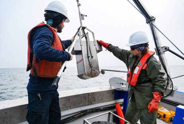
Yves Bernard (Arctic Research Foundation) and Raphaelle Descoteaux (UiT – the Arctic University of Norway), bring in a sediment box corer on the R/V Martin Bergmann: Neha Acharya-Patel.
What we've learned and why it matters
There are faster currents in narrow marine straits throughout the Kitikmeot Sea caused by tides forcing water through the gaps between islands. These currents help to mix the water column and bring nutrients to the surface. This mixing supports plant growth and the marine food web. Inside these passages, soft corals, sea cucumbers, clams, and kelp species take advantage of these nutrients and food particles.
Kitikmeot Sea: a unique marine environment
The Kitikmeot Sea is a unique marine environment in the Arctic due to three main features:
Nutrient-rich deep water
Ocean currents deliver salty, nutrient-rich deep water to the Kitikmeot Sea from other basins in the Canadian Arctic Archipelago. Without sunlight, these dissolved nutrients cannot contribute to plant growth that feeds the rest of the food web.
Freshwater input from rivers
Rivers in the Kitikmeot region deliver massive amounts of freshwater into the Kitikmeot Sea. As freshwater is less dense than salt water, input from these rivers remains at the surface.
Restricted water flow
The seabed in the bounding straits of the Kitikmeot Sea is relatively shallow (no more than 30 metres deep), which limits the exchange of water between the Kitikmeot Sea and other Arctic Ocean basins.
Outside the passages, brittle stars and small marine worms subside on the leftovers. These summer gardens may be important feeding sites for fish or seals. More information on how these straits influence the biological productivity of the greater Kitikmeot Sea region is needed.
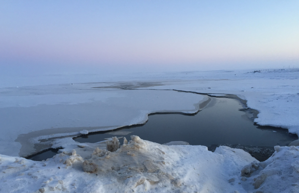
In winter, observations by residents and high-resolution satellite imagery show that these same narrow passages are prone to thin ice and early ice breakup, making them dangerous places for winter travel. These winter holes are caused by warmer water, which is brought to the surface by this mixing process due to the tides.
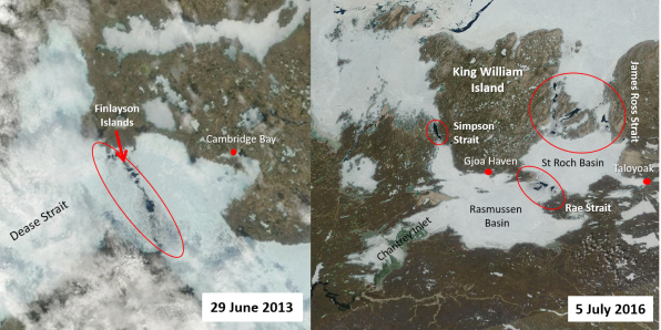
This satellite view shows springtime 'winter holes' created by tidal mixing in the narrow straits:
- a) Finlayson Islands near Cambridge Bay, NU; and
- b) Chantrey Inlet, Rassmussen Basin, and St Roch Basin near Gjoa Haven, NU (https://worldview.earthdata.nasa.gov/)
This simplified diagram describes water circulation in the Kitikmeot Sea. Mixing in shallow areas brings salty nutrient-rich deep water to the surface supporting a diversity of ocean life.

Renewable energy resource assessment
Is renewable energy suitable for all locations?
Key messages
- POLAR aims to help northern communities reduce dependency on fossil fuels for energy generation.
- Local resource assessments are essential to determine if renewable energy sources are suitable for development, for example:
- Wind: An average annual wind speed of 3 to 6 metres per second is needed for a wind project to be economically feasible in remote northern communities.
- Solar: Due to atmospheric conditions, some areas are subject to better solar irradiance than others. This will dictate the placement of solar panels in suitable communities.
- Geothermal: Exploration and deep drilling requirements add significantly to overall project costs to develop this energy source.
Project leader
Rob Cooke, POLAR, info@polar.gc.ca
Cambridge Bay resource assessment
Wind energy
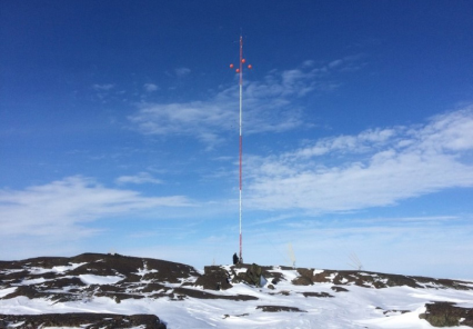
In 2014, POLAR erected a wind tower on the edge of town to measure prevailing wind conditions, in partnership with Natural Resources Canada (NRCan) and the Wind Energy Institute of Canada (WEICan). The study, conducted between 2014 and 2017, showed that a wind project for the community could be technically and economically viable. In 2020, POLAR and WEICan upgraded the sensors on the tower and began wind monitoring again with a view to upgrade data and determine if climate change is having any impact on wind speeds and direction.
Solar irradiance
To evaluate the suitability of solar power for Cambridge Bay, POLAR is conducting solar irradiance monitoring in partnership with NRCan and Campbell Scientific.
POLAR and the Canadian technology provider Spectrafy are collaborating to test and demonstrate direct solar spectral irradiance technology called Solarism. This technology is inexpensive and easy to use, which makes it a viable option for many northern communities. One of seven Solarsim devices was deployed as part of the Build Canada program in Cambridge Bay. The Cambridge Bay project is the most northerly deployment and the only one operating in the Arctic.
Water Lake Road Resource Monitoring Site, Cambridge Bay: POLAR
Community resource assessments
POLAR has provided funding to several northern communities to complete small-scale renewable energy projects and has assisted with resource assessments for potential community-scale projects.
Arviat
The Hamlet of Arviat worked with NRStor, an energy storage company, to install both wind and solar monitoring equipment. The community hopes to develop a wind/solar/storage hybrid project to reduce diesel use.
Arviat solar and wind monitoring: NRStor
Sanikiluaq
In Sanikiluaq, the Qikiqtaaluk Business Development Corporation (QBDC) relied on community engagement to choose an optimal location to install a wind tower close to the community. The results from this monitoring program allow QBDC to develop a robust business case to support a future 400-kilowatt wind project.
Wind tower positioning in Sanikiluaq, NU: QBDC.
Tidal study
Changing sea ice patterns, a consequence of climate change, could present an opportunity to use marine energy in the Canadian North. Since 24 of Nunavut's 25 communities are coastal, POLAR and the National Research Council (NRC) are working together to learn whether tidal energy in strategic locations could meet the year-round energy needs of some communities. NRC is investigating five Nunavut communities that showed the greatest potential in table-top studies.

Nunavut metals management demonstration project
Can a regional model for solid waste management maximize local benefits?
Key messages
- Solid waste management through Inuit Development Corporations is viable and adventageous.
- Over 900 batteries, 12 drums of oil waste, and countless mercury switches were removed from the tundra and shipped south for disposal and recycling.
- Community members hired by the municipality completed all on-site work and received over 30 days of on-site training.
- 59% of project funding stayed in the community as wages, equipment, and materials.
Project leader
Sheldon Nimchuk, Qikiqtaaluk Business Development Corp., snimchuk@qcorp.ca
Financial Contributions
Polar Knowledge Canada, Government of Nunavut, Qikiqtaaluk Corporation, Kakivak Association, Municipality of Kinngait. In-Kind Support: Automotive Recyclers of Canada, Municipality of Kinngait, Qikiqtaaluk Business Development Corpo-ration, Government of Nunavut, plusArctic Consulting Ltd., Kudlik Construction.
What we did
This project aimed to remove metal waste while employing and training area residents. Metal stockpiles contain old cars, snowmobiles, trucks, and appliances. Each of these contain hazardous waste. Old vehicles contain mercury switches, lead, and various liquid wastes such as oil and gasoline. Old refrigerators contain oils and ozone-depleting gases. Decreasing metal waste stops hazardous waste from contaminating the environment.
The project team protected the environment by removing hazardous materials from metal waste. They also extended the lifespan of the existing dumpsite by compacting the metals into bales. This project helps reduce the need for a larger dumpsite in the future. It also decreases the risk of environmental contamination.
This model of delivering solid waste management through Inuit Development Corporations could be applied to address the metal stockpiles that exist in all Nunavut communities. The project approach was Inuit-led and delivered.
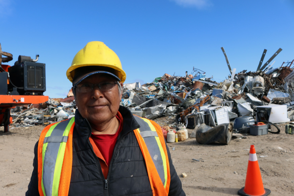
Pitseolak Pudlaq poses near a metal baler: "It is the first time I am seeing this land without old metals all over it. It feels like progress." Over 1,000 metal bales were pro-cessed during this project.
The project prioritized building Inuit capacity, focusing on social return on investment to deliver on the project. Community members hired through the municipality completed all onsite work. The project team delivered training on site, which was open to other community members. The municipality gained the experience and resources necessary to continue managing their metal dumpsite responsibly, without outside contractors.
Why this matters
Solid waste infrastructure in Nunavut communities is inadequate, outdated, and undersized. Limited budgets and competing priorities at all levels of government have contributed to this challenge. Legacy metal is waste that has been around since before the current regulatory and management frameworks. Most of this legacy waste is scrap metal, including old vehicles, fridges, and building materials. If left as is, the hazardous waste contained in the metal will eventually seep into the environment, pose a risk to human health, and pollute our land, water, and air.
This project showed that future agreements between the Government of Nunavut and Regional Development Corporations in the Qikiqtani, Kitikmeot, and Kivalliq Regions are possible. These agreements can address the legacy metal waste stockpiles across Nunavut while keeping money within the territory and maximizing the benefit to Inuit and communities.
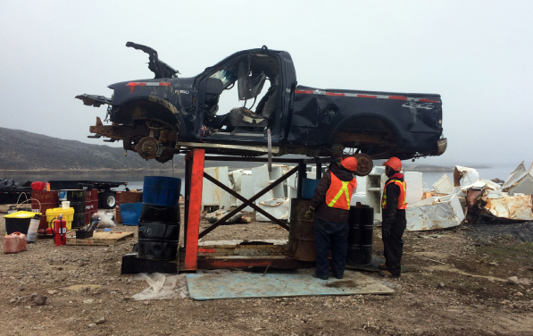
Over 25 end-of-life vehicles were removed from the community core and properly depolluted. "We are pleased to see action toward not only supporting our community with cleaning up the site, but also with providing the training to enable the continued proper management of our waste." — John Hussey, Senior Administrative Officer.
Under Qikiqtaaluk Corporation management, this project:
- Hired six Inuit in Kinngait for two project seasons;
- Provided 30 days of on-site training, including:
- safe depollution to remove hazardous waste from vehicles and fridges
- metal baling equipment operations
- hazardous waste packaging and shipping
- health and safety certifications
- ozone-depleting substances certification
- Produced and published Nunavut-specific training materials in Inuktitut and English, including:
- a guide on removing hazardous waste from metals
- a guide on which metals found in a typical Nunavut metal stock-pile can be baled
- a guide on how to backhaul hazardous waste

Waste management technologies
What waste management technologies are useful in Cambridge Bay?
Key messages
- Residents of Canada's remote northern communities want to improve waste management practices and decrease reliance on fossil-fuel-based energy sources.
- Greenhouse gas emissions, black carbon from fossil fuel use, and environmental contamination from overburdened landfills with open incineration negatively impact public health and contaminate land and food chains.
- POLAR has explored several waste management and waste-to-energy solutions. The knowledge gained is helpful to other northern communities considering clean energy alternatives.
Project leader
Rob Cooke, POLAR, info@polar.gc.ca
Automated Communities System (ACS150)
ACS150 was a collection of technologies, within two sea cans, aimed at meeting the utility needs of a 150-person community. The technologies were grouped so that waste products went in at one end and potable water, heat, and electricity were produced as outputs. This technology demonstration was hosted by Cambridge Bay in 2014, in collaboration with Sustainable Development Technology Canada.
Waste stream analysis
A waste audit of the Cambridge Bay landfill was completed to choose the right waste-to-energy technology for the community. This work was completed in partnership with Concordia University's Institute for Water, Energy and Sustainable Systems. In 2016, workers from the Hamlet, along with PhD student Nathan Curry, spent two weeks sorting 725 kilograms (1,600 pounds) of trash. They held a community meeting at the Elder's Palace and completed formal interviews about waste management. The results showed that the community could benefit from a composting program for food waste and a recycling program for cardboard, plastics, and soda cans.
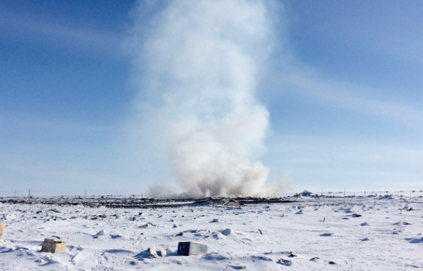
Burning garbage at the Cambridge Bay land ill. Incineration is a common waste management practice in many remote communities: POLAR
Micro Automated Gasification System
With results of the waste stream analysis in hand, POLAR partnered with a Canadian waste-to-energy technology provider, Terragon Environmental Technologies Inc., to test and demonstrate its Micro Automated Gasification System (MAGS) within the community of Cambridge Bay. Terragon commissioned and started up the system and provided preliminary training to two operators from the community.
The system operates by batch loading waste products into two chambers. The waste is heated and breaks down to biochar and a gas consisting mostly of hydrogen and carbon monoxide (synthetic gas: syngas). The syngas is used as the fuel for maintaining the process. The overall objective of the project was to assess the MAGS technology in terms of performance, economic feasibility, and operability within a remote northern community.
Technology assessment
While the MAGS demonstration was running in Cambridge Bay, POLAR engineer Matt Wallace assessed a range of commercially available waste-to-energy technologies. This included heat-recovery technologies, as well as novel solutions to transform waste products into badly needed construction materials or road surface coatings—products that have intrinsic value in remote northern communities. After detailed research, Wallace recommended pursuing a simple incineration system with heat recovery as a starting point for a remote community waste-to-energy system.
Incineration system with heat recovery
Produced by Dynamis Energy, a Thermal Oxidation System (TOS) is successfully operated by the North Slope Borough in Utqiagvik, Alaska. POLAR and Hamlet personnel travelled to Alaska to view the TOS and meet with company and borough representatives. They concluded that this system would meet the waste management requirements of Cambridge Bay.
Although the population of Utqiagvik is double that of Cambridge Bay, similarities between the two communities support the use of a TOS in Nunavut. Utqiagvik is located north of the Arctic Circle and has a predominantly Indigenous population (i.e., over 60% of residents are Iñupiat). Like Cambridge Bay, Utqiagvik has a polar climate, is supplied mainly by sealift, and maintains strong traditions of harvesting country foods. This comparison helped with assessing wheather the system would meet the needs of Cambridge Bay because Utqiagvik and Cambridge Bay, have similar waste profiles.
The TOS in Utqiagvik has significantly reduced waste going into the landfill. It produces clean emissions and inert ash. It is not, however, making full use of the heat or syngas produced, which reduces the overall economic viability of the system. The Hamlet of Cambridge Bay is now actively seeking funding to install a TOS and intends to use the waste heat either for district heating or greenhousing. POLAR and the Hamlet are both interested in the potential to use syngas for energy generation.
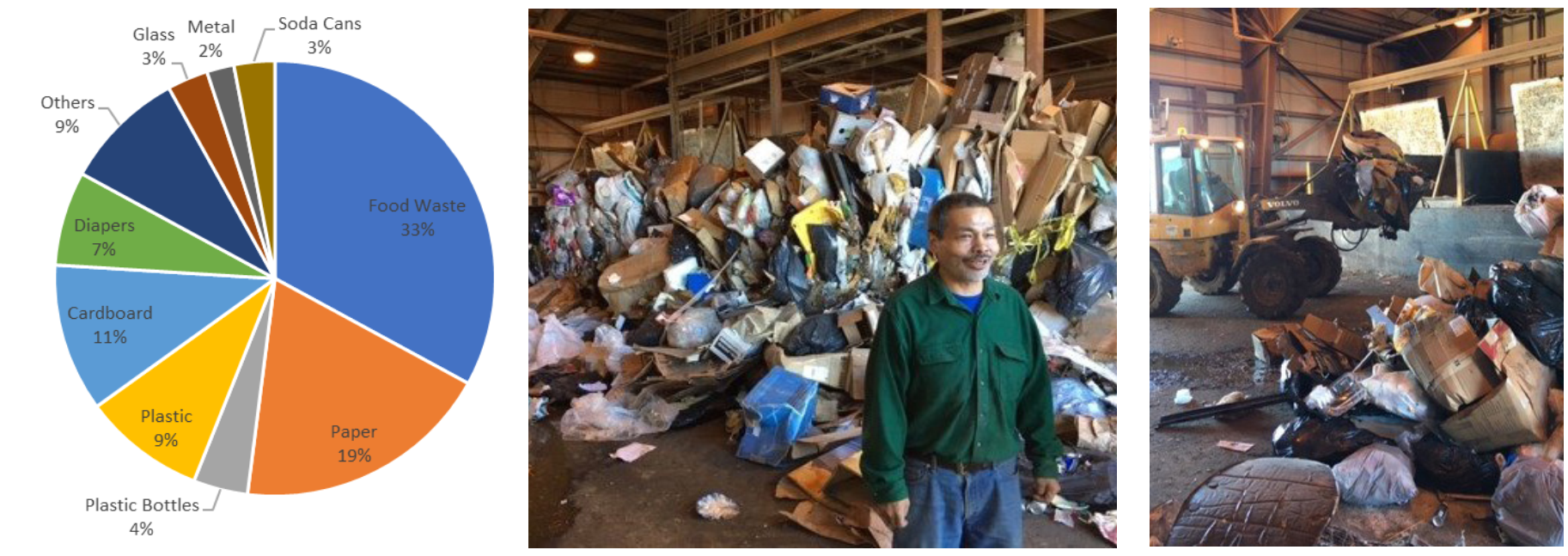
(left) According to a waste stream analysis, a third of Cambridge Bay's trash is food waste. Cardboard and paper make up another third. Data from Nathan Curry, PhD.
(middle and right) Utqiagvik TOS in Operation: Matt Wallace.

Wastewater treatment
How can we improve wastewater management in remote communities?
Key messages
- Applied research to improve water and wastewater management is a strong priority for POLAR's northern and Indigenous partners.
- POLAR has led and supported several studies to understand the effectiveness of current wastewater treatment practices and to test promising technologies for use in Arctic and northern communities.
- Used water from bathing and laundry is known as greywater. It is less contaminated than blackwater (sewage), which includes wastewater from toilets, kitchen sinks, and dishwashers. In many regions of the world where water is not plentiful, people re-use greywater for toilet flushing, irrigation, laundry, and cleaning.
Project leader
Rob Cooke, POLAR, info@polar.gc.ca
Wastewater management
Many remote communities rely on water delivery with wastewater collection, which is inconvenient and costly. Truck deliveries also add to air pollution through dust and increased greenhouse gas emissions from vehicle exhaust.
In these communities, blackwater and greywater from residences and businesses are mixed in collection tanks, collected by heavy trucks, and dumped into sewage lagoons.
Over time, lagoons deal with the waste effectively but have high potential to pollute the land, local waterways, and food chain.
Polar Knowledge Canada (POLAR) supported a University of Winnipeg study to determine the extent of contamination that is close to remote communities to better understand the effectiveness of sewage lagoons and the potential impacts that effluent runoff has on the environment and food chain.
Cambridge Bay's sewage lagoon, as seen in winter: POLAR.
Greywater treatment
Keen to address these problems at their source, POLAR is also studying water conservation through greywater and blackwater treatment technologies.
In 2018, with funding from POLAR, Terragon Environmental Technologies Inc. installed a greywater treatment technology known as the WETT-G on the Canadian High Arctic Research Station (CHARS) campus in Cambridge Bay.
This greywater system relied on automated electrochemical technology, which does not require adding chemicals or maintenance-intensive processes. The quality of the treated greywater was comparable to treated municipal water, and the cost of treatment was significantly lower than municipal water rates. This project showed the eco-nomic feasibility and benefits of re-using water through greywater treatment.
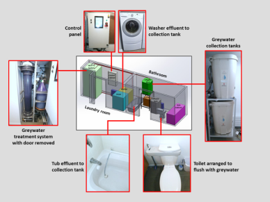
A greywater treatment system similar to the system installed at CHARS: Terragon.
Blackwater treatment: Bioelectrical Anaerobic Sewage Treatment (BeAST)
The National Research Council (NRC) has developed a sewage treatment technology that aims to clean up blackwater before it is sent to a sewage lagoon. The Bioelectrochemical Anaerobic Sewage Treatment (BeAST) system uses microbes to break down waste in a passive flow system. POLAR has partnered with NRC to test this pre-commercial technology at the CHARS campus.
Sewage samples were sent from Cambridge Bay to NRC laboratories in Quebec. Research scientists analyzed the samples and adjusted the BeAST reactor, which was then installed at CHARS. The 30-litre BeAST reactor at CHARS will run for about 12 months.
Initial tests showed that using BeAST allows for much cleaner wastewater to be discharged into sewage lagoons. If further tests are successful, NRC and POLAR will work together to develop and install a larger reactor in residential units in Cambridge Bay.
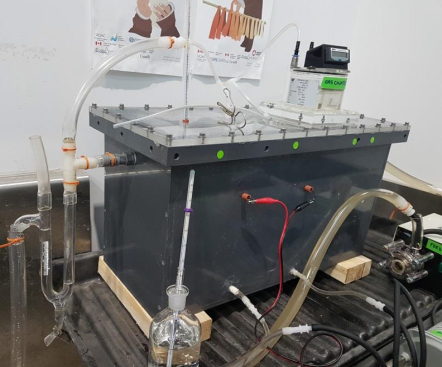
The BeAST Reactor, similar to one installed at CHARS: NRC.
Did you know?
Methane, or biogas, is a by-product of the sewage treatment process. This gas can be captured and used for district heating, biofuel production, or to heat greenhouses. Using this gas can significantly add to the economic and environmental viability of this technology.

Kitikmeot wolverine non-invasive and community-based monitoring
How many wolverines are in the Kitikmeot region?
Key messages
- Wolverines in the Kitikmeot region exist at low densities and are being exposed to increasing levels of human activity.
- Knowing the density of the wolverine population in the region can inform future sustainable harvest limits and could support input to impact review processes. This information can also help inform predator research for caribou management.
- This collaborative research project between the Government of Nunavut and the Kugluktuk HTO provided training and employment to HTO members. It also demonstrates the efficiency of joint research projects to inform wildlife management.
Project leader
Malik Awan, Department of Environment, Government of Nunavut, mawan@gov.nu.ca
Collaborators/Acknowledgements
Kugluktuk Angoniatit Association, Hunters and Trappers Organization Field team: Malik Awan, GN Department of Environment; OJ Bernhardt, Kugluktuk HTO member; Eric Hitkolok, Kugluktuk HTO member; Perry Klengenberg, Kugluktuk HTO member; Jonathan Niptanatiak, Kugluktuk HTO member. Funding: Government of Nunavut, Department of Environment; Nunavut Wildlife Management Board; Polar Knowledge Canada
Project summary
In 2018 and 2019, Government of Nunavut biologists collaborated with the Kugluktuk Angoniatit Association (Kugluktuk HTO), to estimate the density of the region's wolverine population. This project supports long-term regional monitoring by establishing baseline information on the number and density of wolverines in the region.
This research informs predator research for caribou management and could also be used to establish future sustainable harvest limits and support input to Nunavut Impact Review Board review processes.
The research team used non-invasive methods to collect wolverine fur samples northwest of Napaktulik Lake. They placed 154 hair-snag posts, baited with caribou, muskox legs, and scent lures, in a grid across the tundra.
The posts were covered with barbed wire, which snagged fur samples from the animals attracted by the lures. Sampling took place over three 10-day sessions from early March through late April 2018 and again in 2019. This is a practical and cost-effective method for monitoring wolverine populations on the tundra.
Wolverine
The wolverine is one of the larger species in the weasel family. Females usually weigh about 10.5 kilograms (kg) (23 pounds (lb)) while males generally weigh 15 kg (33 lb).
The wolverine is omnivorous and primarily a scavenger. Although it has the strength to kill large game animals, such as deer, caribou, and moose, it only does this occasionally.
In addition to scavenging and preying on big game animals in the winter, wolverines eat eggs from ground-nesting birds, as well as edible roots and berries during the summer months. Wolverines in the study region exist at low densities and are being exposed to increasing levels of human activity.
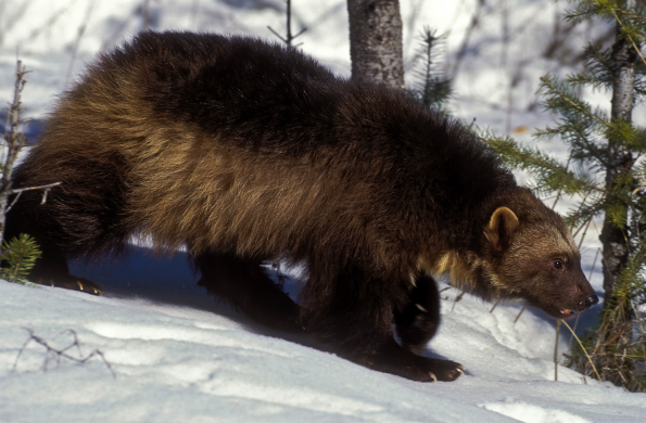
A wolverine: Thomas Kitchin & Victoria Hurst.
Baseline data
Baseline data is information that provides a snapshot of what the conditions or situation is now. Data in the future can be compared against this information to detect changes.
Project results
The research team studied DNA from the collected hair samples to identify individual wolverines and their sex. The research team identified similar numbers of male and female wolverines. They identified 22 wolverines in 2018, of which 11 were females and 11 were males. In 2019, they identified 27 wolverines, of which 13 were females and 14 were males. Ten wolverines identified in 2018 were recaptured in 2019.
The results showed that there are about three to four wolverines per 1,000 square kilometres (km2). These estimates apply only to wolverines whose home ranges are centered within the 4,000 km2 study area near Napaktulik Lake, where the hair-snag posts were set up. Wolverines use the study area in varied ways, which can explain the differences in population density estimates between years.
Wolverines have a large range considering their small size. In 2018, the research team observed a range of approximately 25 km for both males and females. In 2019, the research team observed a consistently larger range for males.
This study demonstrates the importance of joint research projects to inform wildlife management. It also highlights existing opportunities to provide valued training and employment to HTO members through collaborative research projects.
