
Mackenzie Valley Highway
Proponent
Government of the Northwest Territories
Sector
Transport
Location
Routing being developed, Wrigley to the Dempster Highway south of Inuvik, Northwest Territories
Proponent
Government of the Northwest Territories
Sector
Transport
Location
Routing being developed, Wrigley to the Dempster Highway south of Inuvik, Northwest Territories
This project is being considered for listing under the Building Canada Act
Description
The Mackenzie Valley Highway will create a new all-season economic corridor up the Mackenzie Valley, while providing year-round connectivity to three currently isolated communities, and improving access to two additional communities by way of shorter construction periods for winter roads. The road will increase affordability and create new opportunities for inter-territorial and inter-provincial trade, economic development, community resupply, emergency response, and resource access. It also has the potential to enhance connectivity and reduce travel time between National Defence locations and facilities.
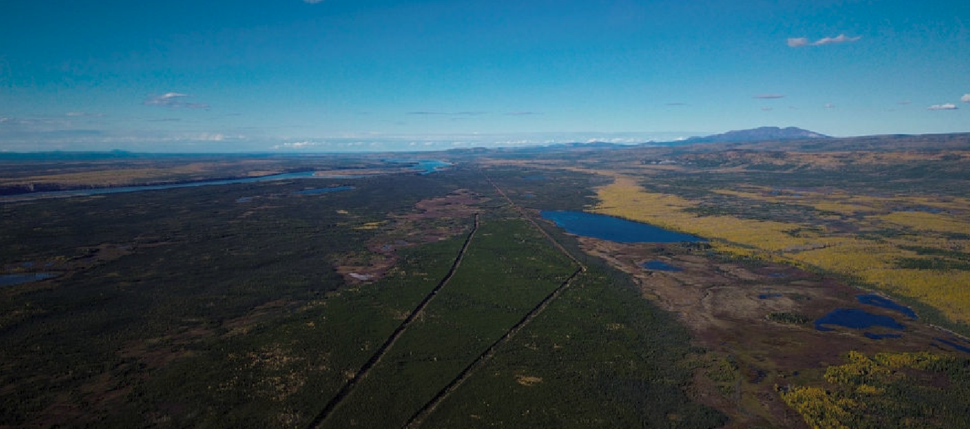
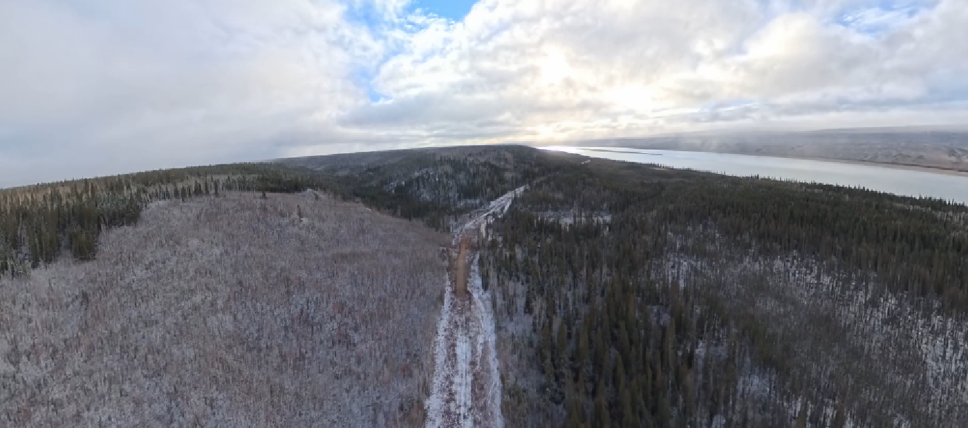
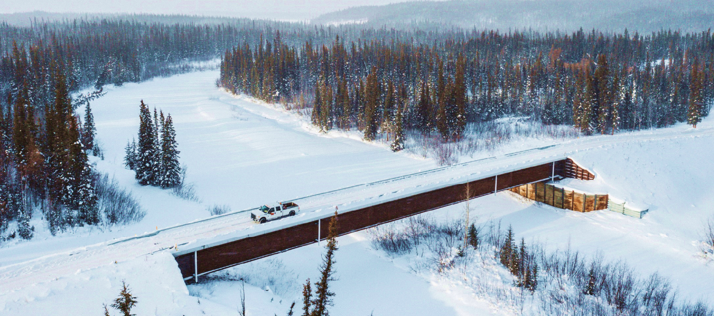
The proposed ~800 km all-season gravel highway would extend from Wrigley to the Dempster Highway south of Inuvik, passing near Tulita, Norman Wells and Fort Good Hope. These communities are currently accessible only by aircraft, river barge and winter road.
This project will create significant opportunities for economic growth and resource development, improve life in isolated communities, enhance Canada’s sovereignty, and support an expanded military presence in the North.
Description
The Mackenzie Valley Highway will create a new all-season economic corridor up the Mackenzie Valley, while providing year-round connectivity to three currently isolated communities, and improving access to two additional communities by way of shorter construction periods for winter roads. The road will increase affordability and create new opportunities for inter-territorial and inter-provincial trade, economic development, community resupply, emergency response, and resource access. It also has the potential to enhance connectivity and reduce travel time between National Defence locations and facilities.
The proposed ~800 km all-season gravel highway would extend from Wrigley to the Dempster Highway south of Inuvik, passing near Tulita, Norman Wells and Fort Good Hope. These communities are currently accessible only by aircraft, river barge and winter road.
This project will create significant opportunities for economic growth and resource development, improve life in isolated communities, enhance Canada’s sovereignty, and support an expanded military presence in the North.
Quick facts
- Indigenous relations: The proponent is working closely with Indigenous communities and governments along the corridor. On June 5, 2026, Sahtu Secretariat Incorporated, Gwich’in Tribal Council, and Pehdzéh Kı̨ First Nation signed a Memorandum of Understanding (MOU) establishing a coordinated Indigenous framework to work together to advance the proposed Mackenzie Valley Highway. The MOU reflects their shared interest in participating directly in the governance, planning, co-design, and long-term direction of the project.
- Transportation access: creates a direct route from Yellowknife to Inuvik, reducing the distance by an estimated 1,200 km and travel time from 38 hours to roughly 23 hours.
- Resource development: provides enabling infrastructure to support natural resource exploration and development activity across the Dehcho, Sahtu and Beaufort Delta regions.
- Tourism: generate new tourism potential, creating a scenic driving loop through the Northwest Territories and the Yukon in combination with the Dempster Highway.
Benefits
- Creates new opportunities for inter-territorial and inter-provincial trade, economic development, emergency response, and resource access.
- Improves inter-community mobility, emergency response, and the reliability of community resupply.
- Will help to stabilize the cost of living by improving transportation access and reducing reliance on seasonal winter roads, aircraft, and barge service.
- Provides year-round access to three isolated communities: Tulita, Norman Wells, and Fort Good Hope.
- Enhances Arctic sovereignty and security through improved safety, reliability, and resilience of the Northwest Territories and Yukon transportation systems in the face of climate change and extreme weather.
- Generates new tourism potential by creating a scenic driving loop through the Northwest Territories Yukon in combination with the Dempster Highway.
- Supports mineral and resource exploration and development activity in the Dehcho, Sahtu and Beaufort Delta regions.
- Potential to enhance connectivity between National Defence locations and facilities in the North.
- Strengthens housing construction capacity, making it less costly to deliver materials and complete projects in northern communities.
Latest updates
- On June 24, 2026, the Government of Canada announced the initiation of the process towards potential listing of the Mackenzie Valley Highway as a project of national interest under the Building Canada Act (BCA). Before any decision is taken, consultations will be held with Indigenous communities who may be impacted by the project, with the Government of the Northwest Territories, and with federal ministers, to determine whether this project should be listed under the Act. These consultations will begin over the next several months, with the intent for the Minister of One Canadian Economy to make a recommendation for Governor in Council decision by the end of the year.
- On March 12, 2026, the project was referred to the Major Projects Office.
- Since then, the Major Projects Office is working with the Government of the Northwest Territories to support and streamline relevant regulatory processes, assess project funding needs and determine funding solutions, and explore and identify opportunities to accelerate project development and construction execution capacity and timelines in collaboration with co-management boards, stakeholders and Indigenous communities and governments.
Page details
- Date modified: